Last Updated: 27th Mar 2024

Intermediate - Experienced

Save Trail Save

I've done it Done

Princess Bath extended

Lake Tennyson and Mount McCabe

Saint James Range, Canterbury

Submitted by Sarah Coxon

Last Updated: 27th Mar 2024

Intermediate - Experienced

Save Trail Save

I've done it Done

Open

Grunt Factor: 49 ?

Gnarl Factor: 50 ?

20.6km

1440m

1440m


Login as a VIP to see driving directions, distance and time.

Trail Map

Type of Run

Back country - remote

Loop

Very hilly

Lakeside

Open ridges/tops

Run Makeup

20%
40%
40%

Gravel Road

Farm Road / 4WD Track

Untracked / Route only

Average Uphill Gradient: +14.0%

Average Downhill Gradient: -13.9%

Trailhead

Login as a VIP to see the trailhead information.

Estimated Times to Run

6:00

Slow

4:30

Moderate

3

Fast

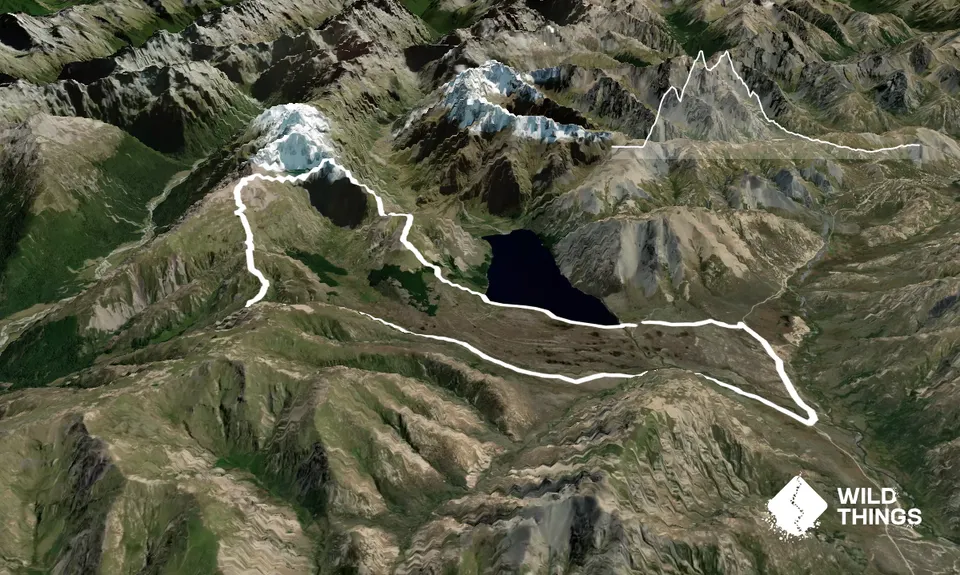
On leaving the campsite at the southern end of Lake Tennyson, cross the lake outlet (Clarence River); this is the only water crossing of the day, so if you're big on dry feet, save donning your shoes until you’re across.

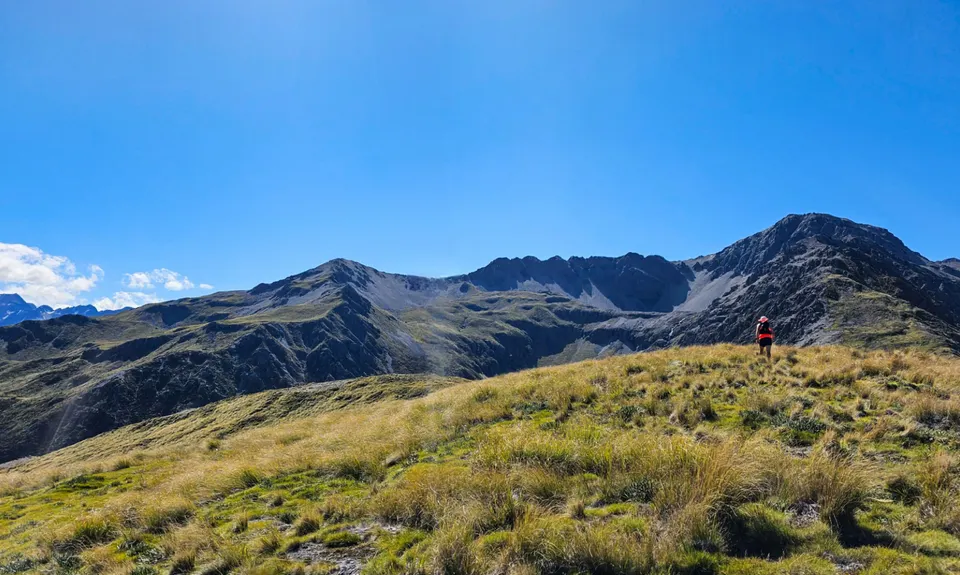
Follow the lake edge for about 2km, firstly on an old 4WD track and then along shingle beach. Soon after reaching the southwest corner of the lake, peel off to your left and start climbing up the grassy lower flank of Mt McCabe. From here you are almost completely off-track until you reach Mailing Pass; there is the occasional though always short-lived ‘trail’ and some small pockets of scrub to negotiate, so its best to pick your own line.

Skirt along the northern edge of two small stands of trees, then cut between two larger stands further up the hill. (It also looks possible to take a line to the south of these trees and nip through a larger pocket of forest). Above the trees is a stretch of steep tussock-bashing before you gain the wide, rocky ridge and the view opens up ahead of you. Follow the ridge north to Mt McCabe, before a short, sharp descent to a small saddle.

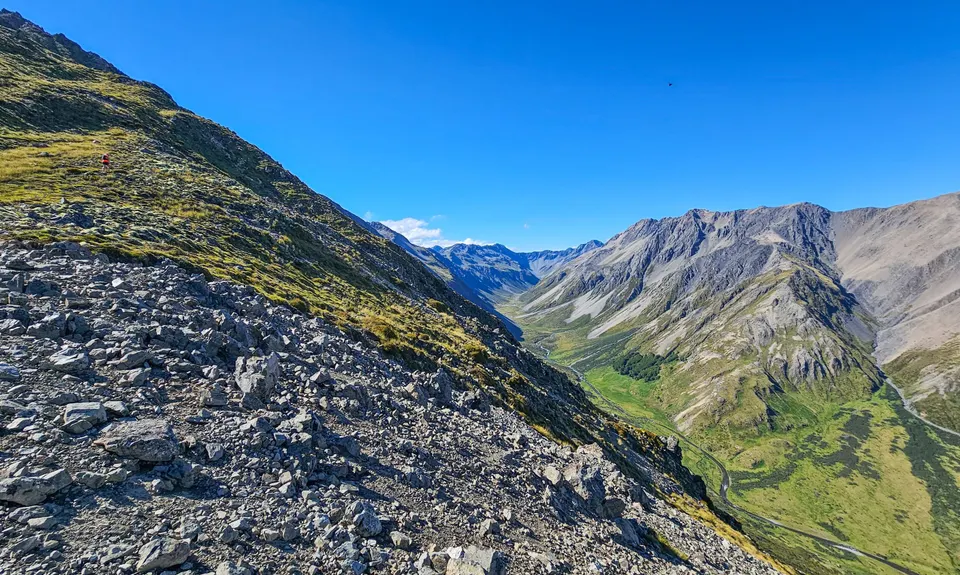
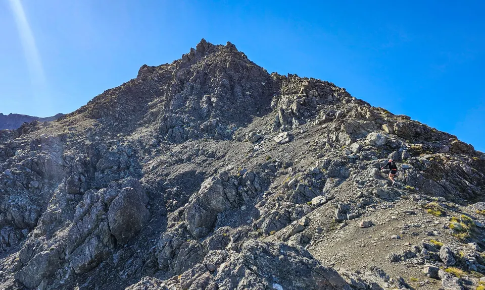
From the saddle, follow the southeastern ridge of Mt Princess, which becomes increasingly rocky and a bit scrambly in places. Stay on the ridge to avoid some impressive bluffs, climbing above the eastern end of the Bath until a nice scree descent becomes obvious on your left at approx. the 1900m contour. Pick your way down to the mossy edge of the Bath - this is a wonderful spot for a bite to eat (and if your time management is better than mine, a swim).

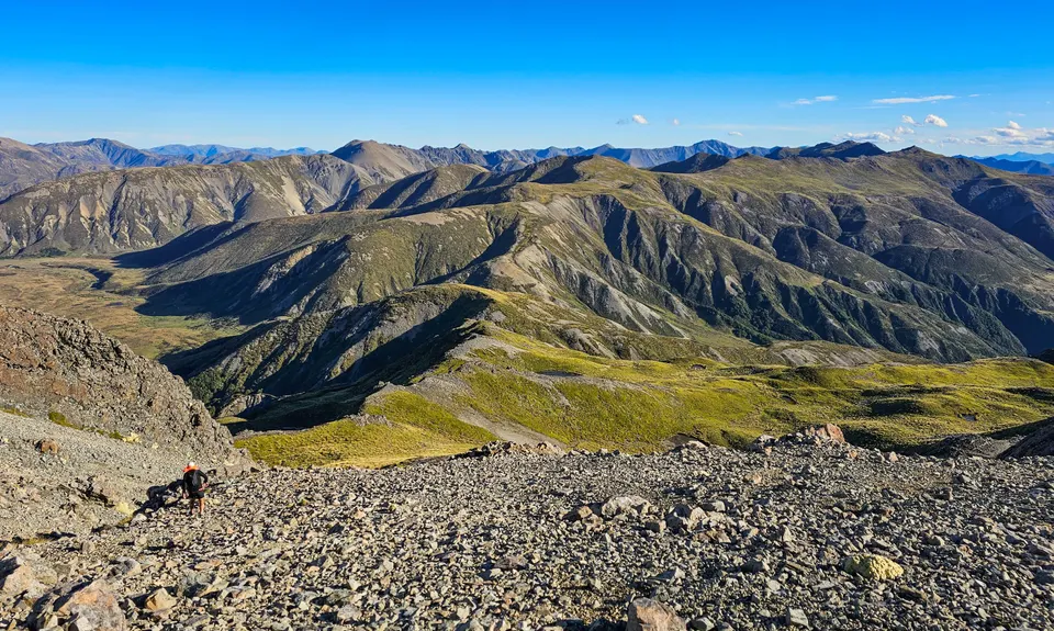
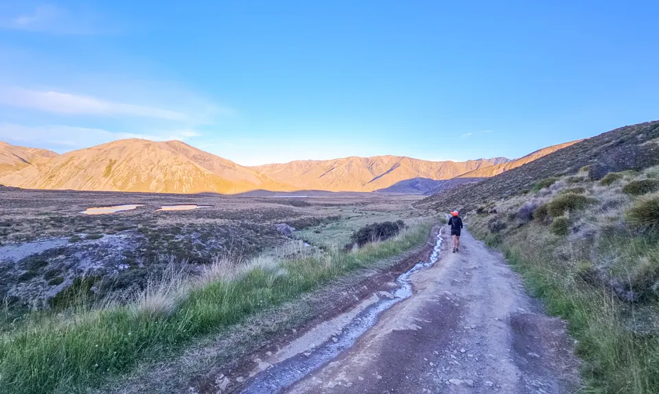
Skirt the southern end of the lake, and resume climbing to gain the ridgeline at a low saddle north of pt 1906. Climbing done, follow the ridge south over pt 1906 and down to the tarn, then along to pt 1572 and down to the road at Mailing Pass. Now its time to switch gears, as there’s 10 km of 4WD road to close out the loop. Don’t despair though – the road surface is pretty good (aside from some rather large puddles following recent rain), allowing for some fast kms to counter all that off-track, and the views down the valley to the Paget Ridge aren’t so bad.

Follow the road out to Tophouse Road and hang a left, then left again when you reach the access road to the campsite.

This trail includes the peak Mount McCabe.

Princess Bath, a beautiful, alpine lake perched high above the valley. Views up the Clarence River and back over Lake Tennyson.

Plenty of parking around the campsite, toilets available.

61 km

149 minutes

Unknown

No

Hard.

The route is off-track from the point you start the climb until you reach Mailing Pass - there are no poles or cairns. You are essentially following the ridgeline for much of this section, but take care in choosing your route off the southeast ridge of Mt Princess - you want to the obvious scree slope that runs between a few sets of bluffs.

Non-existent.

Waterproof leggings, Thermal leggings, Lightweight fleece top, Long-sleeved thermal top, Seam-sealed waterproof jacket, Gloves, Beanie/thermal headwear, Personal Locator Beacon (PLB), Whistle, First aid kit, Extra food for emergencies, Survival bag, Cellphone, Compass, Map, Headtorch and spare batteries, Crampons / microspikes (for winter conditions)

Top up at the Bath if needed (filter or treat at your discretion).

Snow and ice in winter would require appropriate equipment (crampons, ice axe etc) and experience. Best as a summer run.

The exposure on the southeast ridge of Mt Princess is not too bad, but care should be taken. Check your line off the ridge down to the Bath avoids the bluffs.

You and Princess Bath extended

As a VIP member you can record private notes for this trail, see all of your times and more.

Register Now

Already have an account? Login now

Trail Reviews

Be the first to submit a review for Princess Bath extended!

Login to submit a review

Trail Running Community

Find people who are interested in or have completed this trail run.

You must register or login to view this feature.

Register Now

Overlapping Trails

These overlap with this trail to some degree. You may wish to combine them but please note that to qualify for FKTs on these runs you should record a separate activity for each.

Princess Bath

Princess Bath

Length: 16.7km

Level: Intermediate - Experienced

Princess Bath

Princess Bath

Length: 16.7km

Level: Intermediate - Experienced