Last Updated: 29th Mar 2024

Intermediate

Save Trail Save

I've done it Done

Husky Flat via Blue Lakes

Ball Shelter Track

Ball Hut Route

Mt Cook Village, Canterbury

Submitted by Sierra Alef-Defoe

Last Updated: 29th Mar 2024

Intermediate

Save Trail Save

I've done it Done

Open

Grunt Factor: 13 ?

Gnarl Factor: 11 ?

11.1km

275m

275m


Login as a VIP to see driving directions, distance and time.

Trail Map

Type of Run

Front country - easily accessible

Combo

Undulating, small hills only

Native bush

Lakeside

Open ridges/tops

Other

Run Makeup

80%
10%
5%
5%

Farm Road / 4WD Track

Easy Single Track

Moderate Single Track

Technical Single Track

Average Uphill Gradient: +4.9%

Average Downhill Gradient: -4.9%

Trailhead

Login as a VIP to see the trailhead information.

Estimated Times to Run

1:30

Slow

1:10

Moderate

50

Fast

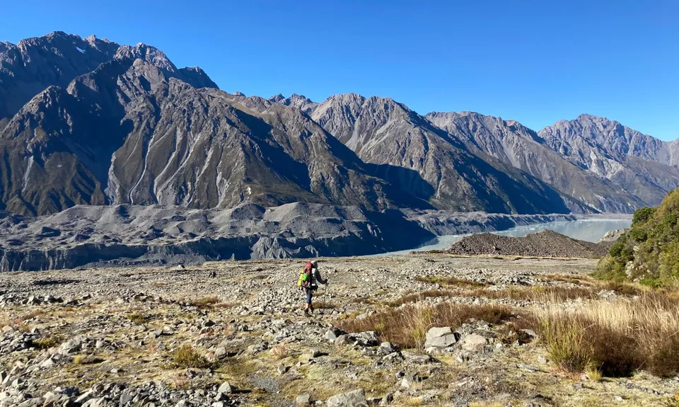
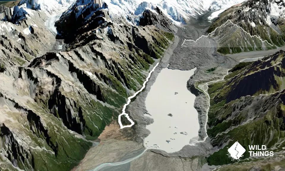
A great alternative to the busy Hooker Valley track, the old Ball Shelter Track to Husky Flat also provides stunning views in the more scenic and quiet Tasman Valley.

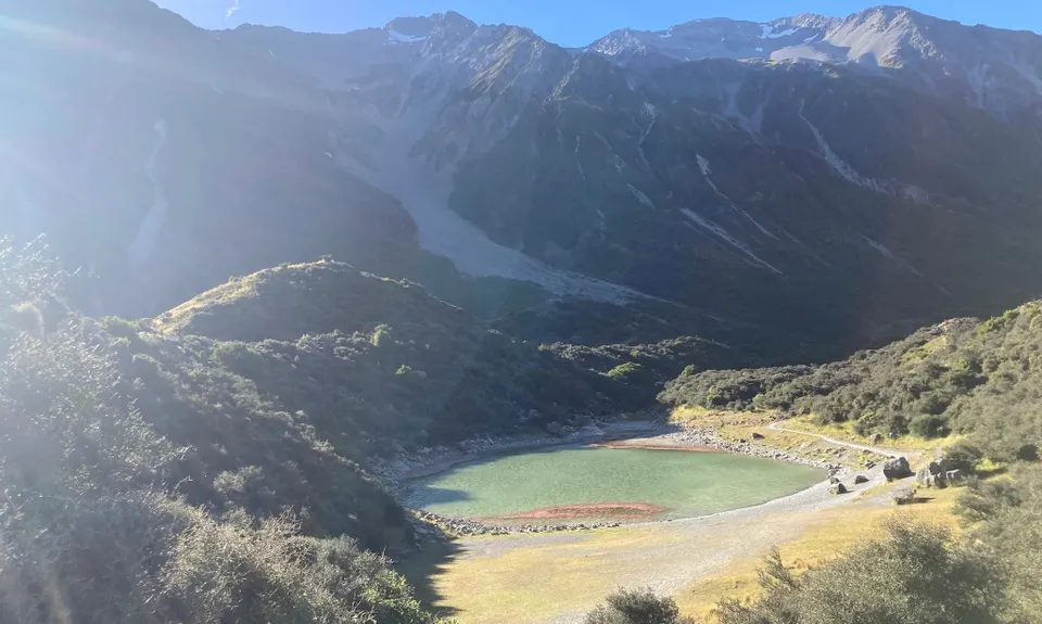
Start your run heading up the Tasman Lakes Tracks, then veer left at the DOC sign for Blue Lakes just a few hundred meters in. The first blue "lake" (they're more like tarns) is on a well-formed track, but it takes a bit more matagauri-bashing and route-finding to get to the second two, and then to pop out onto the Ball Shelter Track -- then turn right.

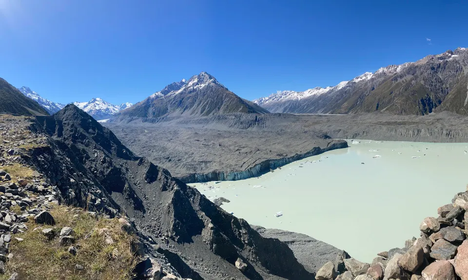
The Ball Shelter Track is a 4wd road, so look out for vehicles and mountain bikes. There are a few bits that are severely rutted that tend to hold water no matter how dry the weather has been, so it may take some care to not get feet wet. The Ball Shelter track gradually takes you up towards Husky Flat, where you get stunning views of the Tasman Lake and glacier terminus.

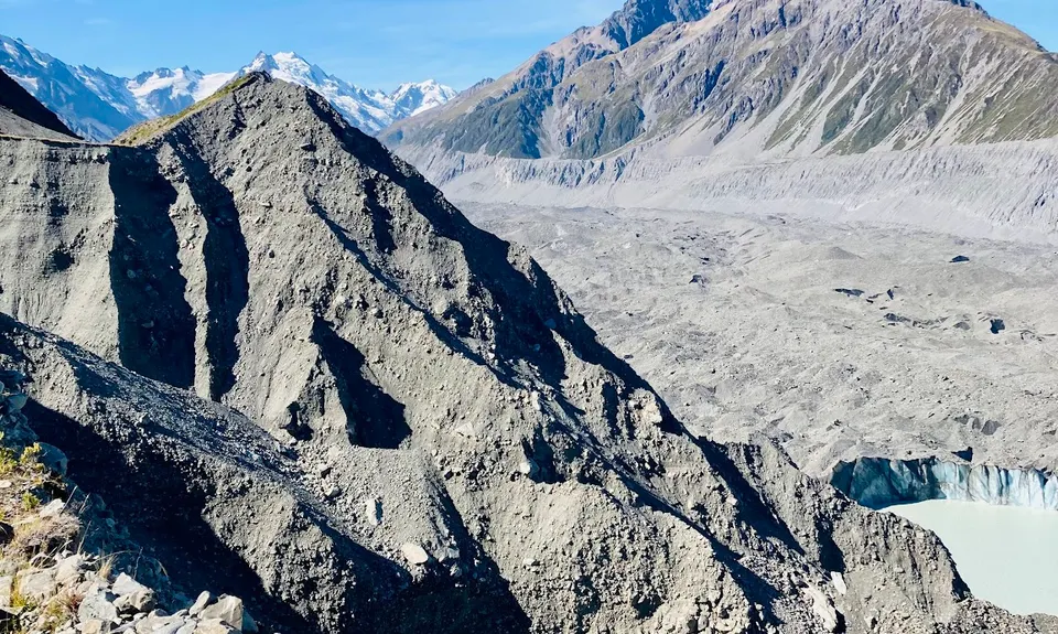
Husky Flat is your turn-around point; the Ball Shelter Track can be followed all the way back to the carpark. Early on the way back, look out for a small impact trail going up the moraine on your left for an extra bonus view of the Tasman lake & glacier (take extreme care up there).

Note: Past Husky Flat, a severe geography-shifting landslide cut off the 4wd track some years back. Mountain guides have re-cut a route through the slip to get to Ball Hut/Shelter and beyond to Caroline Hut and the Ball Pass route, but it's not exactly runnable. For a more adventurous mission, you can carry on to Ball Hut and back, which will double your KMs and more than double your time, considering how slow-going the travel is past Husky Flat.

Tasman Glacier & Tasman Lake.

Unfortunately, no public transport is available. The parking lot can be busy during the day in high season, worst case you may need to park along the road. It is also do-able to cycle to the start of the trail from Mt Cook Village.

9 km

12 minutes

No

No

Moderate.

Ball Shelter Track is easy to navigate, but getting through the Blue Lakes can sometimes involve some matagauri bashing to find the trail.

Non-existent.

Long-sleeved thermal top, Seam-sealed waterproof jacket, Windproof jacket, Personal Locator Beacon (PLB), Whistle, First aid kit, Extra food for emergencies, Cellphone, Map

No reliable/all-weather water source.

Avalanche risk on the Ball Shelter Track in winter/spring -- check with DOC Aoraki Mt Cook Visitor Centre.

Avalanche risk on the Ball Shelter Track in winter/spring -- check with DOC Aoraki Mt Cook Visitor Centre.

You and Husky Flat via Blue Lakes

As a VIP member you can record private notes for this trail, see all of your times and more.

Register Now

Already have an account? Login now

Trail Reviews

Be the first to submit a review for Husky Flat via Blue Lakes!

Login to submit a review

Trail Running Community

Find people who are interested in or have completed this trail run.

You must register or login to view this feature.

Register Now

Other trails nearby
Sebastopol Traverse - sky run

Sebastopol Traverse - sky run

Length: 5.7km

Level: Experienced

Hooker Hut

Hooker Hut

Length: 8.9km

Level: Beginner - Intermediate

Mt Cook Village & Hooker Valley

Mt Cook Village & Hooker Valley

Length: 16.0km

Level: Beginner

Red Tarns

Red Tarns

Length: 3.5km

Level: Beginner

Find more trails and peaks nearby