A-Peeling!Beginner - Intermediate
Submitted by Mike Tennent
Front country - easily accessible
Loop
Undulating, some big hills
Native bushPlantation/exotic forest
Beginner - Intermediate
2:00 (Slow)
1:30 (Moderate)
1:00 (Fast)
-13.2%
+13.8%
Fastest Known Times (FKTs)
To gain a valid FKT, the out and back to the falls must be completed.
Please set your gender to see your position on the FKT leaderboards.
The more , the harder the FKT will be to beat. Learn about Fastest Known Times.
Description
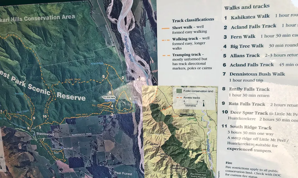
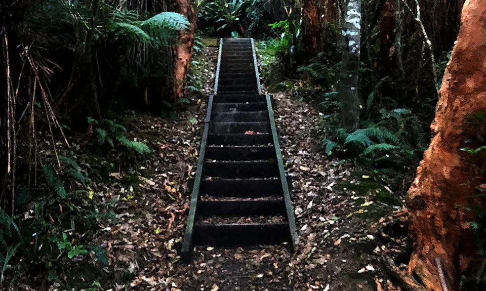
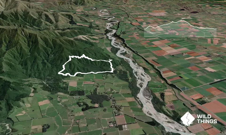
Starting at the shelter run around the gravel roadway clockwise until you are about halfway to the loos, then to the left you will see the sign for Acland Falls. Head onto that trail and straight away onto the steps - 100m vert in about 500m will warm you up.
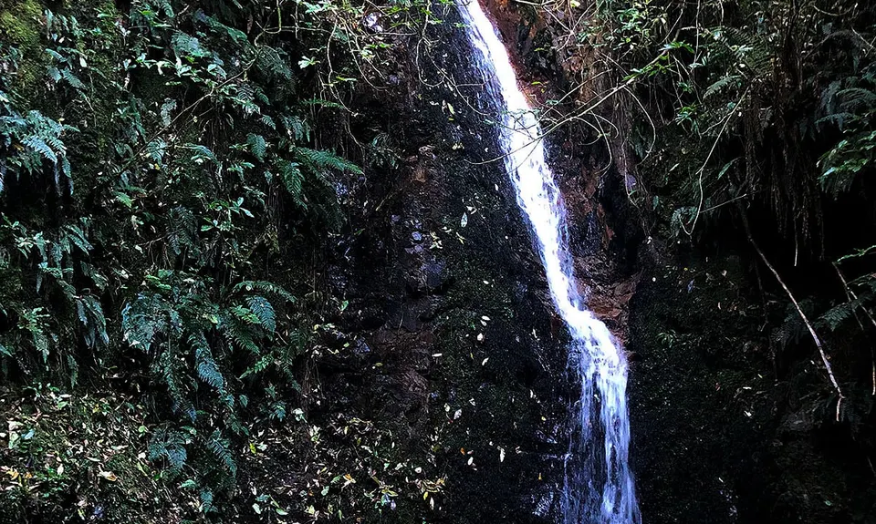
At the intersection head right to the falls and give back all of the 100m as you plummet down the hill. The trail here is exemplary and you will have no trouble pushing it. Take some time at the falls and then retrace your steps back up the 100m vert to the intersection again. At the intersection head right onto Allans Track.
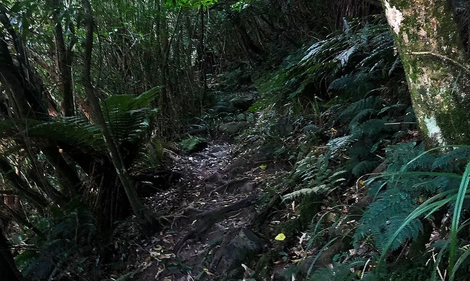
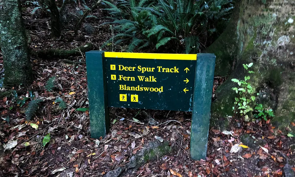
Now kiss goodbye to nice groomed walkway,say hello to mongrel track. Very technical for much of this section, added to some steady climbing - the major part of the 492m vert is done in about 2.5km... you do the math! So follow Allans Track until it comes to a T junction, then head left down the hill. Some lovely flowing downhill here, mixed with a bit of technical and a few mud pools. Keep an eye out on you right for a sign pointing to Fern Walk - you will only see the back of the sign as you are running down.
Turn left onto Fern Walk and you have nearly 2.5km of largely runnable, slightly downhill running. There are sections of mud, tree roots and some gnarly bits, but overall great running and watch out for some big-ass trees. Eventually it will spit you out next to the road. Turn left, run about 40 metres and left again onto Big Tree Walk. Run this and take a left at the intersection and it will spit you out at your car!
Trail Community
Features of interest
Nice wee waterfall, some amazing giant native trees towards the end.
Make Up of Run
Untracked / Route only: 0%
Technical Single Track: 40%
Moderate Single Track: 20%
Easy Single Track: 40%
Farm Road / 4WD Track: 0%
Gravel Road: 0%
Sealed Road: 0%
Route Data
Reviews:
Overlapping Runs
The following trails overlap with this run to some degree. You may wish to combine them but please note that to qualify for FKTs on these runs you should record a separate Strava activity for each
Photos:
Your Trail Wishlist
All the runs that are on your To Do list (no limit).
Add to wishlist view wishlistWild Explorers
I did it!-
Access
Head towards Peel Forest township on Rangitata Gorge Road.... head though to built up area and watch for a big area to your left with a pretty obvious toilet block. At the other side of the cleared area is a shelter with a map of the tracks in it.
24 km
21 minutes
No
No
-
Staying Safe
Easy.
Very patchy.
Waterproof leggings, Thermal leggings, Long-sleeved thermal top, Seam-sealed waterproof jacket, Windproof jacket, Gloves, Beanie/thermal headwear, Personal Locator Beacon (PLB), Whistle, First aid kit, Extra food for emergencies, Survival bag, Cellphone, Map, Headtorch and spare batteries.
Not really any drinkable water other than the falls at the start... maybe one other stream.
Even after quite a lot of good weather and minimal rainfall there were frequent mud-holes on the course. I would imagine it would be way worse in winter and may need to be avoided... up to you!
Wet rocks, some with the telltale green coating, some slippery downhills and lots of tree roots. This trail, especially the technical section needs to be respected.
-
Sponsor this trail