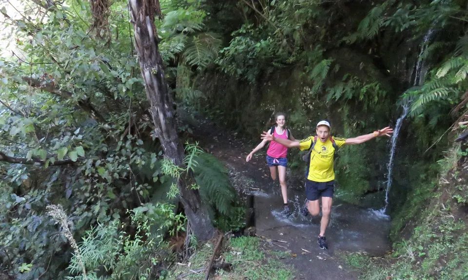
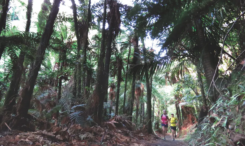
Starting from the northern/Opotiki end, you're straight into the super pretty stuff. The first 4km was once farmed so much of the hillside is regenerating bush, but it's still well-forested. The stream is almost straight below. Run to the music of water!
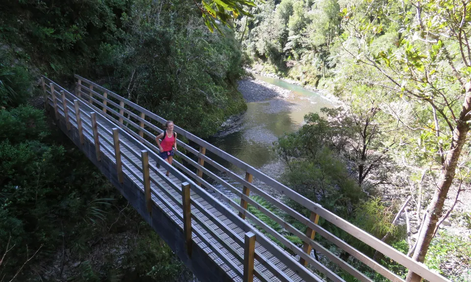
There are 25 bridges on the Pakihi, all built as part of the Motu Trails development in 2010/11.
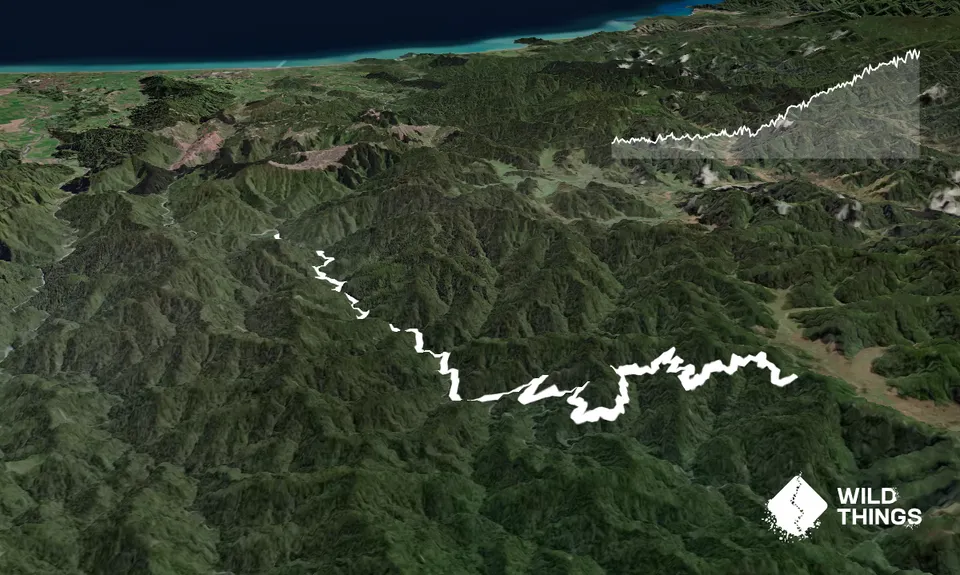
There are no super steep bits, though from midway the climb is solid.
At the Motu Road intersection, there is a tiny shelter. If you want to add distance, turn right/south and after a bit of undulation you will keep climbing.
The Pakihi is an historic track, that a century ago was hoped to become a road. Fortunately, that failed! A wonderful, spectacular outing in remote forest. It's only 30min drive from Opotiki though, and you can run as little or much as you want, so this track is suitable for all abilities/ages.
Starting from the northern/Opotiki end, you kick off at 100m altitude and gradually climb to 600m. The first 9km is alongside the Pakihi Stream, then you climb up through forest. There is a basic DOC hut at half way.
You can see (if you take the time to look!) signs that this is an historic track.
Alongside the midway suspension bridge, there are remnants of historic bridge abutments. Higher up, the track is cut through ridge-tops, as was typical to maintain an even gradient.
The Pakihi was cut by hand from about 1906-1914. It follows the general direction of Te Kowhai track, a route used by Maori.
If you know of any public toilets near the trail start or on the route, please login and then let us know so we can update this section.
Parking and toilets at both ends of the track. The Opotiki/northern entrance is at the end of the unsealed Pakihi Road.
From Opotiki, start heading south on SH2. On the outskirts of town, turn left onto Otara Rd. This has a sign to Bushaven. The road veers south, then heads for the hills. There's about 10km of sealed road, then the road turns to gravel. (Do not turn off onto Tutaetoko Rd or Otara East Rd!)
After 3km of gravel, the road forks. Turn left on the Pakihi Rd. Do not turn right up Te Waiti, unless you want to go to the Te Waiti track (which will be in another entry), or accommodation and camping at Bushaven.
From where the road forks, it is 7km to the road end. Lights on! Go slow! The road is narrow and does carry traffic. Help us keep the support of locals. Go slow! At the road end, there is plenty of space to park and a shelter.
(There are two shuttle companies servicing the Motu Trails. If you have a group, they can drop you off. If you are fit, a good suggestion is to get dropped off at 'the boundary line' at the Motu Road Hilltop. This is the usual cyclist dropoff. You will get 9km of largely downhill gravel road, then the 21km of the track. If you are staying at Bushaven, you could even run on there, for a 45km day)
25 km
33 minutes
Yes
No
Easy.
Once you are at the track, it would be hard to go wrong. There are no side tracks aside from a short detour to the hut.
However, this is backcountry! There is no mobile reception and out of season, few people. Take a PLB, available for hire from the Opotiki i-SITE from $15. Take all emergency stuff, you must be self-sufficient.
Go to the i-SITE in Opotiki, Gisborne or Whakatane, for a free Motu Trails map brochure. Or visit www.motutrails.co.nz. Or email Jim at Motu Trails Charitable Trust on jim@motutrails.co.nz
Plentiful side streams. Best not to drink from the main river. In summer, the upper (southern) half of the track only has a few places to drink.
In winter, the upper/Motu Rd end can get misty and cold, and occasionally snow. The track is predominantly very well draining. You will get muddy feet if it's wet, but there are no bogs.
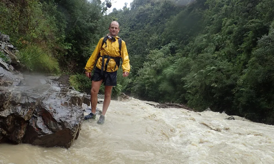
The eastern BOP gets very heavy rain at times. In storms, the track becomes a spectacular water-world of spray, drips and waterfalls. In extremely heavy rain (100mm + in 12 hrs) it's best to delay your run, as the rocky banks are prone to slipping. There are no river crossings, unless the Pakihi goes into a high flood. Treat it with utmost caution.
Be aware, this is a shared use track. Please stand aside for bikers, it's easier for you to do so than them. Smile, say hi, share the love, the track is for all of us!
Hot Bread Shop
Opotiki http://www.motutrails.co.nz
Coffee before, food after, mmmmm. They are official partners to Motu Trails. Their membership helps support Motu Trails Charitable Trust. Without that, there would be no map, and a lot less support for the trails.
Bushaven/Motu Trails Hire & Shuttle
Te Waiti http://www.motutrails.co.nz
Bushaven/Motu Trails Hire & Shuttle offer accommodation, camping, shuttles, bike hire etc. They are also official partners. They are ideally placed, being only 10km from the track entrance.
weka wilds
Pakihi track end http://www.motutrails.co.nz
You can't stay closer to the Pakihi Track than this! Weka Wilds are official partners to the trails so they help us. But get this ... if you have a group, Christian makes and bakes the most wicked pizza. Stay at Weka Wilds, do the run, chill out with mean pizza made with fresh ingredients. Chur bro!
Do you have another suggestion on where to go afterwards for the best coffee / cake / breakfast / brunch / beer?
Beautiful easy profile trail that I completed as an early morning solo effort. Great scenery, and the morning I did it was the only runner on the track. Highly recommended. Also took the few hundred metres down to the Pakahi hut to also check that out.
This is one of the most detailed descriptions on here!! its also an epic run from Matawai/Motu up and over, the Motu Falls are also worth checking out and there are a few short loops around there.
We don't store or share your location; it's only used for these features. You can continue without it, just without distance sorting and live map features.
Send to your phone
Scan the below QR code to open this page on your phone.
Tip: position the QR code in your phone camera screen.