Last Updated: 21st Sep 2023

Intermediate

Save Trail Save

I've done it Done

Full Monty Coastal Challenge

Last Updated: 21st Sep 2023

Intermediate

Save Trail Save

I've done it Done

Open

Grunt Factor: 42 ?

Gnarl Factor: 56 ?

30.0km

600m

600m

84m


Login as a VIP to see driving directions, distance and time.

Trail Map

Type of Run

Front country - easily accessible

Point to Point (one way)

Undulating, small hills only

Beach

Coastal

Open farmlands

Other

Run Makeup

40%
10%
50%

Easy Single Track

Moderate Single Track

Untracked / Route only

Average Uphill Gradient: +4.3%

Average Downhill Gradient: -4.1%

Trailhead

Login as a VIP to see the trailhead information.

Estimated Times to Run

6:00

Slow

4:30

Moderate

3:00

Fast

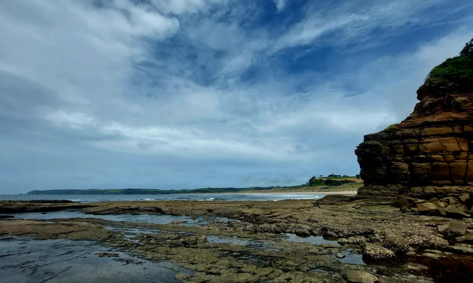
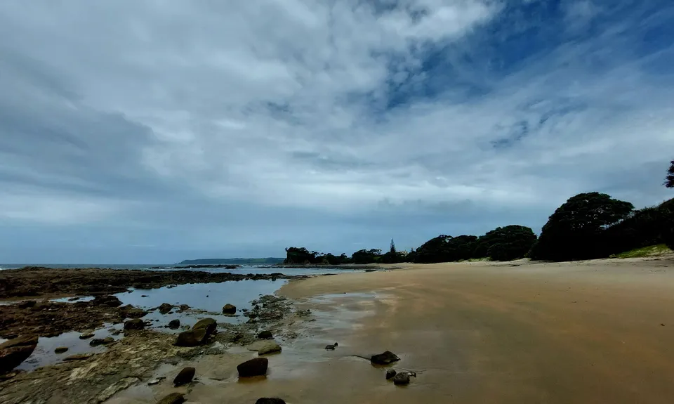
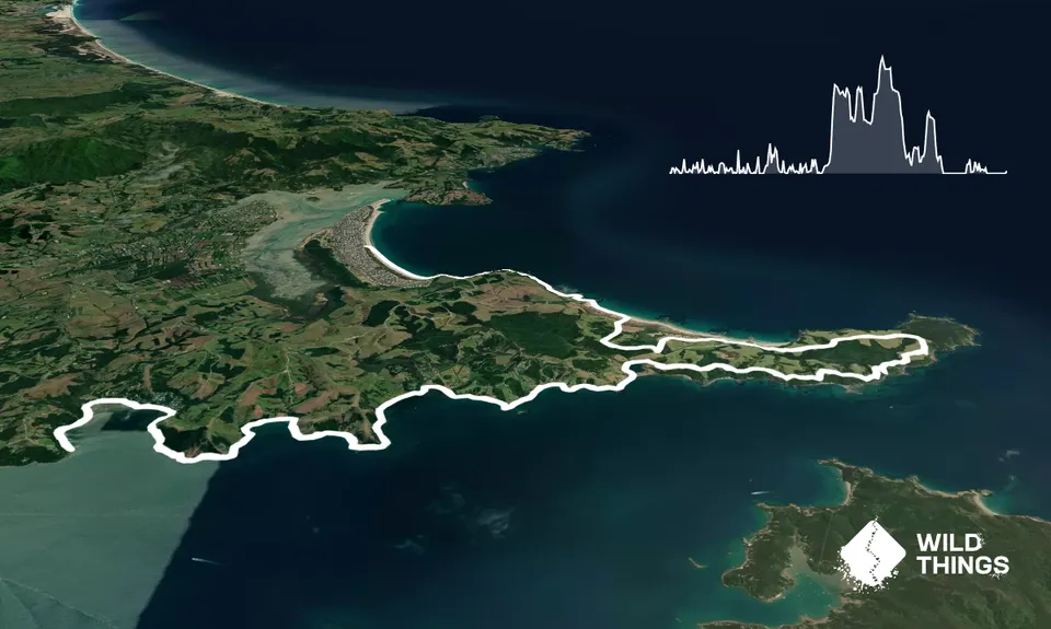
This is the Full Monty course from the Coastal Challenge running series organised by Total Sport. We started at Campbell's beach (eastern coast of the Mahurangi Peninsula) about 30 minutes after high tide and ran south along the sandy coast AWAY from Omaha beach, towards the Sand Spit entrance (with the water on your left) for 2.5km. The water level at this time ranged from ankle deep to chest high at one inlet crossing. The rocks all along this route had pretty good grip, better than a lot that I have felt around New Zealand.
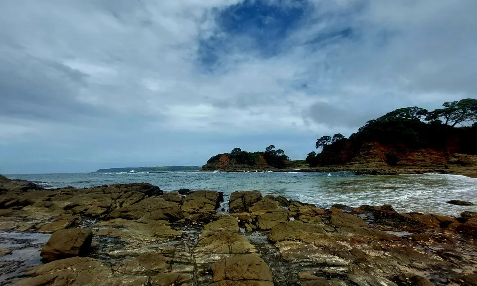
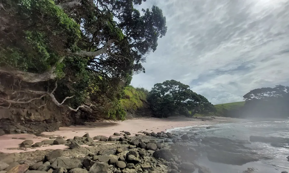
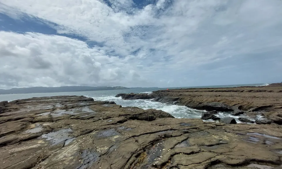
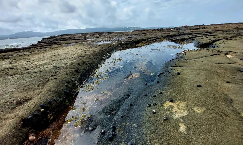
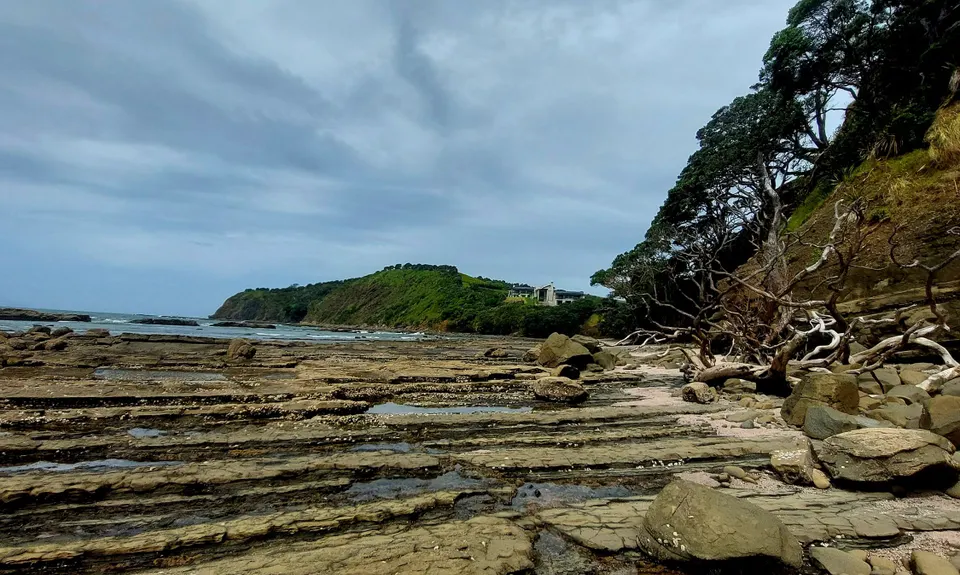
At 2.5 km we turned around and headed back to Campbells beach. Pass Campbells and continue on around the coastline heading north. The next 9 km is pure rock hopping and bolder climbing. You will not be going fast! A few spots required a little swim across an inlet. There are 3 or 4 beautiful little sandy beaches, including 2 that had pink sand! Not sure what causes this, possible the red algae or seaweed.

Stay along the coast until you get to Jones Bay and the edge of Tawharanui Regional Park (bathrooms here if you need them!). Please note, no dogs are allowed in the park. Enter the park and go around the lagoon and then up and over the peninsula, and onto the South Coast Track following the white markers. This will turn into the North Coast Track eventually (still white markers). It is mostly rolling grassy sheep/cow tracks with views of Kawau, Little Barrier and the Omaha Bay. You can pick up a Tawharanui map near the lagoon.

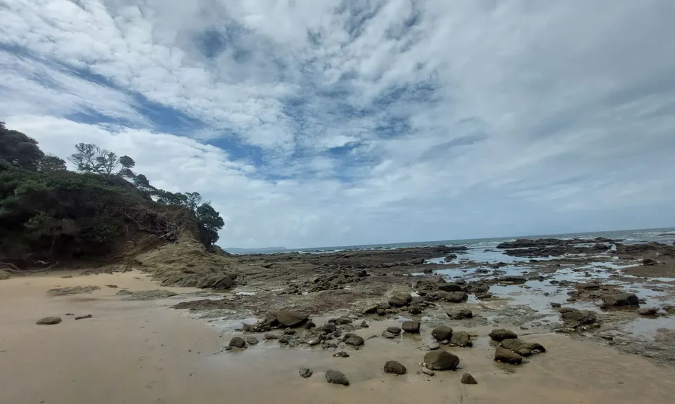
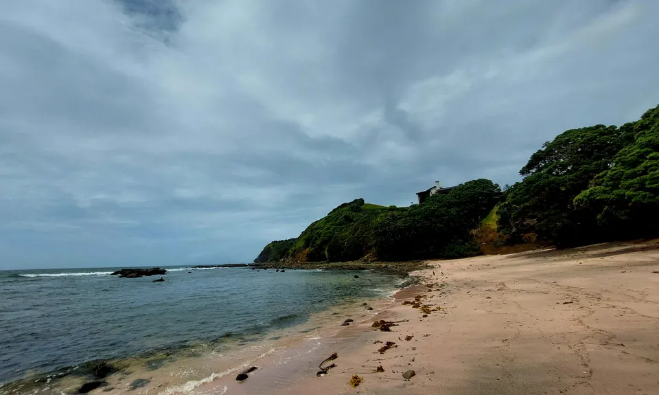
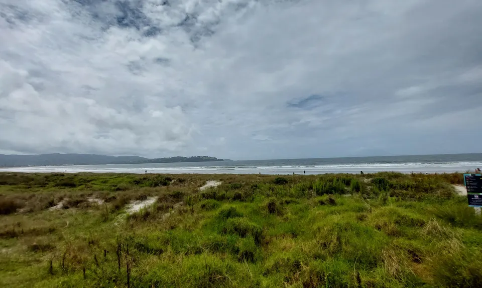
The North Coast Track drops down towards the golden sand of Anchor Bay (more bathrooms here!). From Anchor Bay, pick up the inland section of the West End Track (blue markers). The West end track spits you out almost on the coast, so take the short, sandy dunes track onto the beach. Run the length of the beach north and get back on to the rocky coastline. This rock hopping is much easier than the first section, with smooth, flat rocks and not so much cliff climbing. From here you'll be in and out of the water as you make your way to the southern end of Omaha beach. Once the rocks end, it's a quick sprint along the beautiful Omaha Beach to Fraser Reserve next to the Omaha Surf Club (more bathrooms and showers too).

Swims and cliff climbing if its high tide. 2 pink sand beaches. Beautiful sea views.

Public Beach

9 km

13 minutes

Unknown

No

Moderate.

Consider tides! Realise, if it's high tide, you will swim some.

Generally good.

Short-sleeved thermal top, Windproof jacket, First aid kit, Extra food for emergencies, Cellphone.

Not much along the way, but bathrooms at the start and finish. Showers at Omaha Beach.

Great on a nice sunny day!

Sharp, slick rocks, tides, waves.

You and Full Monty Coastal Challenge

As a VIP member you can record private notes for this trail, see all of your times and more.

Register Now

Already have an account? Login now

Trail Reviews

For those terrified of committment I only did Omaha to Tawharanui Marine Reserve and back at low tide. I nice 11km adventure. Could run in the water to cool off. Felt like a kid hopping over the rock pools. Magical.

Karen Koch

February 4, 2023

Login to submit a review

Trail Running Community

Find people who are interested in or have completed this trail run.

You must register or login to view this feature.

Register Now

Overlapping Trails

These overlap with this trail to some degree. You may wish to combine them but please note that to qualify for FKTs on these runs you should record a separate activity for each.

Tawharanui Loops

Tawharanui Loops

Length: 18.0km

Level: Beginner - Intermediate

Other trails nearby
Mt Tamahunga

Mt Tamahunga

Length: 5.1km

Level: Beginner

Tamahunga to Pakiri Beach

Tamahunga to Pakiri Beach

Length: 17.4km

Level: Beginner - Intermediate

Find more trails and peaks nearby