Last Updated: 21st Sep 2023

Beginner - Intermediate

Save Trail Save

I've done it Done

Aotea Track, Great Barrier Island

Claris, Auckland

Submitted by Gareth Morris & Sam McEwan

Last Updated: 21st Sep 2023

Beginner - Intermediate

Save Trail Save

I've done it Done

Grunt Factor: 46 ?

Gnarl Factor: 31 ?

31.0km

1700m

1700m

627m


Login as a VIP to see driving directions, distance and time.

Trail Map

Type of Run

Front country - easily accessible

Loop

Undulating, some big hills

Native bush

Open ridges/tops

Run Makeup

20%
45%
25%
10%

Gravel Road

Easy Single Track

Moderate Single Track

Technical Single Track

Average Uphill Gradient: +10.4%

Average Downhill Gradient: -10.4%

Trailhead

Login as a VIP to see the trailhead information.

Estimated Times to Run

7:00

Slow

5:00

Moderate

3:30

Fast

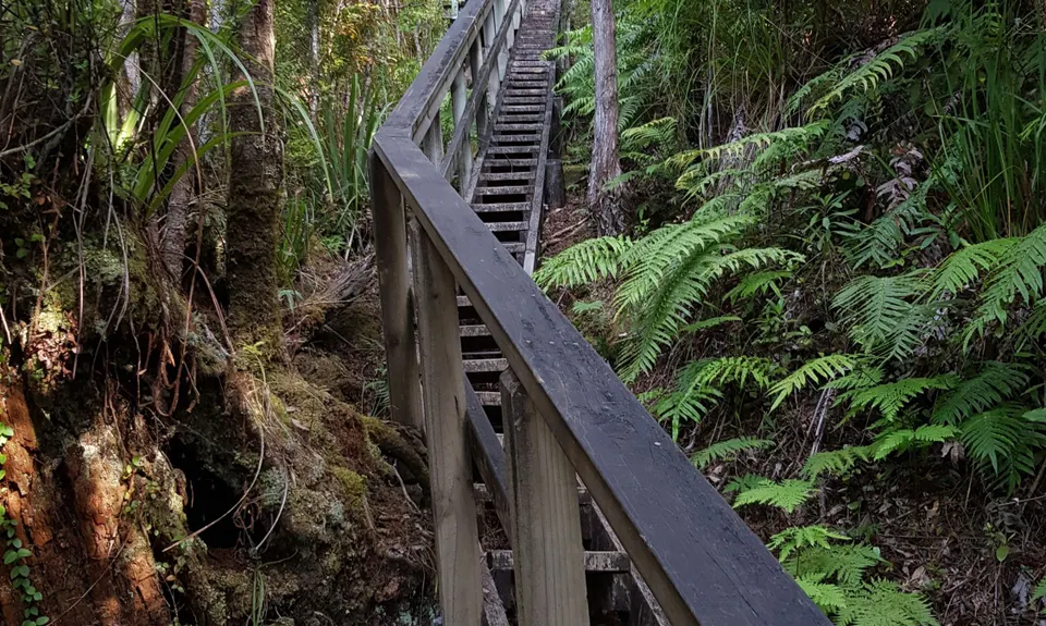
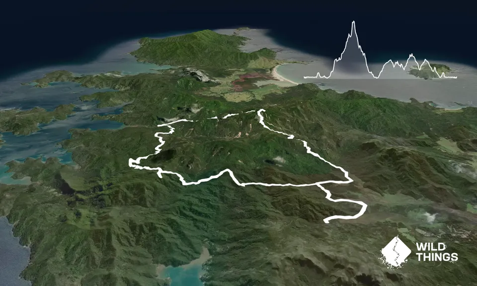
Start at the beginning of Kaitoke Hot Springs Track on Whangaparapara Road. Scrub and spray your shoes at the wash station before heading along a couple of kilometres of easy trail and boardwalk through the wetlands to the hot springs. Pause briefly to think about how nice the hot springs will feel on your feet before charging up some stairs and along some trails to hit Tramline Track.

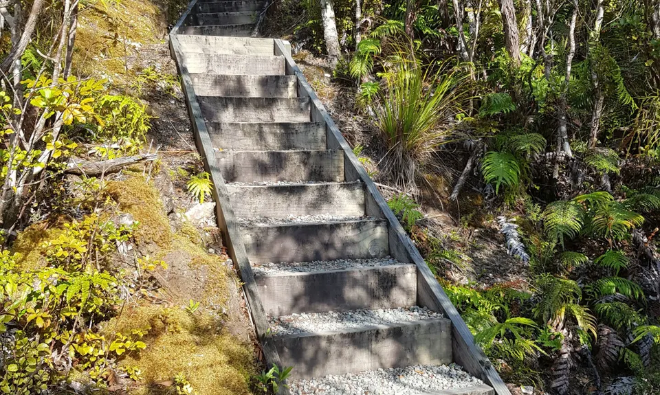
This is well signposted, with the junction just over a small bridge. Hang a right and enjoy the lovely, buttery smooth trails of Tramline Track for about 1.5k before turning left for the many stairs of Peach Tree Track. Keep going up the long climb and enjoy the views as you head up above the bush. After about 5k you'll hit a junction with South Fork Track (also well signposted). Take the right, uphill trail and you'll hit Mount Heale Hut, which has beautiful views down to the West Coast of the island.

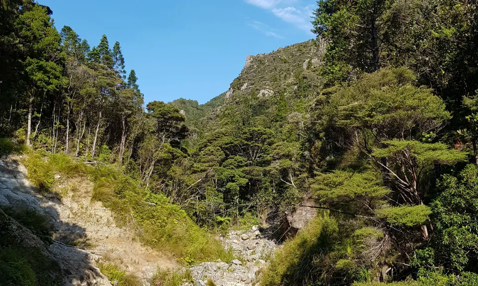
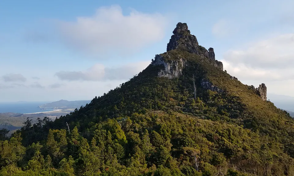
Enjoy the views before heading up to Mount Hobson just over a kilometre further up; there are a LOT of stairs. On a fine day it's worth heading up to the summit itself for the views, before dropping back down. There is a complex junction here, but it is well signposted. You want to head Northwest on Kaiaraara Track and back long some very long sets of stairs. On the way down you'll see lots of evidence of slips, plenty of suspension bridges as well as some very informative signs about Kauri logging.

After about 5.5k you'll come to a final swing bridge across the river, which is well signposted. Cross over the river and find Kaiaraara Hut about 100m to the Southwest. The next section is on the gravel Forest Road and easy to follow, if not as adventurous. It is worth taking the brief signosted diversion on the left to see two magnificent Kauri about 5k in, and the longer signposted diversion on the right a further 2k on to enjoy the views from Maungapiko. 3.5k further along the forest road, you'll see the signpost to rejoin the Tramline Track which will take you a further 2k to rejoin the junction with the Kaitoke Hot Springs Track. Head back down towards the hot springs for a well-earned dip, before the easy 2k trot back to the start of your route.

This trail includes the peaks Mount Hobson (Gt B Is) and Maungapiko.

Plenty to see and experience! The magnificent Hirakimata (Mount Hobson) is the highest point on the island and provides an amazing outlook to the Coromandel and Hauturu (Little Barrier). Keep an ear / eye out for Kaka. Kauri Dams line the gorge you descend into. There are also old tramways near Kaitoke Hot Springs, stunning waterfalls, wetlands and some beautiful kauri.

Kaitoke Hot Springs is at the start (and finish) so it's nice to dangle your feet in the naturally hot water to refresh! 

Either drive and park in the small parking area at the start of the trail, get a taxi or walk/run (5k from Claris, 15k from Tryphena.)

The hot springs are frequented by visitors so you may need to park up the road a little. The Barrier is generally very safe but still hide any valuables. Hitching is also easy on the island too.

5 km

10 minutes

Unknown

No

Easy.

The route is very well signposted so navigation is easy PROVIDED you read every sign. There's a PDF map of the route on the DOC site, which can also be picked up in leaflet form from many places on the island.

Patchy.

Long-sleeved thermal top, Seam-sealed waterproof jacket, Gloves, Beanie/thermal headwear, Whistle, First aid kit, Extra food for emergencies, Survival bag, Cellphone, Compass, Map, Headtorch and spare batteries

While there is water available at the huts, you are advised to boil it before use. There are numerous streams in the area; however it is not known whether it is advisable to drink from them.

Probably a bit muddy after rain.

Lots of wooden steps which could become very slippery in wet weather.

Currach Irish Pub
Tryphena
http://www.currachirishpub.co.nz/
Excellent beer and pizzas straight from a wood-fired oven. Can get very busy though!

You and Aotea Track, Great Barrier Island

As a VIP member you can record private notes for this trail, see all of your times and more.

Register Now

Already have an account? Login now

Trail Reviews

Forest road was indeed the worst bit of the track, but the other bits more than made up for it. Tramline track was just spectacular, if brutal on my legs. Stayed at Heale hut and it was a fantastic hut, the kaka wheeling overhead during the mornings was a great highlight.

The hot pools were very welcome after the run.

Andy Savage

October 20, 2022

Agree that the Forest road is a little tedious but the side trips to the Kauri and Maungapiko rocks are well worth it-there is a nice bench at the top of the rocks. The rest of the track has some great views. If you are not a fan of wooden steps though this is not the track for you !

Simon Huntley

February 10, 2021

Whist the forest road is a little ho hum, the rest of the track has some great trails, views, dams, and hot pools. Just off the track there are other great sights like Coopers Castle, Windy Canyon, and canyoning down Awana Stream. Spent 2 days staying at Mt Heale Hut over NY which was a fantastic base for running these trails.

Ian Gilmour

January 30, 2020

Login to submit a review

Trail Running Community

Find people who are interested in or have completed this trail run.

You must register or login to view this feature.

Register Now

Overlapping Trails

These overlap with this trail to some degree. You may wish to combine them but please note that to qualify for FKTs on these runs you should record a separate activity for each.

Hobson Hoedown

Hobson Hoedown

Length: 20.0km

Level: Beginner - Intermediate

Other trails nearby
Harataonga Coastal Walkway

Harataonga Coastal Walkway

Length: 11.7km

Level: Beginner - Intermediate

Te Ahumata Summit

Te Ahumata Summit

Length: 9.0km

Level: Beginner - Intermediate

Find more trails and peaks nearby