Wild Things - New Zealand's trail running community
New Zealand's trail running community

Login


don't have an account?

Pukerua Scenic Tua, Wellington

Trail Directory proudly supported by Further Faster

Update Your Header Picture

Pukerua Scenic TuaIntermediate

Submitted by Mick Finn

Info Info
Map Loading

Trail Information

5.50km

220m

215m


Wellington

Pukerua Bay

Front country - easily accessible

Loop

Undulating, some big hills

Native bush
Beach
Coastal
Open farmlands
Open ridges/tops

Intermediate

1:30 (Slow)
1:10 (Moderate)
0:50 (Fast)

-7.9%

+8.1%

The track across the top is on private farmland and there is no access from 20 August to 15 October due to lambing. 

Best to go at low tide, as the final section along the coast can be very hard to sidle around at high tide.

Download PDF Guide

Fastest Known Times (FKTs)

Please set your gender to see your position on the FKT leaderboards.

Men

Women

Filter FKTs

The more , the harder the FKT will be to beat. Learn about Fastest Known Times.

Missing your time?

Register or login as a VIP and get yourself on the FKT leaderboard!

Register Now

Description

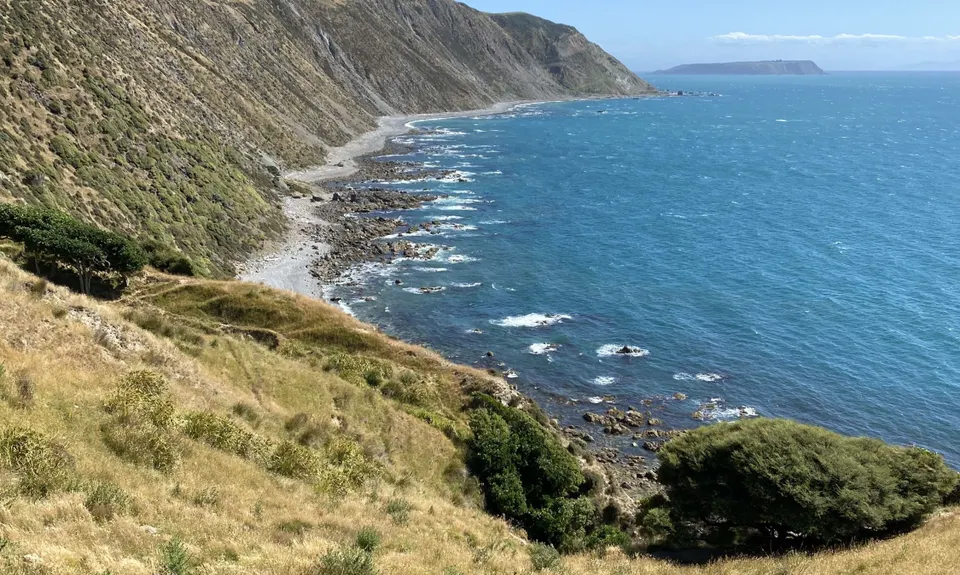
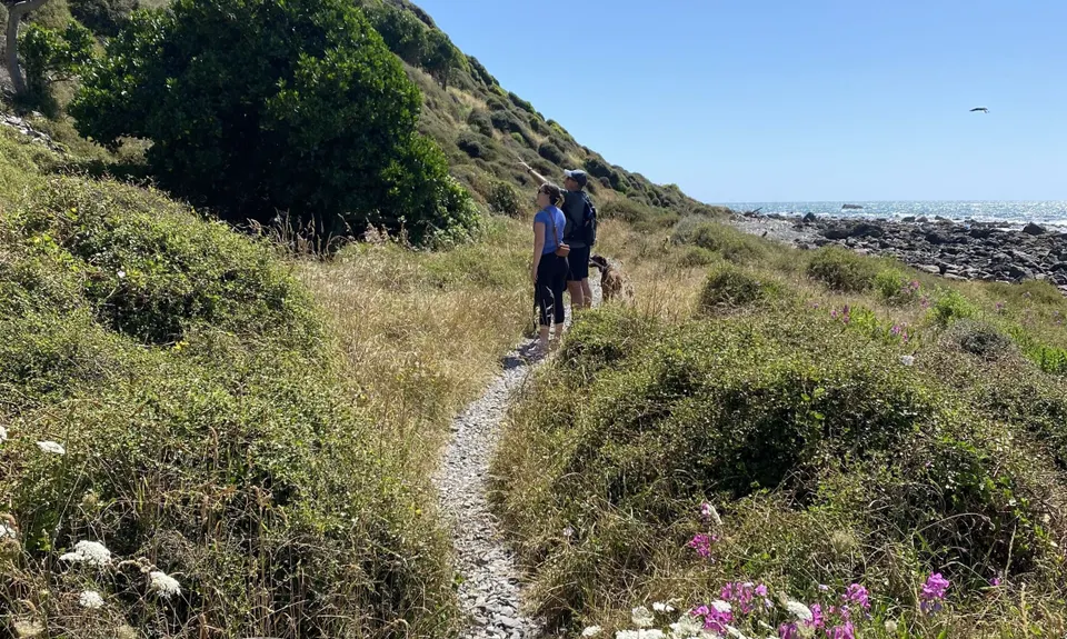
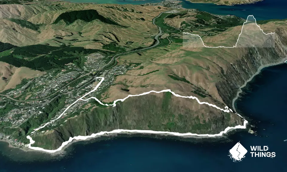
Easy road start heading along Teihana Road W and then Rawhiti Road towards the sea. Follow the steps down at the end of the road and then veer left (a south) along the coast, first road and then singletrack past the pau/post. The track varies from easy singletrack to rough but mostly stays just above the rocky beach amongst the scrub. The rock arch is on the track and worth a pic.

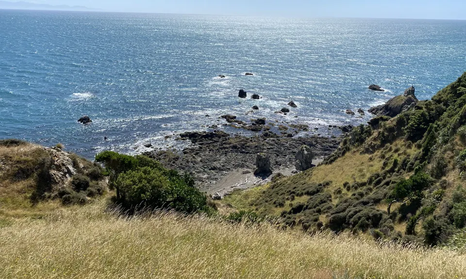
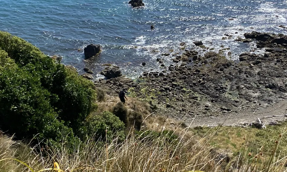
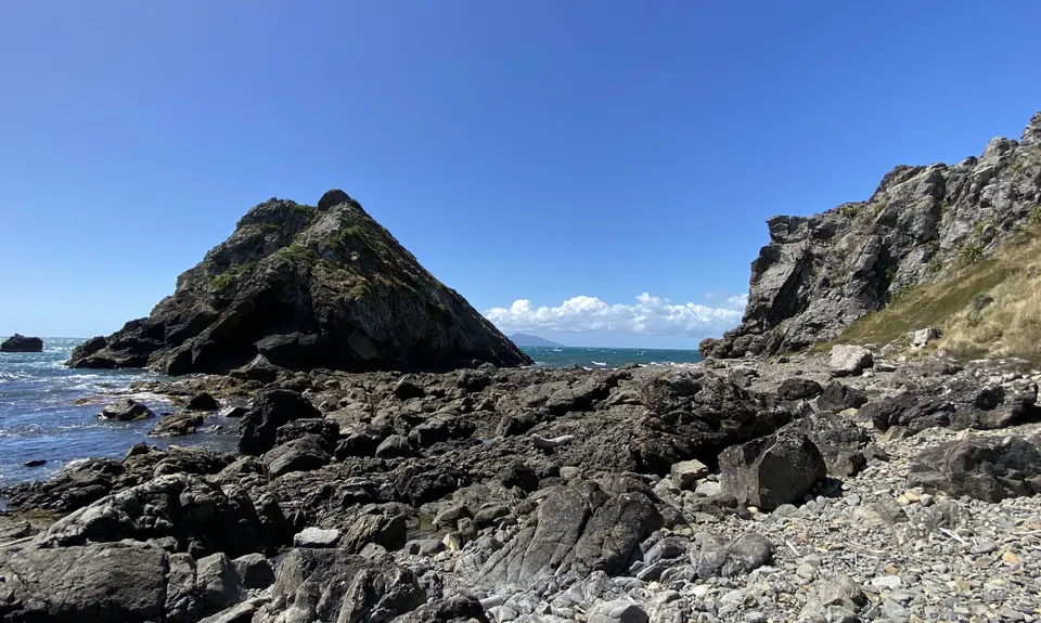
The track runs out at Wairaka Point where you follow the rocky beaches past the rock pyramids, scrambling past a small cave - this can be tricky at high tide, and very easy at low tide. From here you need to look for the small stream hidden in the scrub about 100 m on from the cave. There used to be an easy track along the stream to the mossy waterfall but it is often washed out at the base and/or covered by small land slips.

Once you get to the waterfall the track/route continues up the steep ridge and rejoins the stream just before some windswept Dr Seuss looking tress. Here, the route finding starts - you head north keeping above the steep terrain and gradually sidling up the hills using sheep tracks where possible. After a few hundred metres you can see where you’ve come from and the way back along the hills is easy to see.

There is a rough farm track for a short section approaching the highest point before dropping down to the fence line along the top of the cliffs. At the final fence crossing into native bush (Raroa Reserve) look for the track leading down to the right which is easy to run and leads down to Raroa place (with a quick photo stop detour to the lookout early on).

Turn left along Raroa place then first right down a side street to Rawhiti Road, right again to follow it back to the shops.


Trail Community

Find people who are interested in this run.

You must register or login to view this content.

Features of interest

This walk includes a rock arch, Wairaka Point (possibly a seal or two), a hidden waterfall, and spectacular views of Kapiti Island and the Kapiti Coast to the north. It varies from roads to rough singletrack and rocky beach to steep farm hills and a pleasant singletrack downhill through native forest.


Make Up of Run

Untracked / Route only: 40%

Technical Single Track: 12%

Moderate Single Track: 12%

Easy Single Track: 6%

Sealed Road: 30%


Route Data

Reviews:

You must register or login to view this content.

Photos:

You must register or login to view this content.

Your Trail Wishlist

All the runs that are on your To Do list (no limit).

Add to wishlist view wishlist

Your Trail Dreamlist

The runs you most want to do (limited to 10).

Add to dreamlist view dreamlist

Wild Explorers

I did it!
  • Access

    Pukerua Bay Shops.

    You can either take the train to Pukerua Bay station and walk two minutes to the start at the shops, or drive to the carpark at the dairy on the highway. 

    0 km

    0 minutes

    No

    No

  • Staying Safe

    Moderate.

    Hardest point is the turnoff from the coast up to the waterfall - but once you pass the cave there is only one obvious gully, about 10pm on. If you miss the turnoff you will just be on rocky beach (very hard going) for the next 1-2 km and then 5 km of road to Plimmerton. The untracked route back is easy on a clear day if you aim for the patch of native bush by sidling up and along the hills and then on the final stretch down some steep farm hills.

    Patchy.

    Windproof jacket, Whistle, First aid kit, Extra food for emergencies, Cellphone, Map.

    Some at the toilets on the beach about 1.2 km in.

    Need hat in summer as not much shelter for 95% of the way. Need wind/water proof jacket as the route is very exposed to the norwester, especially on the second half.

    Seals may be loitering near Wairaka Point at the midpoint. The open hills can be rough underfoot.

  • Post run indulgence

    Pukerua Bay Dairy
    Pukerua Bay
    Scoops of ice-cream on a hot day post-run are perfect.

  • Sponsor this trail

    If you are interested in learning about sponsorship opportunities, please get in touch below:

    Submit

Got a favourite trail? Tell us about it.

Share the love and add your favourite trail(s) to our growing trail directory.

Submit A Trail

Become a member today

Start enjoying the many benefits to becoming a member of our thriving community.

Become a member

Great brands at great prices with our VIP member's discount

Stay up to date

Sign up to our newsletter for latest offers and trail guides

Share this trail with a friend:

VIP Membership

Please register as a VIP or login to your VIP account to view this content.

Cancel Login Register

Membership Required

You can see up to three trail guides without being logged in but after that we require you to be logged in to your Free or VIP account. If you don’t yet have an account you can register here.

Login Register