Last Updated: 7th May 2025
Ngatapuwae
Last Updated: 7th May 2025
Open
Grunt Factor: 20 ?
Gnarl Factor: 50 ?
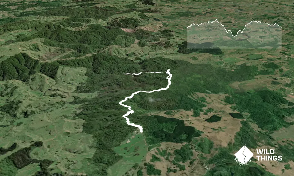
13.2km
420m
420m
317m
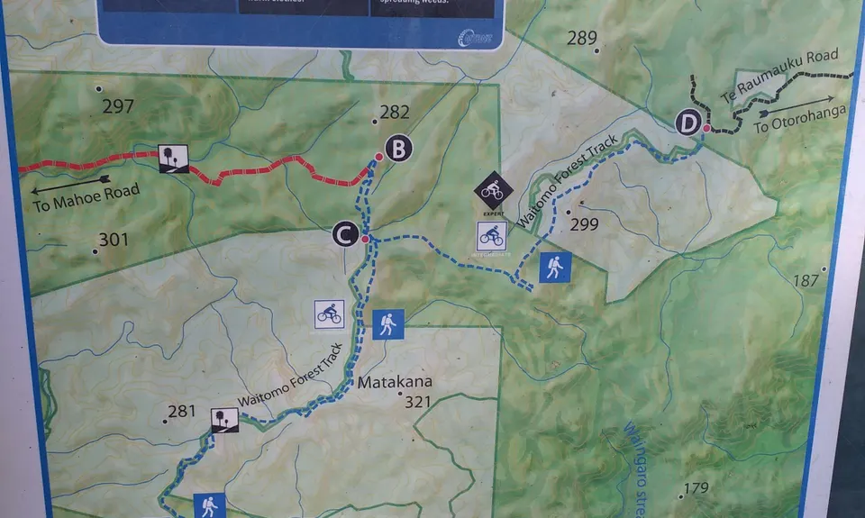
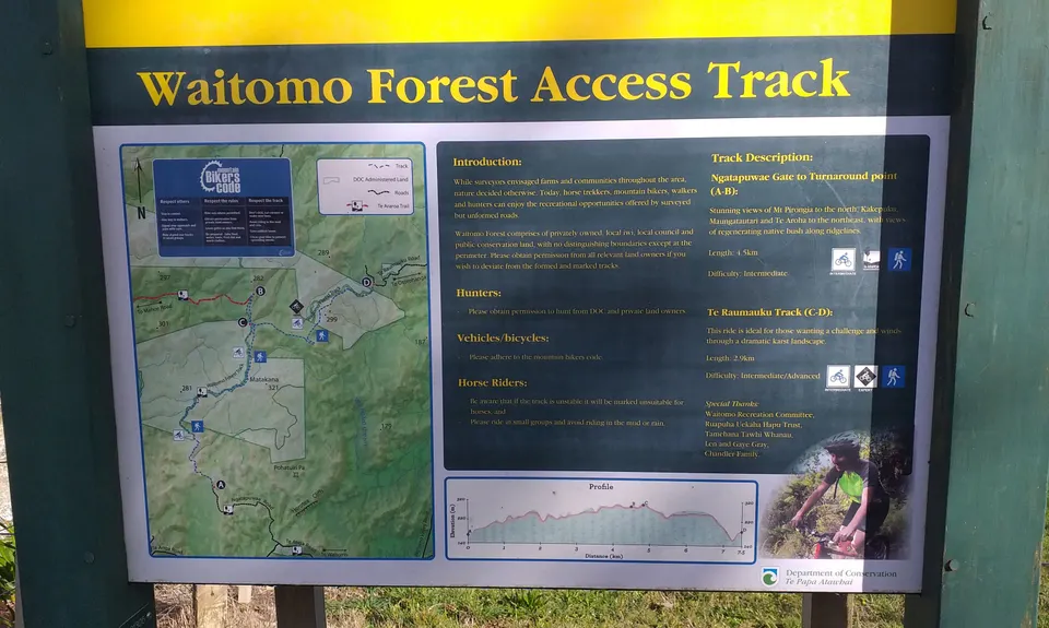
Trail Map
This Topo layer only covers NSW/ACT.
Switch to another map layer when viewing outside this area.
Switch to another map layer when viewing outside this area.


