Last Updated: 7th May 2025
Ngatapuwae
Last Updated: 7th May 2025
Open
Grunt Factor: 20 ?
Gnarl Factor: 50 ?
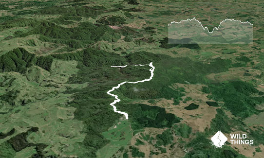
13.2km
420m
420m
317m


Last Updated: 7th May 2025
Last Updated: 7th May 2025
Open
Grunt Factor: 20 ?
Gnarl Factor: 50 ?
13.2km
420m
420m
317m
Front country - easily accessible
Combo
Undulating, small hills only
Dog Friendly
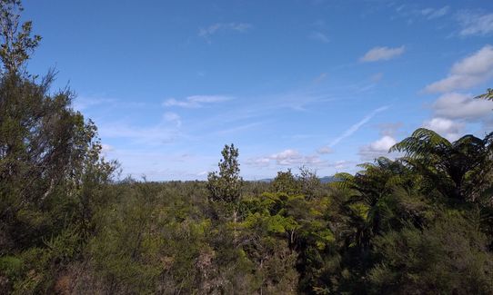
Native bush
Plantation/exotic forest
Easy Single Track
Moderate Single Track
Technical Single Track
Average Uphill Gradient: +8.00%
Average Downhill Gradient: -8.10%
VIP Feature: Send this route to your Garmin account so you can follow the course on your Garmin device.
Become a VIP Member to see the trailhead information.
2:30
Slow
1:40
Moderate
1:10
Fast
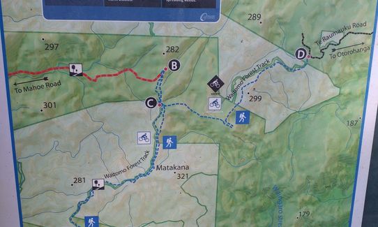
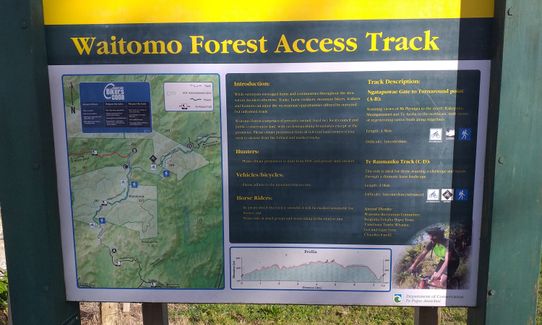
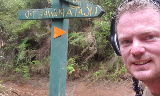
Start at the DoC sign which has a map of the route - this follows the A-B track on the map then goes a little further, but gives a good idea. You will be branching off the main track onto side tracks that criss-cross the main spine. These are marked with small uprights like road markers.
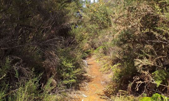
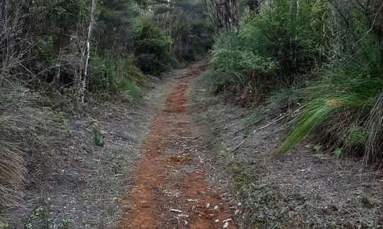
The track climbs gradually through thick bush. The first turn-off the main track is on the right after about 700m. These single tracks were built as MTB tracks - look out for bikes but it is very infrequently used. You reach the main track and cross straight onto the left. The right-left pattern repeats again, then after a stint on the central track you turn onto a right-hand trail again - this is marked as one-way in the wrong direction. After this joins the main track again turn right and continue for a few kms before turning sharply to the left and starting to go downhill.
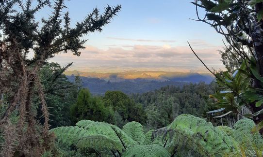
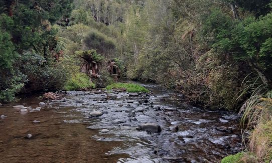
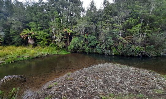
During this section you might see DoC orange triangles in the bush on the lefthand side - these are on the track you will return on so ignore them for now. You will see a further turn-off on the left. Ignore it and head on down the main track. It becomes quite rough and overgrown from here. after another 1.5km you will reach the river - have a splash and a drink before turning around. When you reach the first turn-off, now on your right, take it. This roughly parallels the main track but is all single track and through thick lush bush. You pop out on the main track again. From here you can again take the right-left-right-left side tracks, or stay on the main track for variety. Follow your nose back to the carpark.
If you know of any public toilets near the trail start or on the route, please login and then let us know so we can update this section.
Space for 2-3 cars, safe parking, no public transport
5 km
9 minutes
Yes
No
Easy.
Just keep an eye out for the side turn-offs - some of the markers get covered in bush. If you don't find them, the main track is still a really nice out-and-back.
Non-existent.
Personal Locator Beacon (PLB), Whistle, First aid kit, Extra food for emergencies, Cellphone, Map
The river at the turnaround point is the only reliable water access - there are other small streams after rain but these dry up in the summer.
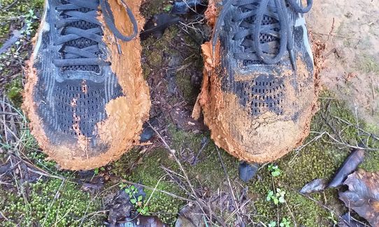
Clay track gets very muddy and slippery after rain. Mostly well shaded in summer.
Do you have a suggestion on where to go afterwards for the best coffee / cake / breakfast / brunch / beer?
Trail Legend
Login as a VIP to become a Trail Legend. Learn about Trail Legends.
Fastest Known Times (FKTs)
You and Ngatapuwae
As a VIP member you can record private notes for this trail, see all of your times and more.
Already have an account? Login now
Had a great day out, and the description of the route is super clear thanks Katie!
The side tracks are really fun, especially the one on the return. There were quite a few goats in the forest when I did it.
I did it after a lot of rain and some muddy parts but not too bad.
October 10, 2024
Not a bad trail. Turned into a bit of a ninja warrior course on way down to the stream, which was fun. I'd recommend running in inov8 or rugby shoes, running the side trails and maybe include te raumauku and te araroa tracks aswell
September 11, 2022
Mud wasn't too bad on my visit. Track pretty rough though due to horses cutting it up. Bush gets a bit more interesting (original) once you've crossed the stream.
July 7, 2021
Nice trail with a surprising amount of elevation, mix of sand and clay - some parts smooth and packed and some not. The "main" track is not marked with much, doesn't need to be, out and back is simple if you stick to the large sandy trail. There are several side tracks which loop back to the main track - can be a bit confusing. I did an out and back, stayed on the main track and had no issues. 6.4km out to the stream (lovely spot for a paddle and a picnic) and the same return. Tough in wet conditions, shin deep clay/mud/sand in places.
July 29, 2020
Send to your phone
Scan the below QR code to open this trail on your phone.

Tip: position the QR code in your phone camera screen.
Plan smarter, stay motivated, track your progress, and unlock the full Wild Things experience — while saving along the way.


