
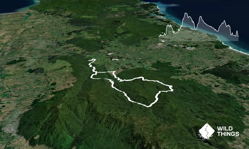
Trail Map
This Topo layer only covers NSW/ACT.
Switch to another map layer when viewing outside this area.
Switch to another map layer when viewing outside this area.
Back country - remote
Loop
Very hilly
With permit
Native bush
Open farmlands
Farm Road / 4WD Track
Easy Single Track
Moderate Single Track
Technical Single Track
Average Uphill Gradient: +9.80%
Average Downhill Gradient: -8.60%
VIP Feature: Send this route to your Garmin account so you can follow the course on your Garmin device.
Become a VIP Member to see the trailhead information.
10:00
Slow
7:30
Moderate
5:00
Fast
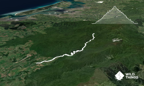
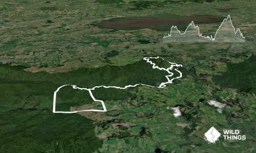
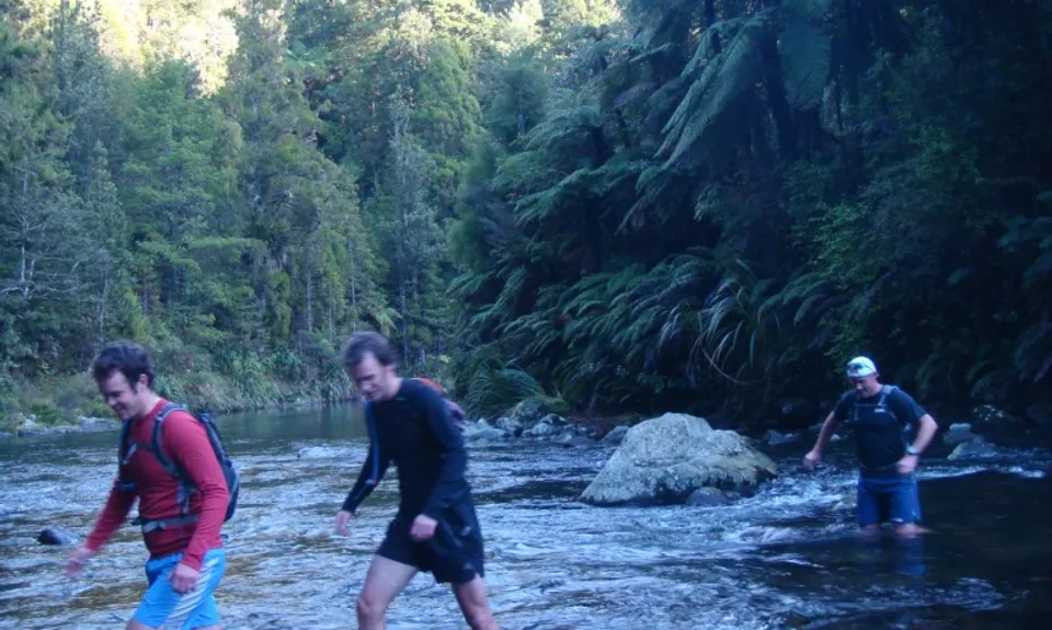
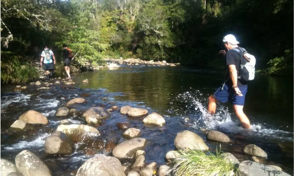
From the Dickey Flat car park take the Mangakino Pack Track south towards Daly's Clearing Hut. This pretty much follows the Waitawheta River, which after a couple of kms is crossed (caution - can get high after rain) before ascending through beautiful regenerating bush.
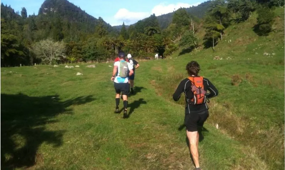
About 6 kms from the start take a left turn on Dean Track, following the sign to Franklin Road. Descend through bush before breaking out on to farmland with wide views all around. Follow this straight on over a few stiles until Franklin Road is reached. Turn right following signs forWaitawhetaValley and follow farm track for a couple of kms before turning left on to Bluff Stream Kauri Loop Track (to Kauri Trees and Ananui Falls).
A couple more stream crossings and a steep climb take you to the site of two spectacularly large kauris. At this point you also have the option of following the track past the kauri trees and continuing down a steep descent to get back to the Waitawheta River and complete a shorter loop (the Kaimai Semi-Killer!)
For the full Killer loop keep following the track uphill towards the Ananui Falls. The next 10 kms or so are steep, rough and technical so be prepared. The Ananui Falls are a worthwhile side trip before dropping steeply into the next river valley. At the next junction turn right to cross the river following the sign for Waitawheta Hut. A very technical section of bush running follows. The hut itself is accessed via a bridge across a spectacular gorge but the route lies straight ahead on the Waitawheta Tramway.
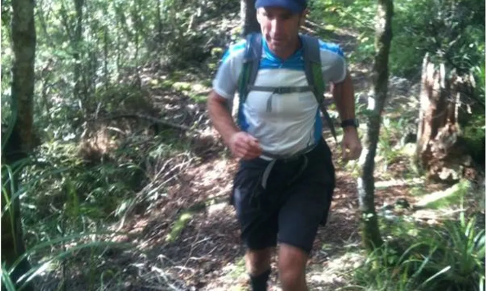
The next few kms are relatively easy running following the old tramway as it criss-crosses the gorgeous Waitawheta River. On reaching Dalys Clearing Track turn left and climb the hill to Daly's Clearing Hut. A short way past the hut turn right on to the Mangakino Pack Track again and follow this for a couple of kms to complete the big loop section of the run. For the final 6 kms you'll be re-tracing your steps from the start of the day.
This trail includes Daly's Clearing Hut, Waitawheta Hut and Dickey Flat Campsite.
Beautiful regenerating bush, large kauri trees, second highest waterfall in the North Island (Ananui Falls), numerous stream crossings, huts, the Waitawheta Tramway, swing bridges & gorges.
This is a serious run and should not be attempted in bad weather or by inexperienced parties.
If you know of any public toilets near the trail start or on the route, please login and then let us know so we can update this section.
Plenty of parking at the DoC campground. Take the usual precautions with valuables
12 km
13 minutes
With Permit
No
Moderate.
Tracks are well signposted but stay aware and anticipate turn-offs by keeping an eye on the map. This is not country where you want to take a wrong turn!
Very patchy.
Long-sleeved thermal top, Seam-sealed waterproof jacket, Gloves, Beanie/thermal headwear, Personal Locator Beacon (PLB), Whistle, First aid kit, Extra food for emergencies, Cellphone, Compass, Map, Headtorch and spare batteries
Drinking out of the lower reaches of the Waitawheta River is NOT recommended but once clear of the farmland around Franklin Road it should be OK. There are numerous other side streams that are also fine to drink from and tank water at Daly's Clearing Hut. Setting off with at least 1L of your own water is nevertheless advisable, particularly on a hot day.
The trail is almost entirely within bush so is not particularly exposed BUT it can be treacherously muddy after heavy rain so be prepared!
River crossings will be your main concern, in particular the first crossing of the Waitawheta. If this is already at mid-high flow levels and more rain is expected do NOT attempt to go further as it will keep rising and you could be cut off with no way back to the start. Treat this river seriously and if in doubt turn back.
Do you have a suggestion on where to go afterwards for the best coffee / cake / breakfast / brunch / beer?
Fastest Known Times (FKTs)
You and Kaimai Killer
As a VIP member you can record private notes for this trail, see all of your times and more.
Already have an account? Login now
I did this today.......Brilliant, and yes its a killer!!!!!!! Great description to work off, my only advice.....if going solo be confident with your navigation and enjoy. I'll most definitely have another crack before summer. Cheers for submitting this one Mal
May 3, 2018
These overlap with this trail to some degree. You may wish to combine them but please note that to qualify for FKTs on these runs you should record a separate activity for each.
Send to your phone
Scan the below QR code to open this page on your phone.

Tip: position the QR code in your phone camera screen.