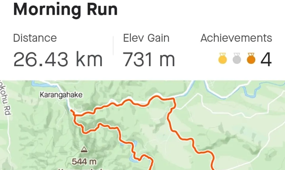
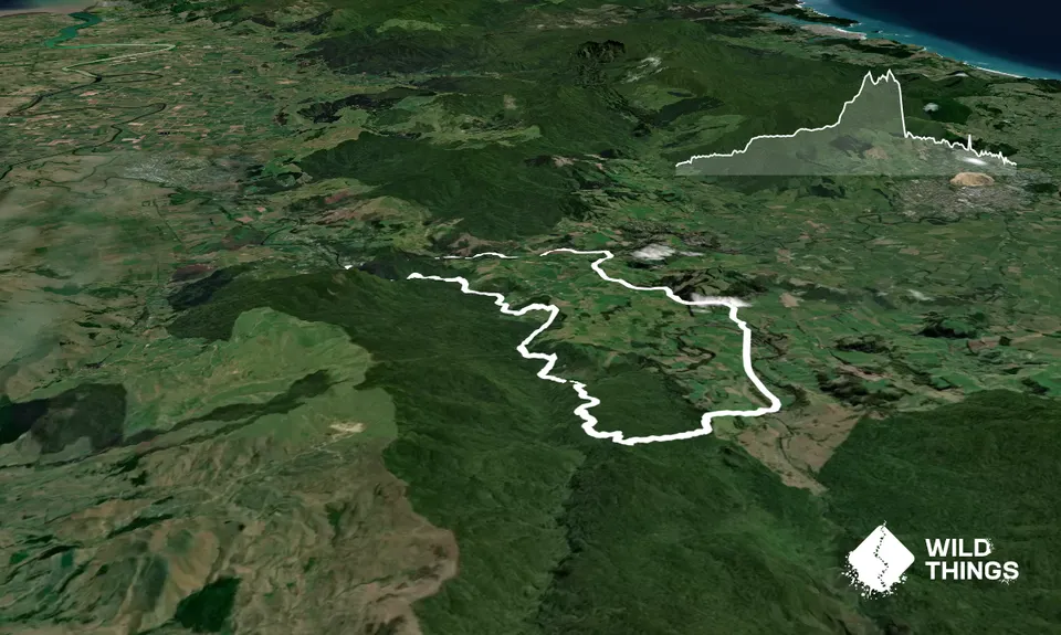
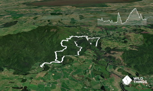
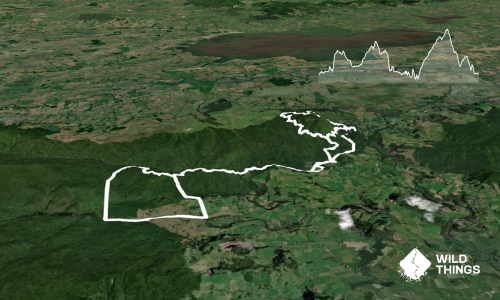
Note: this route uses 6.5 km of road running to join up the loop; of course you could use two cars or make some other arrangement to make an 18 km pure trail run. The road is scenic and quiet though.
Starting at the huge carpark on SH2, cross the Ohinemuri River on the big bridge. Then follow the track left and cross the Waitawheta river also on a bridge. You are then at a sign offering a choice between the Karangahake Gorge Historic Walkway, and the Windows Walk. Head for the Historic Walkway. The first 1.2km are a narrow fun trail alongside the river. Then you meet the rail trail as it exits the tunnel and crosses the river, and you follow this to Waitawheta Road at 4.7km.
Turn up the road, passing the attractive Owharoa Falls. Keep going, ignoring the turnoff to Dickey Flat, until the right turn to Franklin Rd is reached after a group of houses at the 8.9km mark. Go along Franklin Rd almost to the end, and 100m past the carpark for trampers there’s a track leading up steps to the right with a sign saying “Dean Track”. Go up here. There’s now 1km across an attractive farm, gradually climbing, until you reach the Forest Park boundary.
Keep going at an easy uphill and at the 13.6km mark you reach the junction with the Mangakino Pack Track. Turn right and follow this. It’s gently undulating with nice forest running for a couple of km, then the track drops 200m steeply down to cross the Mangakino stream. This is usually quite a small stream. 500m further on you reach the Waitawheta river. Of the six crossings of the river on this loop this is the only ford. It can be a surprisingly big river and is NOT safe to cross when in flood. At normal levels it’s fine.
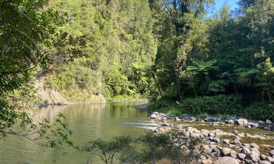
Once across you now follow the river for nearly 8 glorious km, all the way back to it’s junction with the Ohinemuri where you started. You pass through some stunning kauri forest, beautiful Dickey Flat campground, a miner’s tunnel, a beautiful gorge, and will meet heaps of tourists and walkers as you near the carpark again.
-1.jpg)