Last Updated: 27th May 2024
Top of the Coromandel
Last Updated: 27th May 2024
Grunt Factor: 44 ?
Gnarl Factor: 27 ?
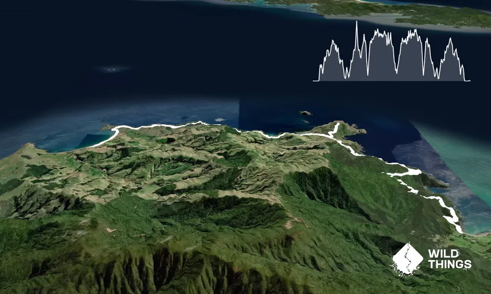
35.6km
1250m
1250m
200m
Trail Map
This Topo layer only covers NSW/ACT.
Switch to another map layer when viewing outside this area.
Switch to another map layer when viewing outside this area.


