Last Updated: 4th May 2024
Hello Rotoroa
Submitted by Jenny Hirst
Last Updated: 4th May 2024
Open
Grunt Factor: 9 ?
Gnarl Factor: 12 ?
7.5km
125m
125m
543m

Last Updated: 4th May 2024
Submitted by Jenny Hirst
Last Updated: 4th May 2024
Open
Grunt Factor: 9 ?
Gnarl Factor: 12 ?
7.5km
125m
125m
543m
Front country - easily accessible
Out and Back
Undulating, small hills only
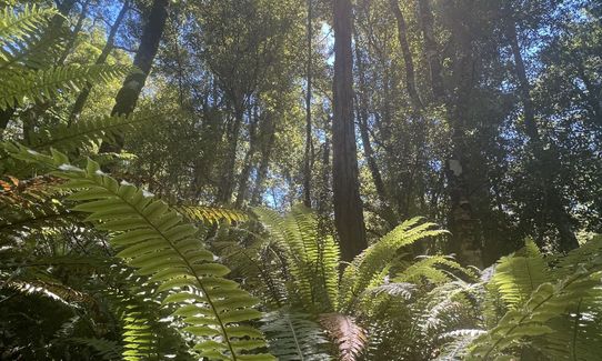
Native bush
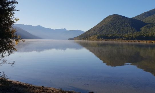
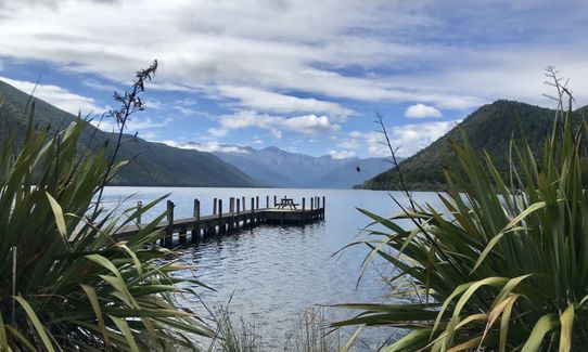
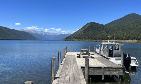
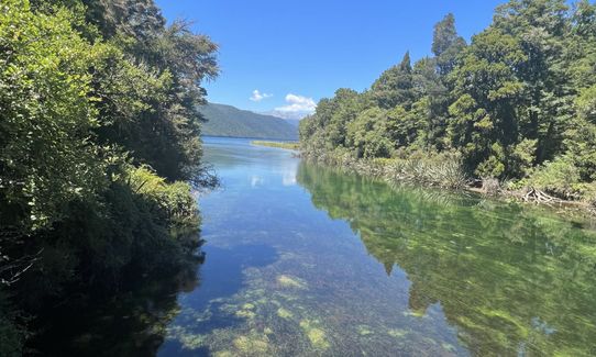
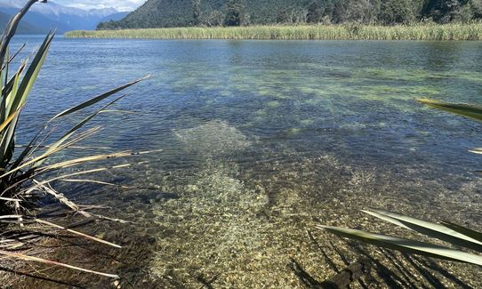
Lakeside
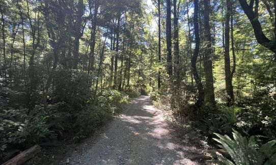
Gravel Road
Farm Road / 4WD Track
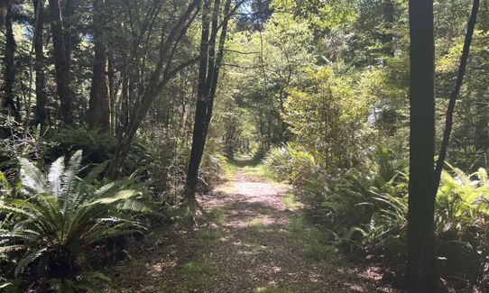
Easy Single Track
Average Uphill Gradient: +4.3%
Average Downhill Gradient: -5.4%
VIP Feature: Send this route to your Garmin account so you can follow the course on your Garmin device.
Login as a VIP to see the trailhead information.
1:10
Slow
0:50
Moderate
0:35
Fast
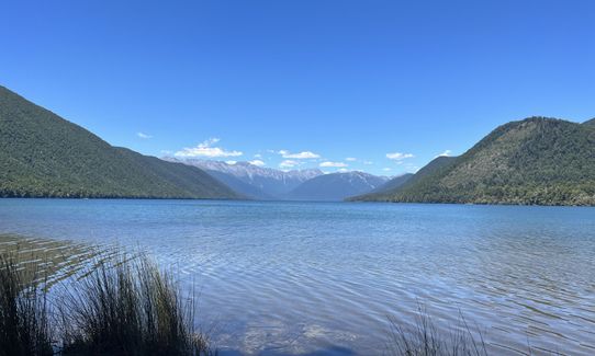
This is a lovely short run linking up 3 walks around Lake Rotoroa, great to do if you are camping there, or between bigger missions in the area. Short drive from Murchison to the west and and St Arnaud to the east.
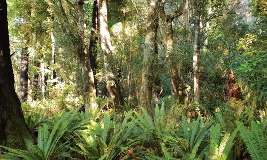
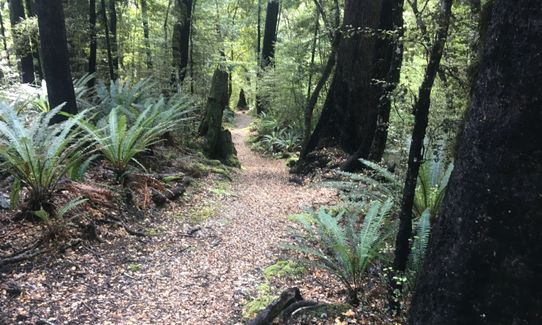
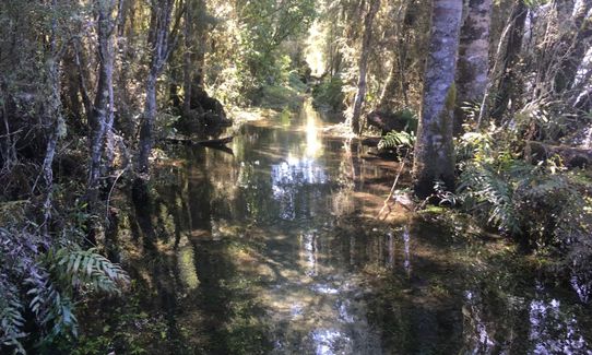
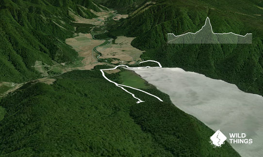
Start at the DOC campsite/picnic area on Porika Rd, just a short distance up from the beachfront. Head right up Porika Rd for a short distance (this is a 4 wheel drive track that can also be explored for a longer mission). Very soon there is a sign for the Nature Walk on your right. Take this path and follow it for about a km to the lakefront, through a variety of tall forest trees (kahikatea, beech), shrubs, climbing vines, mosses and ferns.
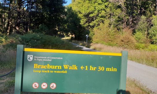
Cross the waterfront, past the old carved canoe belonging to an early resident of the lake, to find the Flower Brothers track on the other side of the wharf. This is a very short (200m) track that leads to Porika Rd. Turn left and follow the road past the grand Rotoroa Lodge, across the Gowan River Bridge and onto the Braeburn Road - which is a gravel road. After around 400m you will reach the start of the Braeburn Walk on your left.
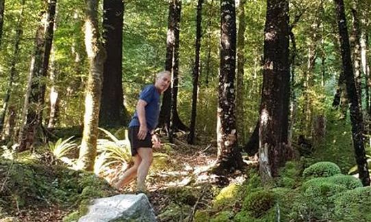
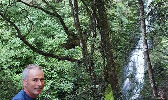
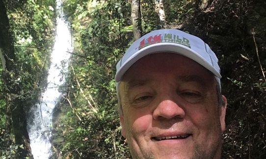
Initially the track follows the remains of a road constructed in the 1950s during the hydro-electric investigations. It then becomes single track forest trail. There is a loop at the end, and also a signposted track up to a waterfall which is worth investigating. The waterfall track is the steepest part of the run but it is a reasonably well formed track, with some roots and rocks and it zig-zags a bit. On completion of the loop return to the campground the way you came.
Beech forest with mature trees, and beautiful ferns. Lake, waterfall, mountain views. Plenty of birdlife.
If you know of any public toilets near the trail start or on the route, please login and then let us know so we can update this section.
No public transport. Plenty of parking at the beachfront and the DOC campsite.
43 km
43 minutes
No
No
Easy.
Non-existent.
Short-sleeved thermal top, Seam-sealed waterproof jacket
Tap at campsite, probably OK to drink but best to provide your own.
Waterfall track can be muddy after rain. Sandflies!
Sandflies!
Trail Legend
Login as a VIP to become a Trail Legend. Learn about Trail Legends.
Fastest Known Times (FKTs)
You and Hello Rotoroa
As a VIP member you can record private notes for this trail, see all of your times and more.
Already have an account? Login now
Nice easily navigated run on flowing single trail. The waterfall is a good viewing highlight.
Sandfly repellent a must for the lakefront.
January 11, 2022
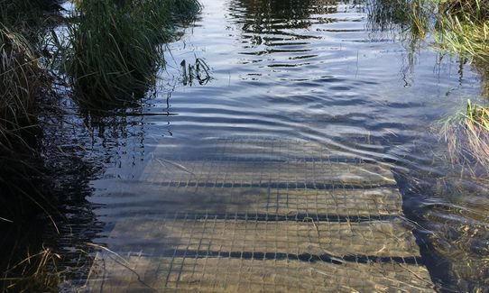
This run surprised me. It's my favourite run this year. It starts of running mostly downhill towards the lake through a lush forest. After running across the boat launch car park, it rejoins the lush trail. Today , about 300m of the trail, including boardwalks, were under 300mm of crystal clear cold water that was really refreshing to walk through. The upper part of the trail, Braeburn Walk, is another lush forest with lots of glistening ferns and a soft flat forest floor that is easy to run on. To cap it all, there is a beautiful waterfall at the top of the run. No photos do it justice. Run it if you can.
November 15, 2020
A nice lush explore of the forest. The Flower Brothers section was underwater today, lake is very high. Nice cruising
October 12, 2020
Send to your phone
Scan the below QR code to open this trail on your phone.

Tip: position the QR code in your phone camera screen.


