Last Updated: 21st Sep 2023
Poor Petes
Last Updated: 21st Sep 2023
Open
Grunt Factor: 46 ?
Gnarl Factor: 57 ?
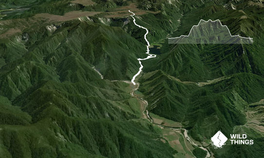
21.0km
1280m
1265m
1115m

Last Updated: 21st Sep 2023
Last Updated: 21st Sep 2023
Open
Grunt Factor: 46 ?
Gnarl Factor: 57 ?
21.0km
1280m
1265m
1115m
Back country - remote
Out and Back
Very hilly
Native bush
Riverside
Farm Road / 4WD Track
Easy Single Track
Technical Single Track
Average Uphill Gradient: +12.6%
Average Downhill Gradient: -12.5%
VIP Feature: Send this route to your Garmin account so you can follow the course on your Garmin device.
Login as a VIP to see the trailhead information.
5:00
Slow
3:30
Moderate
2:30
Fast
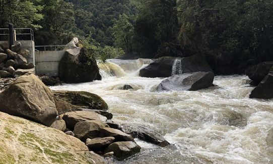
From the carpark, cross the bridge and follow the 4WD track for 3km. The hydro station construction is quite interesting to view along the way. Keep left at any intersections as these are not marked.
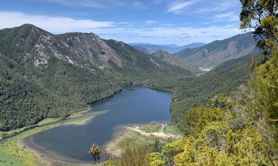
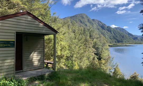
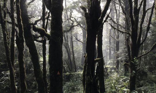
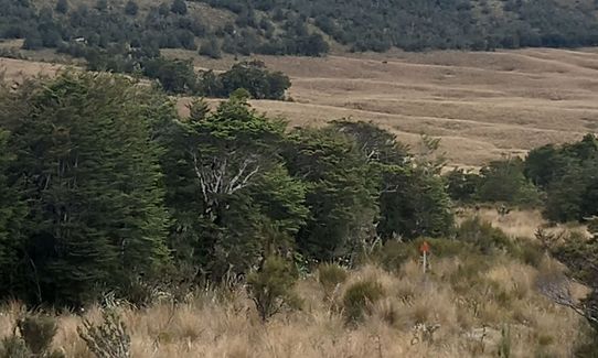
Eventually, you'll come to a small clearing with a track venturing into the bush. Follow this - it's very clear and well marked. Shortly you'll arrive at Lake Matiri Hut. Beautiful views of the lake. From here, continue around the lake, cross the small stream and swampy patch and then you get to the sign pointing up to the Plateau. Head straight up. There's a clear, well-marked track, but very steep.
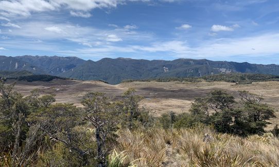
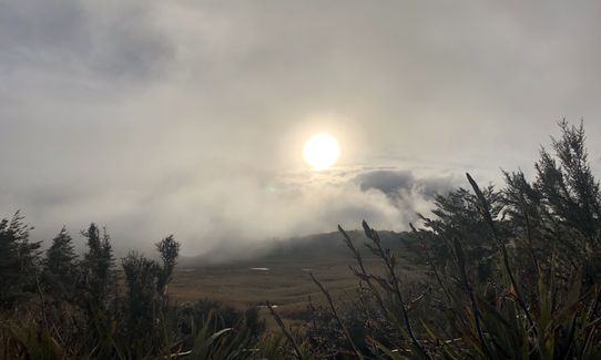
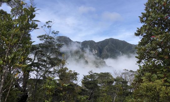
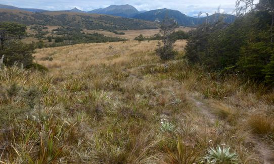
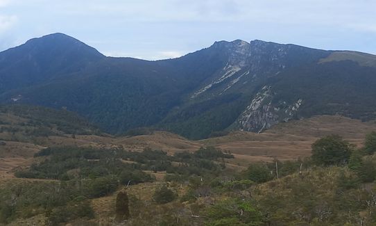
At the top, you'll come out onto the plateau. Head to Poor Petes Hut. This trail finishes at the high point (Pt1115) just above Poor Petes and affords wonderful views of the spectacular plateau (though you could continue for a further 10km across the plateau to Larrikin Creek and the Needle).
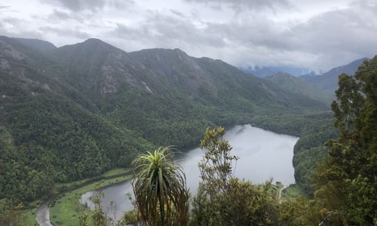
Turn around and come back the way you came. Around 3/4 of the way down, there is a small track off to the side which has awesome views of the Matiri Valley and Lake.
If you know of any public toilets near the trail start or on the route, please login and then let us know so we can update this section.
Plenty of parking
23 km
26 minutes
Unknown
No
Moderate.
Patchy.
Short-sleeved thermal top, Seam-sealed waterproof jacket, Gloves, Beanie/thermal headwear, Whistle, First aid kit, Survival blanket, Cellphone, Map
Plenty at Lake Maitiri and Poor Petes Hut
Snow on tops in winter.
Zens
Murchison
Trail Legend
Login as a VIP to become a Trail Legend. Learn about Trail Legends.
Fastest Known Times (FKTs)
You and Poor Petes
As a VIP member you can record private notes for this trail, see all of your times and more.
Already have an account? Login now
Lovely steep but easy vert if conditions dry. Limestone country so take plenty of water as none past the lake
January 3, 2023
I’m sure if the weather had been better the views would have been amazing! ? unfortunately it was raining cats and dogs and very overcast. Stayed at Poor Pete’s for the night which was a lovely wee hut. If I was going in again I’d make sure for dry weather (in the days leading up too) the rain made the track unnervingly slippy and especially hard to descend. I’d also say take the predicted times with a pinch of salt. My moving time was 5 hours and usually I’m comfortably within the moderate time estimate. Wet feet and a gnarly, super steep climb. Hopefully next time I’m rewarded with some good views and a trip to Larrikin Creek Hut and beyond!
December 10, 2021
Send to your phone
Scan the below QR code to open this trail on your phone.

Tip: position the QR code in your phone camera screen.


