Last Updated: 15th Sep 2024
Tihaka Beach Track
Last Updated: 15th Sep 2024
Open
Grunt Factor: 17 ?
Gnarl Factor: 47 ?
13.0km
255m
255m
152m
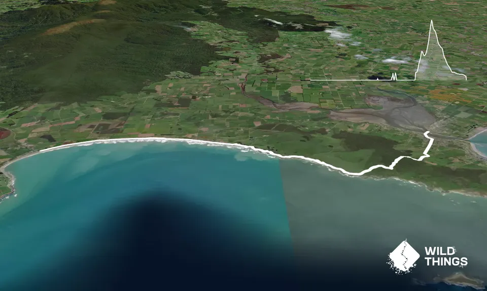
Trail Map
This Topo layer only covers NSW/ACT.
Switch to another map layer when viewing outside this area.
Switch to another map layer when viewing outside this area.


