Wild Things - New Zealand's trail running community
New Zealand's trail running community

Login


don't have an account?

Trotters Trot, Otago

Trail Directory proudly supported by Further Faster

Update Your Header Picture

Trotters TrotBeginner - Intermediate

Submitted by Mike Tennent

Info Info
Map Loading

Trail Information

5.70km

290m

295m


Otago

Moeraki

Front country - easily accessible

Combo

Undulating, some big hills

Native bush
Riverside
Open tussock/grasslands

Beginner - Intermediate

1:40 (Slow)
1:00 (Moderate)
0:45 (Fast)

-10.0%

+9.8%

Download PDF Guide

Fastest Known Times (FKTs)

Please set your gender to see your position on the FKT leaderboards.

Men

Women

There are currently no female FKTs for Trotters Trot.

Filter FKTs

The more , the harder the FKT will be to beat. Learn about Fastest Known Times.

Missing your time?

Register or login as a VIP and get yourself on the FKT leaderboard!

Register Now

Description

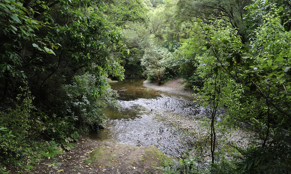
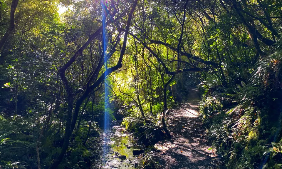
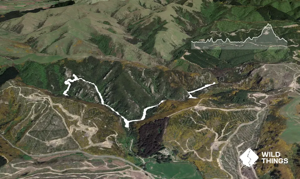
Starting at the campground you will see the trail sign at the far end, take the trail to the right onto Trotters Creek Track first and straight away you will come to a stream crossing, don't try keeping your shoes dry, you will cross this stream 6 times going out and consequently, 6 times coming back.

There is nowhere to go wrong, just take care at the crossings as the rocks can be a touch slippery, the water is only ankle deep.

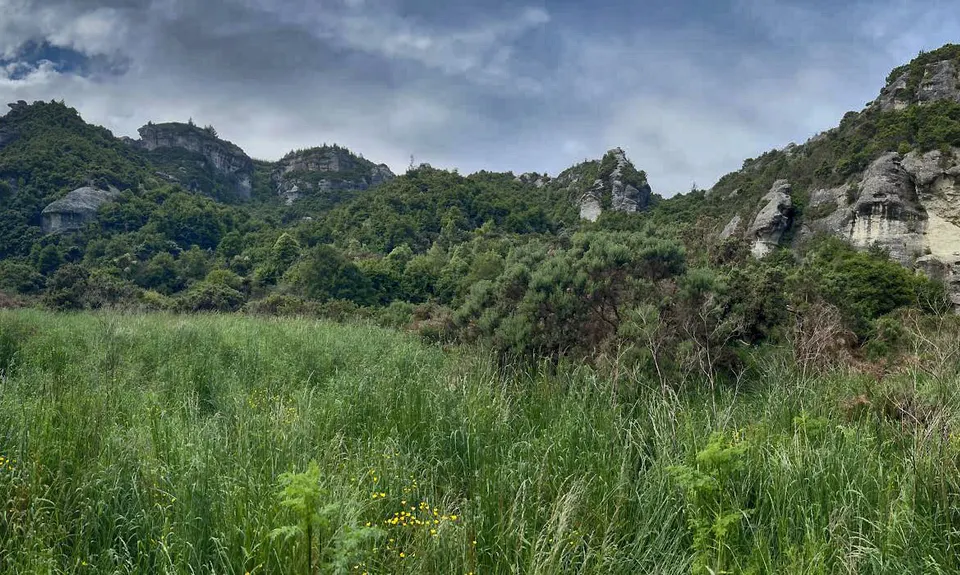
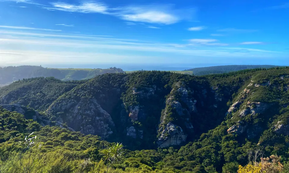
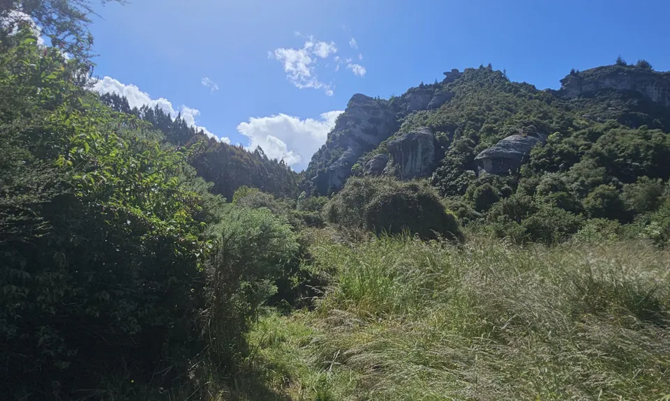
Along the way you will see some quite cool stream banks and eventually it opens out to give some fabulous cliff views. At about 1.5km there is a sign saying the care-for trail stops there. For this guide the is where you turn around. The DOC guys working on the trail told me a 'locals trail' continues for a bit up the gorge and there are a few 'hunters trails' around as well if you fancy exploring.

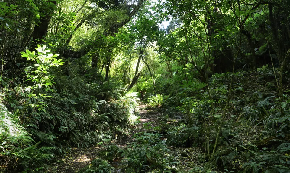
Once you have retraced your steps to the start, turn right and head off on the Trotters Gorge Track.

About 500m down this track you may see another track coming in from the right, if you look along it you will see a sign about 50m down the track. This is where you will come out from the loop, more on this in the Seasonality Issues, for now, head straight ahead.

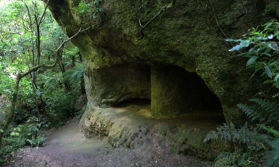
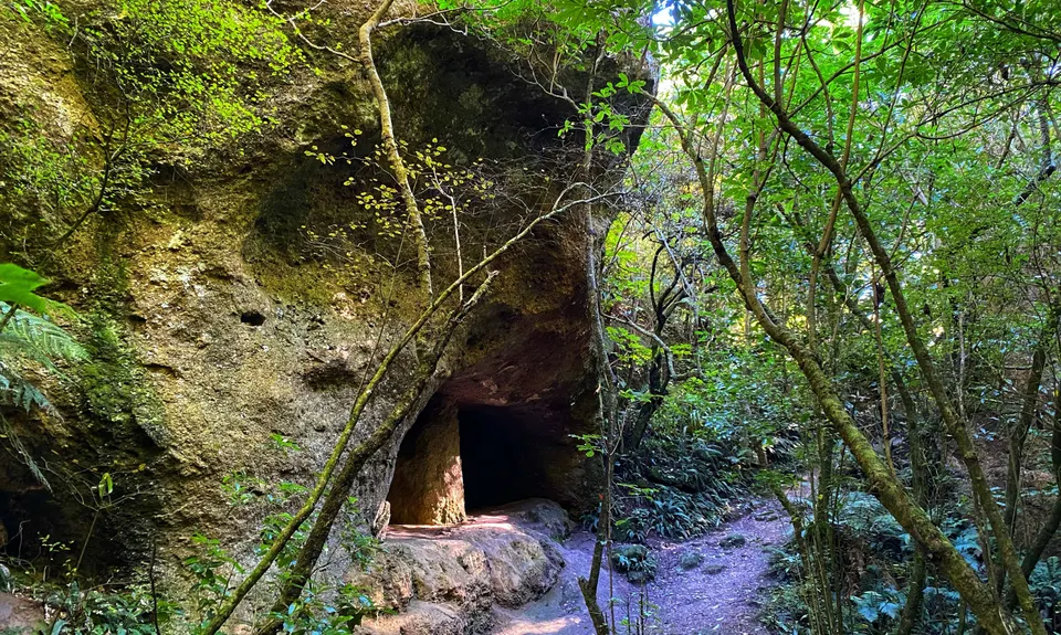
At about 3.7km you will come to the 'caves' which are really large indentations, but worth a look.

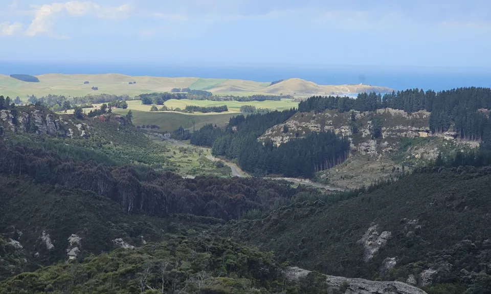
Then the climbing starts with 130m vert in the next 700m or so. You will get glimpses of the valley at times as you climb.

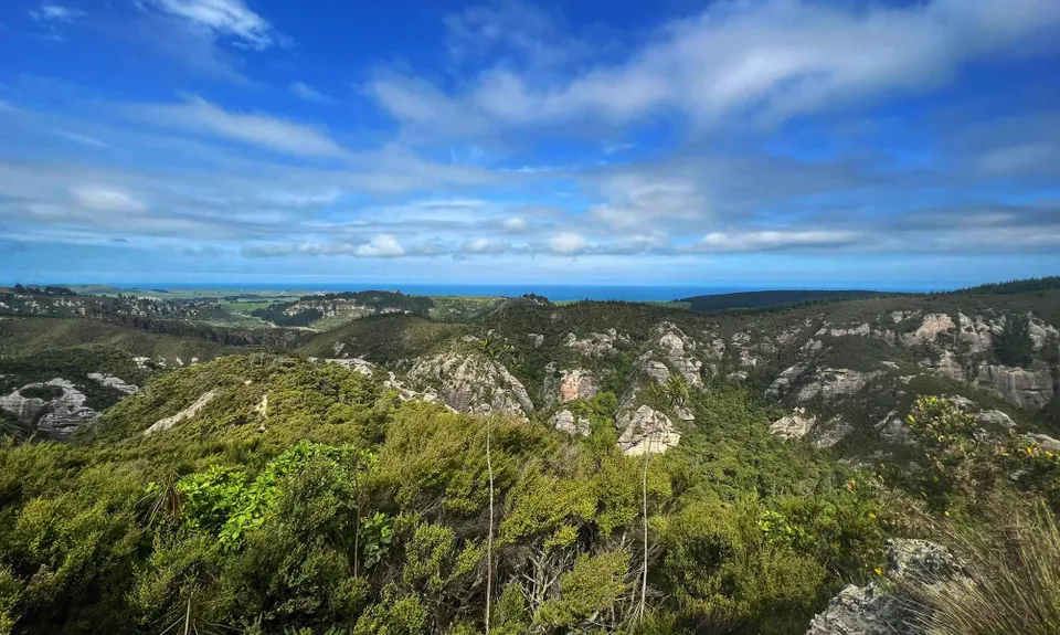
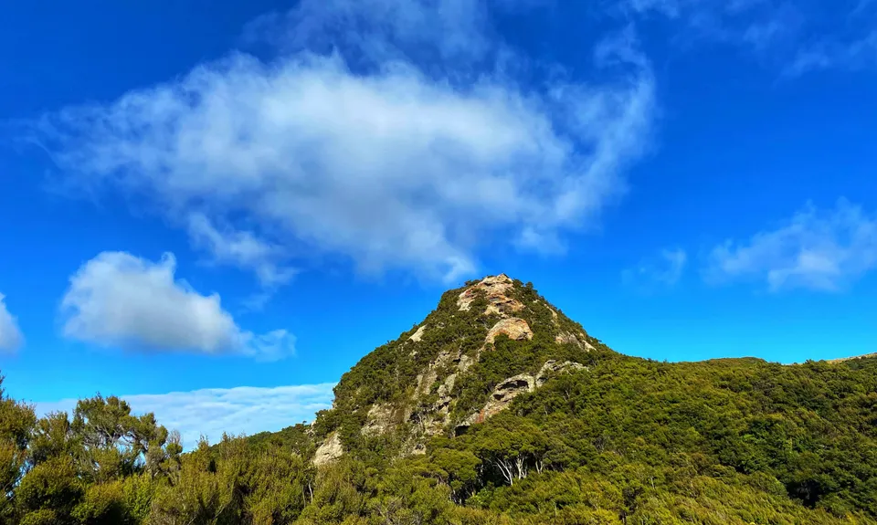
At about 4.4km you will come to an intersection where the DOC arrows point right, however for now, turn left and just opposite you will see a rock formation. If you make your way carefully onto that you will get great views out to the coast.

Then carry on up that trail as it climbs quite steeply for another 100m or so to another rock with even better views.

After you have taken your photos, head back down and rejoin the main trail and start the descent. Be careful the next 1.5km as the descent is treacherous in places, steep, and can be very slippery. Eventually, you will intersect with the main trail and head left to the carpark.


Trail Community

Find people who are interested in this run.

You must register or login to view this content.

Features of interest

The caves and cliffs are a greywacke-breccia conglomerate and were formed after the last ice age 12 - 15,000 years ago. Some great natural features and abundant birdlife... even if you only hear it.


Make Up of Run

Untracked / Route only: 0%

Technical Single Track: 5%

Moderate Single Track: 20%

Easy Single Track: 75%

Farm Road / 4WD Track: 0%

Gravel Road: 0%

Sealed Road: 0%


Route Data

Reviews:

You must register or login to view this content.

Photos:

You must register or login to view this content.

Your Trail Wishlist

All the runs that are on your To Do list (no limit).

Add to wishlist view wishlist

Your Trail Dreamlist

The runs you most want to do (limited to 10).

Add to dreamlist view dreamlist

Wild Explorers

I did it!
  • Access

    Heading South, just after Moeraki turn off, look for Horse Range Road on the left. Head down there about 7km watching for the sign for the Reserve. Heading North, at the northern edge of Palmerston watch for Horse Range Road on the left. Alternately and to be spot on, enter Trotters Gorge Scenic Reserve into Google Maps.

    It is a good size campground so plenty of parking.

    9 km

    9 minutes

    No

    No

  • Staying Safe

    Easy.

    Very patchy.

    Waterproof leggings, Thermal leggings, Long-sleeved thermal top, Seam-sealed waterproof jacket, Gloves, Beanie/thermal headwear, Personal Locator Beacon (PLB), Whistle, First aid kit, Extra food for emergencies, Survival bag, Cellphone, Map.

    Lots of water on the Creek Track, some water on the Gorge Track.

    If it is extremely wet, beware of the Creek rising as you need to be able to cross it. If it has been raining a lot or is the middle of winter, on the Gorge Track you may wish to go left at the 3.5km mark (500m onto the Gorge Track) as in slippery conditions the hill may be easier going up this way than coming down.

    Stream crossings always need care, even though they are shallow. The loop has some steep slippery technical bits that will be safe if treated with respect.

  • Sponsor this trail

    If you are interested in learning about sponsorship opportunities, please get in touch below:

    Submit

Got a favourite trail? Tell us about it.

Share the love and add your favourite trail(s) to our growing trail directory.

Submit A Trail

Become a member today

Start enjoying the many benefits to becoming a member of our thriving community.

Become a member

Great brands at great prices with our VIP member's discount

Stay up to date

Sign up to our newsletter for latest offers and trail guides

Share this trail with a friend:

VIP Membership

Please register as a VIP or login to your VIP account to view this content.

Cancel Login Register

Membership Required

You can see up to three trail guides without being logged in but after that we require you to be logged in to your Free or VIP account. If you don’t yet have an account you can register here.

Login Register