Whangamumu Track, Kauri Ridge Track and Te Toroa track are all "temporarily" closed since 2 April 2021 to help prevent the spread of kauri dieback. If you have an update on this status please email us
PLEASE NOTE: Part of the track passes through private land. While landowner "permission" as such is not required, track fees are payable, which can be done through DOC website.
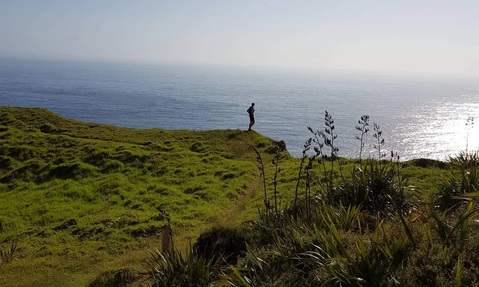
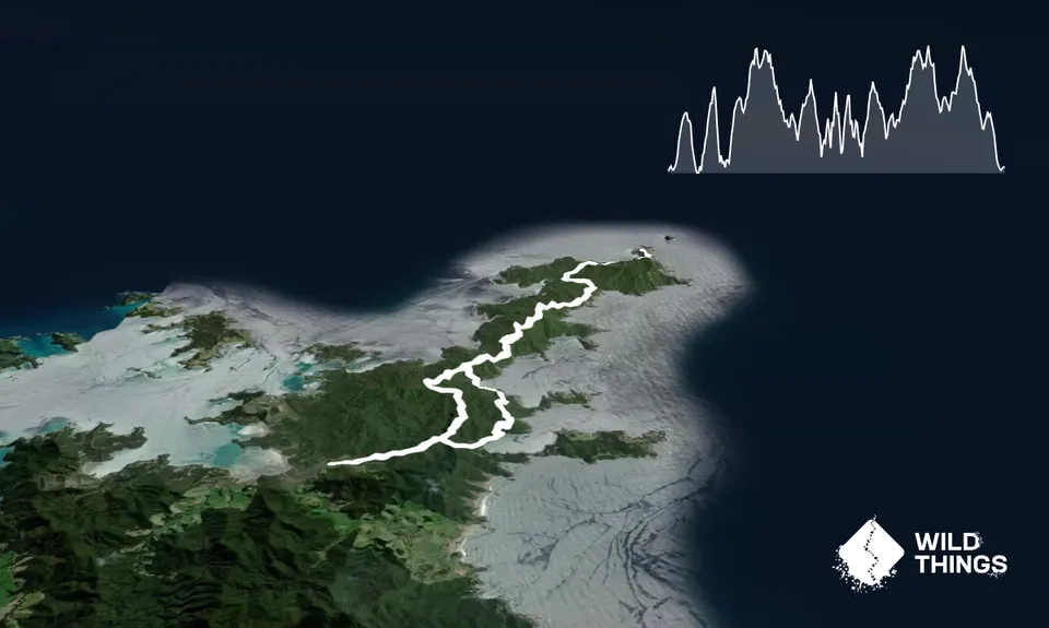
This is a continuously hilly track following the Whangamumu Track, Kauri Ridge Track and Cape Brett Walkway. Follow the Whangamumu Track via Te Toroa Bay to the Cape Brett Track junction, turn right and follow all the way to Cape Brett (20k return from this point) where you can usually refill your water (check DOC website!) The last 4k around Cape Brett are the hilliest so beware! Return along the same route except carry on straight through the junction with the Whangamumu Track, up the next big hill and turn left at the junction near the top and follow the Kauri Ridge Track down to join the Whangamumu track again. Turn right and you are back at the car after a couple of kms.
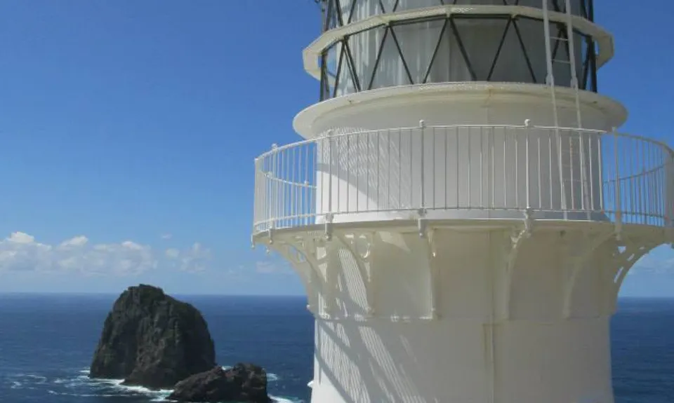
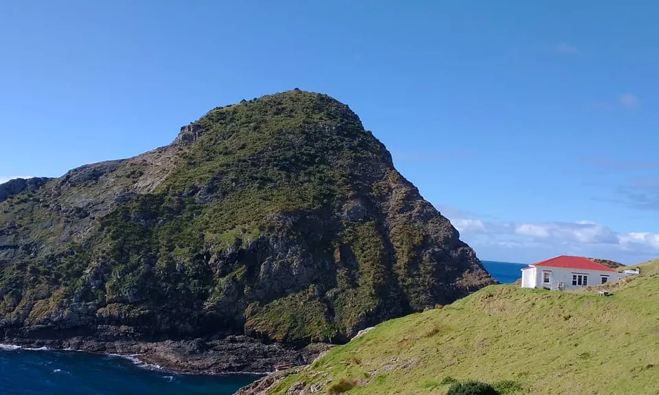
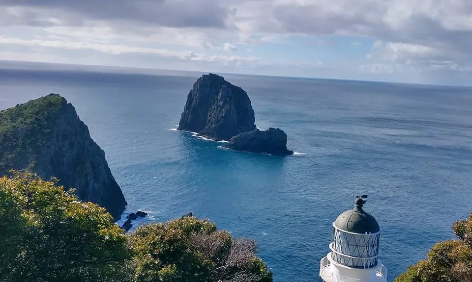
Lighthouse, historic whaling station and lighthouse keepers hut, birdlife, amazing views of Bay of Islands.
If you know of any public toilets near the trail start or on the route, please login and then let us know so we can update this section.
Parking area opposite the sign on the roadside. Fairly safe with clear visibility from road.
26 km
31 minutes
Unknown
No
Moderate.
Turn right at Whangamumu / Cape Brett tracks junction on the way out. Go straight on at the same junction on return and turn left at the next junction near the top of the final big hill.
Water tank at the Cape Brett hut, although this can run dry in drought conditions or if the tank is leaking, so check DOC website before going. There is another tank at the Cape Brett track junction although this should be sterilised first. There is a small drinkable stream near the Deepwater Cove junction although it would be wise to sterilise this too. You can carry in some bottles and stash at the Cape Brett track junction for the way home.
Has clay sections that can be slippery after heavy rain.
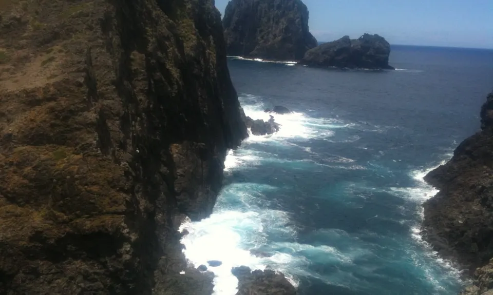
Be careful on the knife-edge ridge section near the lighthouse. There are several other large 'drop-offs' to watch out for too.
Duke of Marlborough
Russell
Good beer and food. Historic.
Do you have another suggestion on where to go afterwards for the best coffee / cake / breakfast / brunch / beer?
Great track, fun day out. We went in winter and the track was really slippery. Hills quite challenging.
Please note: the Kauri Ridge Track is closed, so if you want to do the Cape Brett track you need to start from Rawhiti (Oke Bay Scenic Reserve).
Amazing track but we started and finished at Rawhiti and stayed overnight in the hut at Cape Brett. Very dry conditions and very little water at the hut. We carried 7 litres of water between us as we were warned that there may not be water at the hut. All streams were dry. We also went down to Deepwater Cove for a swim and lunch which added about 1.5km. Agree the last 5km to the hut are really hard work though didn't feel so bad on the way back the next morning! It took us 6 and half hours on the way out and 5 and a half on the way back all walking.
Amazing views and well-kept trail. It's very challenging. My wife and I ran are experienced trail runners and it took us 6hrs. We had 3ltrs of water each and still ran out since the water sources were contaminated. In the summer there isn't a lot of airflow, so you will get very hot.
We don't store or share your location; it's only used for these features. You can continue without it, just without distance sorting and live map features.
Send to your phone
Scan the below QR code to open this page on your phone.
Tip: position the QR code in your phone camera screen.