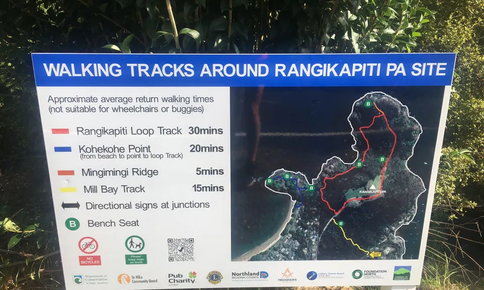
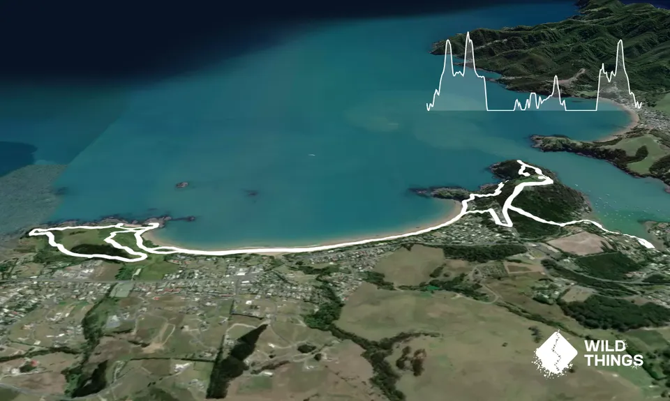
From the vicinity of Acacia Lodge run north-west along Mill Bay Road for about 500m until you see a DOC sign saying 'To Rangikapiti Road'. Take this trail - it's a lovely bit of single track for about 300m. When you come out onto a gravel road, turn right and follow the road to the end of the gravel and beyond onto the grass/4WD trail right out to the point.
You will reach a square concrete pad, to go past this requires ropes! So retrace your way back on the track to where the gravel road starts. On the right there is a green DOC marker, go right here and up to the top of the Pa site. Suck in the wonderful views, grab some pics, then back down and onto the road again and back down past where you came out earlier. Onto the sealed area and take a right into Mahoe lane
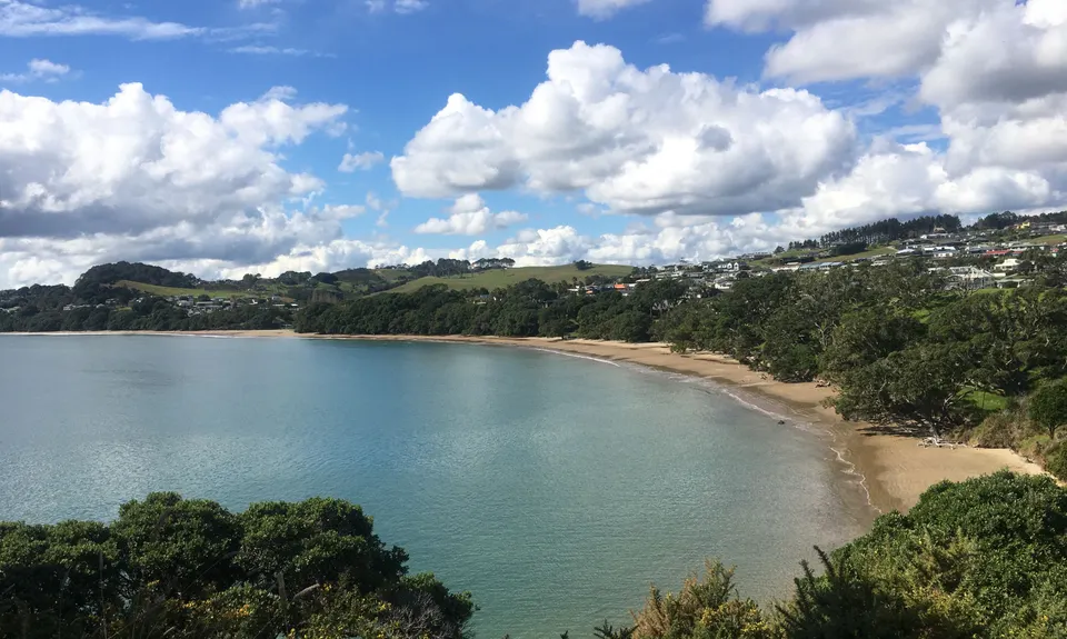
Follow Mahoe Lane around until you spot the trail leading down to the beach between the houses. Down you go and onto the beach. Take a left and follow the beach to the other end. Just past the last house on the beach is a stream gully and next to that you will see signs of a route up. Go up there and then take a right on the mown grass trail. Follow this trail ignoring any left or right off-shoots until you get out to a small peninsula. If you veer right on a small but worn single trail you can trace your way out to the end of the point.
Then once the mandatory pics have been taken, turn around, when you get back to the cleft in the rocks, go between them and down to the bay. Then up and back on to the trail to the right. Keep taking the right turn options through to the next peninsula and then right again and round to the final peninsula. Then the trail (still keeping right) takes you downhill and back inland to some trees and a stream. Follow this trail along until towards the end of the trees (you can see buildings again) where there is a split. This time go left and up, left and up at the next as well and continue up to the top of the hill and anothe Pa site for more great views.
Then continue over the other side of the summit and take a right at the next mown track. Follow this down to the next intersection... then right again and back over trail you did earlier. Take the left down to the beach (earlier than the one you took off it) and follow the beach to the very end. At the very end of the beach look behind the Pohutukawas for a set of steps. Follow these up, you will come to a choice between a road and a trail, take the trail until you come to a grassy area with two tracks off it, take the left hand track. Follow this lovely new trail almost all the way to the point again. Then take a right and you are back on the original trail to the point.... retrace your steps back to the start.