Last Updated: 22nd Feb 2024

Experienced

Save Trail Save

I've done it Done

Queen Charlotte Ultramarathon

Queen Charlotte Track, Marlborough Sounds

Queen Charlotte Track, QCT

Ship Cove, Marlborough

Submitted by Sarah French

Last Updated: 22nd Feb 2024

Experienced

Save Trail Save

I've done it Done

Grunt Factor: 95 ?

Gnarl Factor: 42 ?

70.3km

2395m

2395m


Login as a VIP to see driving directions, distance and time.

Trail Map

Type of Run

Urban fringe

Point to Point (one way)

Undulating, some big hills

Native bush

Beach

Coastal

Open ridges/tops

Run Makeup

2%
98%

Gravel Road

Moderate Single Track

Average Uphill Gradient: +6.8%

Average Downhill Gradient: -6.8%

Trailhead

Login as a VIP to see the trailhead information.

Estimated Times to Run

Not suitable

Slow

9:30

Moderate

8:30

Fast

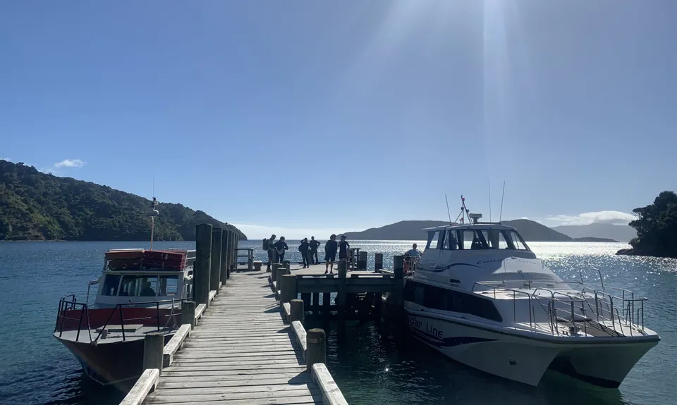
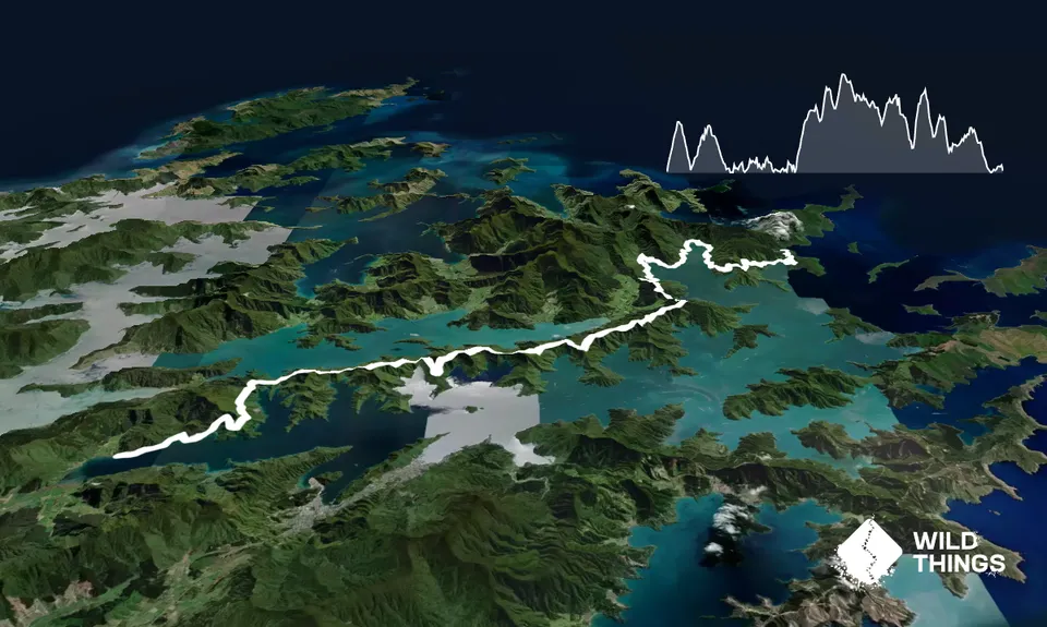
The Queen Charlotte Track is typically advertised as a 3-5 day tramp; however, for an epic adventure, tackle it in a single day!

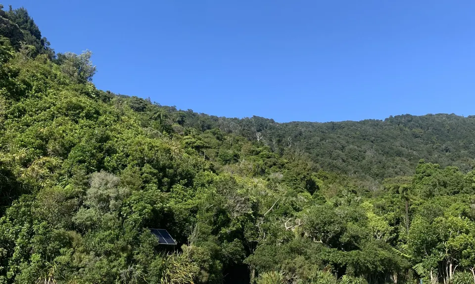
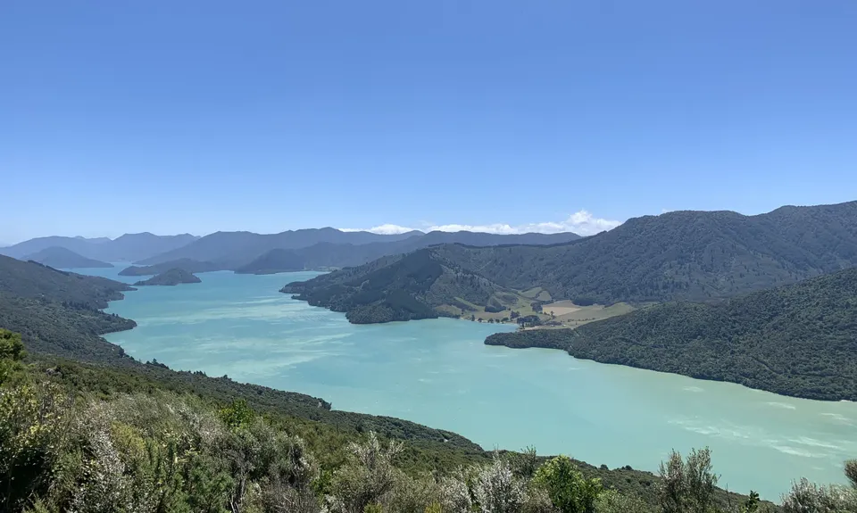
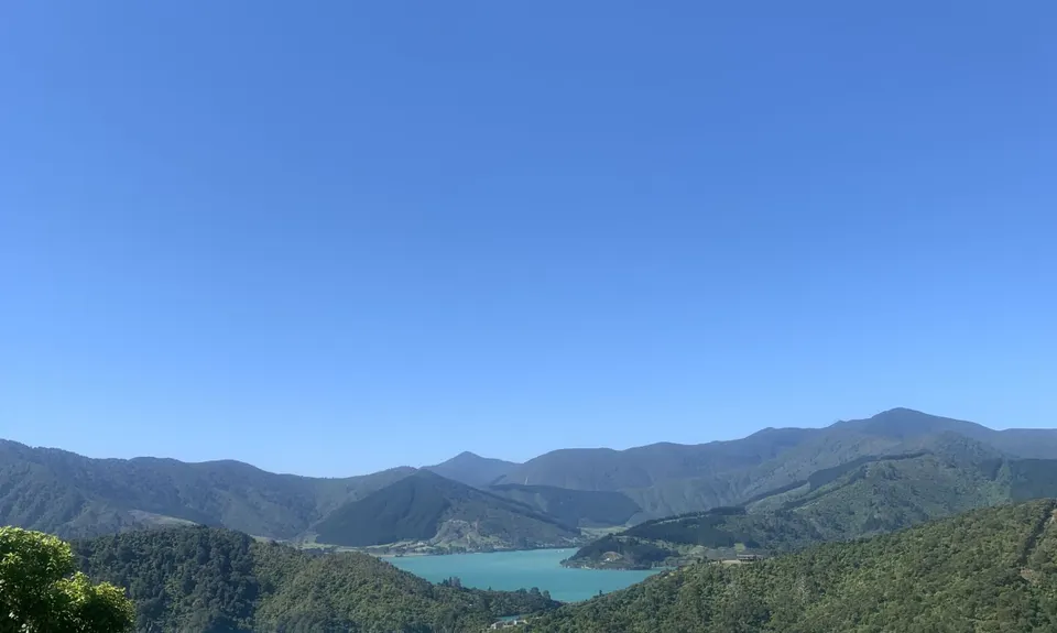
Enjoy this well-maintained track that is predominantly shaded by native trees, first hugging calm bays before ascending and crossing Kenepuru Saddle, which offers captivating views of both the Queen Charlotte and Kenepuru Sounds.

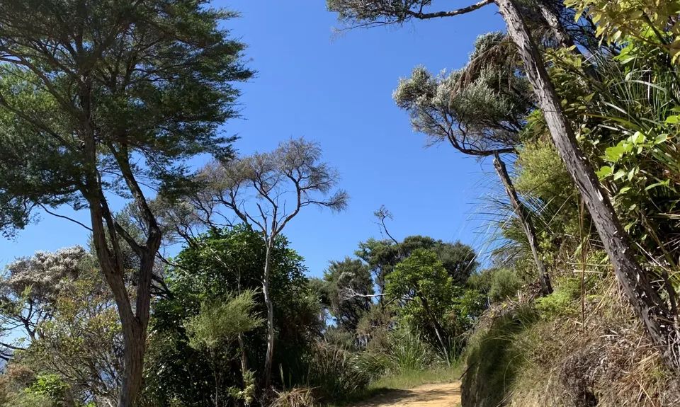
Route Navigation: The route is well-defined, marked by typical DOC "distance to X" boards and occasional kilometer-to-go markers.

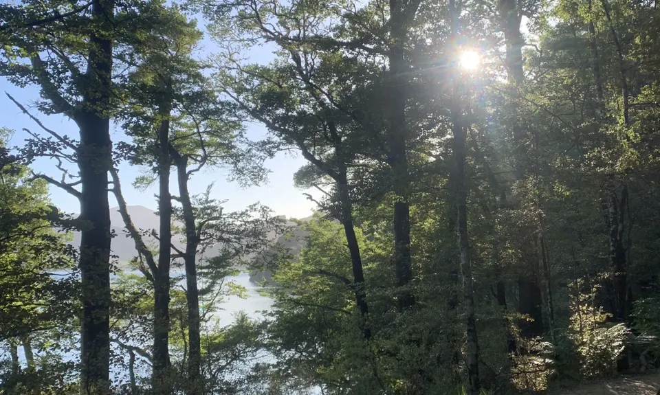
Upon starting at Ships Cove, the trail is immersed by native forest along a clay/loose rock path, accommodating two abreast. To warm up, it immediately starts with a climb, shortly passing Resolution Bay on the right. Descending a second hill to sea level the track hugs the bay leading into Furneaux Lodge. Between Furneaux and Punga bay, the track is largely more of the same. Think of a relatively flat, not-so-technical track with stunning bay views.

At the 27 km mark, there is a fork in the trail. Option A involves bypassing Punga Cove/Camp Bay campsite for a 1.7 km climb to Kenepuru Saddle (~9km to the next water stop). Option B adheres to the main track, staying at sea level to reach Camp Bay campsite/Punga Cove, rejoining the trail at Kenepuru Saddle via a dirt road, albeit slightly longer.

Across the Kenepuru saddle, underfoot, it changes to a dirt track with sections of single-track for the climbs. Still, it's well-maintained and not overly technical, but expect the odd muddy patch even in summer. Now you are up on the ridge, through breaks in the trees, you can enjoy views down to the Kenepuru sound (and phone reception to share some snaps!). Rolling along another ~7.5 km (not 10 km as the DOC sign suggests) the track passes through the Bay of Many Coves campsite and shortly after, the highest point of the track.

The next stop is Black Rock campsite before a steeper descent to Torea Road. The junction at Torea Road indicates Cowshed Bay campsite to the right, Torea Bay to the left, and forward is the QCT with another climb. The ridge becomes more exposed as the forest disperses, featuring mostly dirt single tracks with occasional rocky switchbacks on the downs. At around the 55 km mark, there's a turn-off to Lochmara Lodge, and at 57.5 km, after a steep downhill section, a sign provides information about Mistletoe Bay.

Continuing straight in the direction of "2 km to Mistletoe Bay" leads to a quiet dirt road. After turning left and following the road for ~100 m, cross and follow the well-signed QCT. At 58 km, with about 12 km remaining, a flat section and a final uphill section await. The delightful downhill section begins at 64 km, surrounded by ferns, featuring a forgiving wide and dirt track.

At 67.5 km, a minor detour to Davies Bay campsite provides an opportunity to fill up on water, or continue straight for another 2.5 km to reach Anakiwa.

Other logistics: As the route crosses through private land, a Queen Charlotte Track Land Cooperative (QCTLC) visitor day pass is required ($15 per day in 2023). Can be purchased online, via an app, at a tour/boat taxi in Picton or on the track.

Boat ride, native bush, native bird, historic route.

If you know of any public toilets near the trail start or on the route, please login and then let us know so we can update this section.

In Picton, there is plenty of secure paid parking near the ferry terminal or free street parking can be found. The track finishes in Anakiwa which is located a 30 min drive to Picton or 40 min drive to Blenheim via Havelock. Ideally a support member can pick up from Anakiwa. Alternative options to return to Picton include organizing a taxi, dropping a car at the trailhead the day before, or chartering a water taxi for an earlier start to make the last water taxi from Anakiwa to Picton.

1 km

No

No

Easy.

Well signed.

Patchy.

Long-sleeved thermal top, Windproof jacket, Whistle, First aid kit, Extra food for emergencies, Survival blanket, Cellphone, Map, Headtorch and spare batteries

Drinking water opportunties:
0k - Ships Cove
5.8k - School Bay campsite
17.1k - Furneaux Lodge (from the cafe/restaurant)
~25k - Picnic area water tap on track
27k - Camp Bay campsite/Punga Cove*
36k - Bay of Many Coves campsite
45.5k - Black Rock campsite
50.6k - Cowshed Bay campsite*
67.7k - Davies Bay campsite

*Requires short detour off track
The water at campsites is unfiltered and untested and DOC recommends it to be boiled/treated.

Toastie Lords
Picton
https://www.toastielords.co.nz/
Pre ferry coffee/toastie

The Fancy Cow
Rupara
https://www.thefancycow.nz/
Post run pizza/beers if heading to Blenheim for the night

Oxley's Bar & Kitchen
Picton
https://www.oxleys.co.nz/
Post run feed in Picton

Trail Legend

Delphine Touzouli

Delphine Touzouli

has completed Queen Charlotte Ultramarathon once in the last year.

Learn about Trail Legends.

You and Queen Charlotte Ultramarathon

As a VIP member you can record private notes for this trail, see all of your times and more.

Register Now

Already have an account? Login now

Trail Reviews

Be the first to submit a review for Queen Charlotte Ultramarathon!

Login to submit a review

Trail Running Community

Find people who are interested in or have completed this trail run.

You must register or login to view this feature.

Register Now

Overlapping Trails

These overlap with this trail to some degree. You may wish to combine them but please note that to qualify for FKTs on these runs you should record a separate activity for each.

Cove to Cove

Cove to Cove

Length: 29.0km

Level: Beginner - Intermediate

QCT - Anakiwa to Te Mahia

QCT - Anakiwa to Te Mahia

Length: 23.0km

Level: Beginner - Intermediate

Cove to Cove

Cove to Cove

Length: 29.0km

Level: Beginner - Intermediate

QCT - Anakiwa to Te Mahia

QCT - Anakiwa to Te Mahia

Length: 23.0km

Level: Beginner - Intermediate