Last Updated: 13th Nov 2024
A Fishy Trail
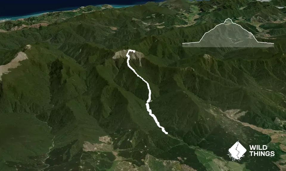
Mill Flat Campsite to Mount Fishtail
Mt Fishtail Route
Last Updated: 13th Nov 2024
Grunt Factor: 53 ?
Gnarl Factor: 75 ?
18.2km
1540m
1550m
Trail Map
This Topo layer only covers NSW/ACT.
Switch to another map layer when viewing outside this area.
Switch to another map layer when viewing outside this area.