Last Updated: 30th Dec 2024
Mt Hikurangi - Sacred Mountain
Last Updated: 30th Dec 2024
Grunt Factor: 53 ?
Gnarl Factor: 46 ?
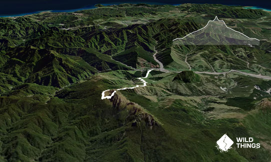
24.0km
1600m
1600m
1752m
Last Updated: 30th Dec 2024
Last Updated: 30th Dec 2024
Grunt Factor: 53 ?
Gnarl Factor: 46 ?
24.0km
1600m
1600m
1752m
Back country - remote
Out and Back
Mountainous
Open farmlands
Open tussock/grasslands
Open ridges/tops
Farm Road / 4WD Track
Technical Single Track
Untracked / Route only
Average Uphill Gradient: +14.5%
Average Downhill Gradient: -14.5%
VIP Feature: Send this route to your Garmin account so you can follow the course on your Garmin device.
Login as a VIP to see the trailhead information.
8:00
Slow
5:00
Moderate
3:30
Fast
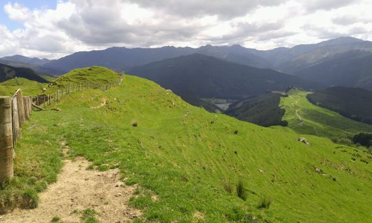
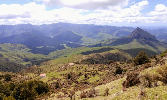
This really is a trip of 2 distinct halves. The first half is a very pleasant gentle stroll up to the hut through open farmland. Very easy to find your way, although the trip to the maori carvings requires a minor diversion from the main trail, but it is an extremely worthwhile sidetrip.
The very friendly landowner will give you detailed directions to the carvings, and there is then a 'short cut' to the hut from the carvings to save dropping back down to the main trail. If visibility is poor it would be much safer to backtrack onto the main trail.
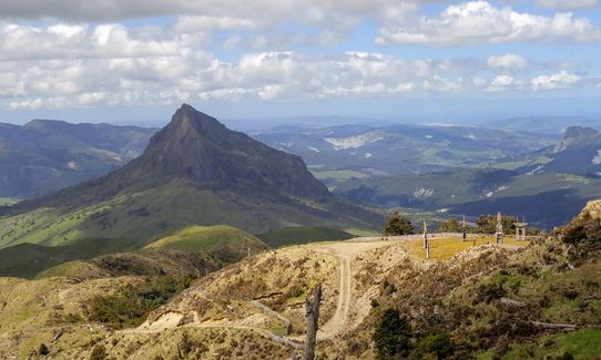
Beyond the hut, this really does change into a challenging route. The gradient steepens, the track becomes more technical, and the navigation a lot more tricky. There is a poled route from the hut which climbs steeply and then sidles around to a very steep gully which is the start of the final ascent to the summit. There is a marker to indicate which gully to head up, but beyond this you have to find your own way. It is steep and loose, and there is some mild exposure in places, but on the whole, if care is taken, the summit can be reached fairly quickly. If you don't like steep loose stuff, this is possibly not for you.
I personally found it more difficult to descend the gully , so extra care should taken for this section in both directions. I took poles and found them very helpful.
Once you have made it safely back down the gully, it is a fairly straight forward trip back out the same way you came in.
Additional Hikurani Maunga information can be found here.
This trail includes the peak Mount Hikurangi.
This mountain is reputed to be the first place in NZ to see the sun on each new day.
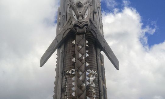
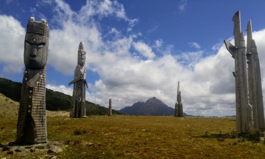
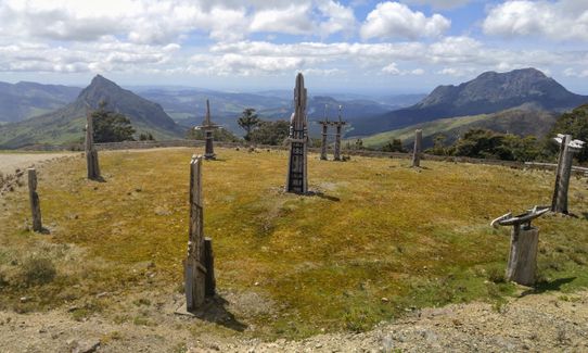
This is also a sacred mountain and there are some huge maori carvings situated on a plateau at around 1000m altitude.
If you know of any public toilets near the trail start or on the route, please login and then let us know so we can update this section.
There is a formal carpark just below the station manager's house. There is no public vehicle access past this point.
150 km
140 minutes
No
Yes
Name: Te Ara ki Hikurangi track crosses private farmland - leave gates as you find them and don't disturb stock. The track may be closed for short periods during the year for farming or cultural reasons. All closures will be publicly notified.
Telephone: Contact Te Runanganui o Ngāti Porou before you start: Te Runanganui o Ngāti Porou, 1 Barrys Avenue, Ruatoria 4032 Phone: +64 6 864 9004 Email: Hikurangihutt@tronp.org.nz or info@tronp.org.nz
Hard.
Navigation to the hut is very straight forward, through open farmland. Beyond the hut it is a poled route and could be difficult if visibility was poor. The final ascent to the summit (the last 150m-200m of ascent) is not marked at all, you follow a very steep/loose gully. This is by far the most difficult part of this trip and extra care should taken here. I personally found the descent harder than the ascent.
Patchy.
Lightweight fleece top, Long-sleeved thermal top, Seam-sealed waterproof jacket, Gloves, Beanie/thermal headwear, Personal Locator Beacon (PLB), Whistle, First aid kit, Extra food for emergencies, Survival bag, Cellphone, Compass, Map
There is water at the hut. The climb to the hut is very open (no shade), so take plenty of water from the start and top up at the hut.
If the visibility is poor, the final ascent could be very tricky. The lower section could be very slippery following heavy rain.
Trail Legend
Login as a VIP to become a Trail Legend. Learn about Trail Legends.
Fastest Known Times (FKTs)
You and Mt Hikurangi - Sacred Mountain
As a VIP member you can record private notes for this trail, see all of your times and more.
Already have an account? Login now
TN
was well worth the effort. Beautiful views from the trig at the top. Hut at 10km mark if you want to stay.
January 27, 2020
Many moons ago I got the privilege of playing here. We made life interesting by bush bashing our way west from the summit and overnighting in one of the most rugged places you can imagine. Great country, the Raukumara Range topography is just a sight to behold
February 15, 2018
Send to your phone
Scan the below QR code to open this trail on your phone.

Tip: position the QR code in your phone camera screen.


