.jpg)
.jpg)
.jpg)
.jpg)
.jpg)
.jpg)
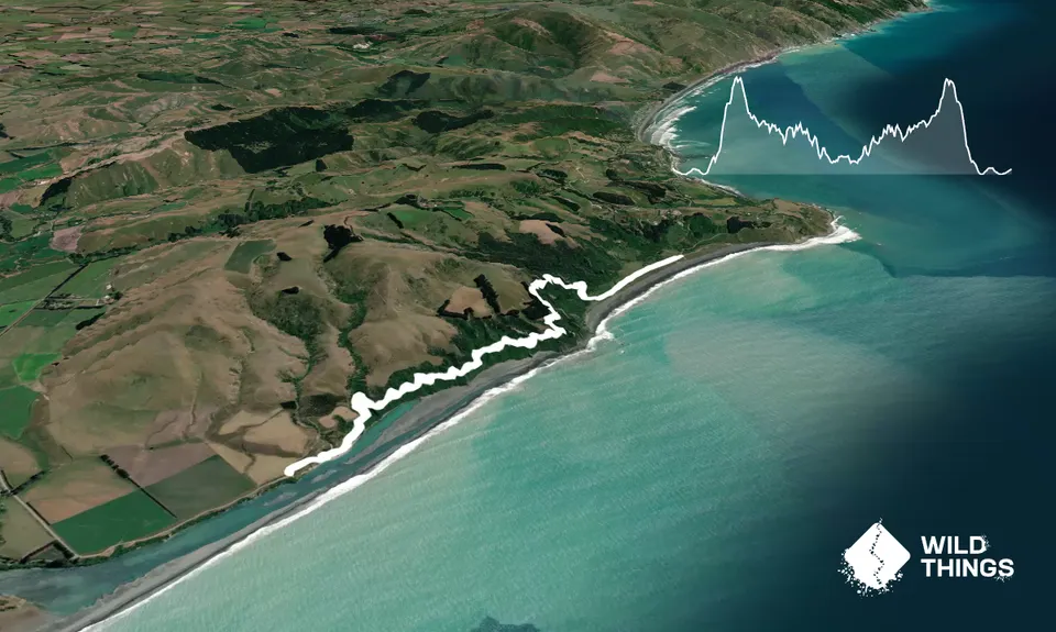
Trail Map
This Topo layer only covers NSW/ACT.
Switch to another map layer when viewing outside this area.
Switch to another map layer when viewing outside this area.
Front country - easily accessible
Out and Back
Undulating, small hills only
Plantation/exotic forest
Beach
Coastal
Open tussock/grasslands
Open ridges/tops
Farm Road / 4WD Track
Easy Single Track
Moderate Single Track
Technical Single Track
Average Uphill Gradient: +10.70%
Average Downhill Gradient: -10.70%
VIP Feature: Send this route to your Garmin account so you can follow the course on your Garmin device.
Become a VIP Member to see the trailhead information.
1:20
Slow
1:00
Moderate
0:40
Fast
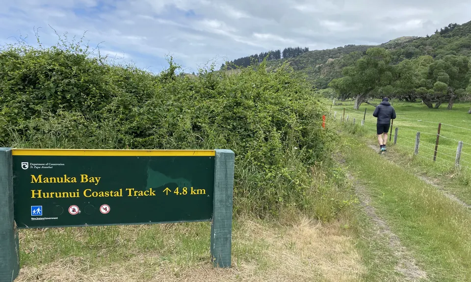
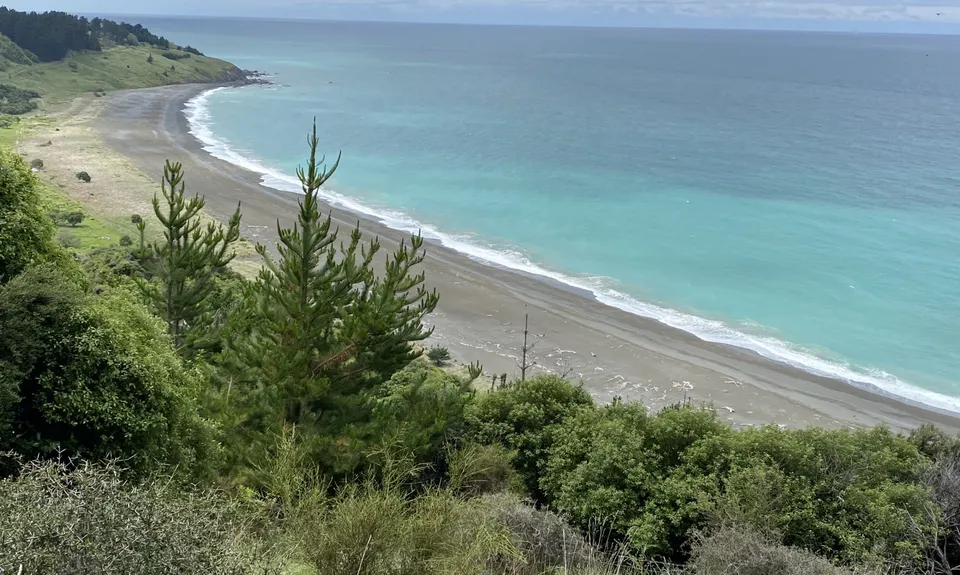
Starting from Manuka Bay: The track as with a wide 4WD track. About 750m from the start take the right fork through a gate which also displays an orange triangle. This takes you into the forest and a climb up through regenerating manuka and flax. Lots of cicadas and bird song too. About 80% of the track is shaded by the forest with occasional lookouts over Manuka Bay and the Hurunui river mouth.
At the 1.5km mark you come to a notice saying the track crosses private farm land. No permission needed, just stick to the track identified by orange marked poles. 5-10 minutes later you will cross back into the public track again. The hillside shows a history of erosion though the track is well formed. There is an occasional section that has been narrowed by some erosion but is very passable.
No toilets or water available on the track nor at either end of the track. No dogs allowed on the track. Check the DOC website for any alert notices. There was an alert notice about bait/poison traps when we were there.
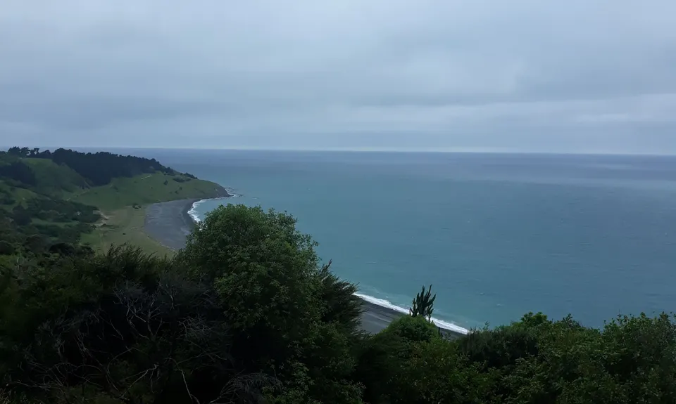
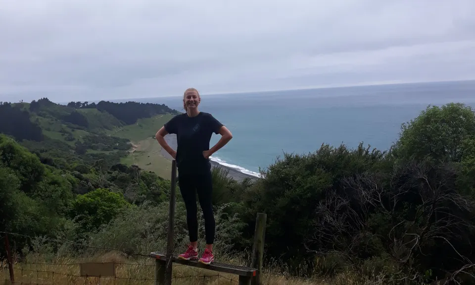
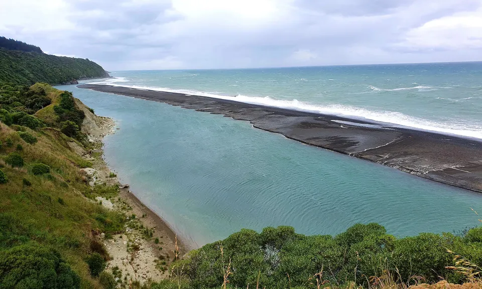
There are several stunning coastal bay views on this track. In particular, the mouth of the Hurunui river was a stunning sight with the sandbar across the mouth directing the water out a narrower opening.
If you know of any public toilets near the trail start or on the route, please login and then let us know so we can update this section.
Easy parking down at both Manuka Bay end and Hurunui Mouth road end for several vehicles.
17 km
19 minutes
Unknown
No
Moderate.
Very easy to navigate once you get onto the track in the forest.
About 750m from the start, at Manuka Bay, take the right fork through a gate which also displays an orange triangle.
Non-existent.
Short-sleeved thermal top, Windproof jacket, Whistle, First aid kit, Extra food for emergencies, Cellphone, Map
No water available on the track nor at the ends of the track.
Track could be slippery when wet.
In a couple of places the well formed track had eroded making it narrow but still passable so just be extra careful there.
Two Rivers Cafe
11 Hall Street, Cheviot
https://www.tworiverscafe.co.nz/
Friendly service, relaxing indoor/outdoor atmosphere, interesting artworks for sale on the walls, tasty salmon bagel, delicious coffee, dog friendly -but don't bring the dog in through the front door like we did. Take the dog around the right hand side of the cafe through a closed gate into the garden at the back of the cafe.
Cheviot Tea rooms
33 Hall Street, Cheviot
Great quick service for take away coffees, ice creams and cold drinks.
Do you have another suggestion on where to go afterwards for the best coffee / cake / breakfast / brunch / beer?
Fastest Known Times (FKTs)
You and Manuka Bay Track
As a VIP member you can record private notes for this trail, see all of your times and more.
Already have an account? Login now
A wee ripper! Much more bush than I expected with lots of lovely bird song. Magnificent views up and down the coast. Seals frolicking in the waves.
January 4, 2021
Heavy rain the night before, made for a very slippery track which was and not overly runnable (for me) in places. Grass long and track overgrow in open areas, making for some sogginess! Otherwise great wee jaunt if you happen to be in the area, just as stunning in bad weather with crashing waves and moody skies. I ran from Gore Bay, the road is actually quite pretty too and it makes a 20km return trip.
November 22, 2020
Great diversion on the way down to Christchurch. Enjoyable bush track with stunning views. Toilets located at Gore Bay.
November 22, 2020
Send to your phone
Scan the below QR code to open this trail on your phone.

Tip: position the QR code in your phone camera screen.


