Last Updated: 29th Nov 2025
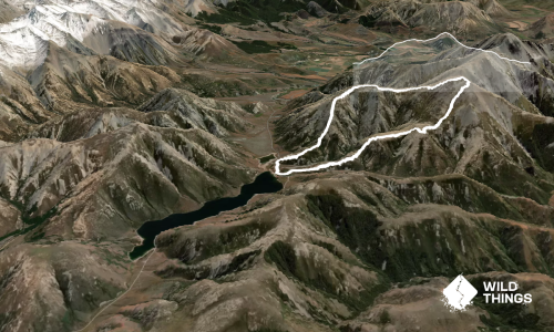
Mt. Plenty route
Last Updated: 29th Nov 2025
Open
Grunt Factor: 24 ?
Gnarl Factor: 123 ?
4.6km
755m
745m


Last Updated: 29th Nov 2025
Last Updated: 29th Nov 2025
Open
Grunt Factor: 24 ?
Gnarl Factor: 123 ?
4.6km
755m
745m
Front country - easily accessible
Out and Back
Undulating, some big hills
Dog Friendly
Open ridges/tops
Untracked / Route only
Average Uphill Gradient: +33.30%
Average Downhill Gradient: -32.80%
VIP Feature: Send this route to your Garmin account so you can follow the course on your Garmin device.
Become a VIP Member to see the trailhead information.
3:00
Slow
2:15
Moderate
1:30
Fast
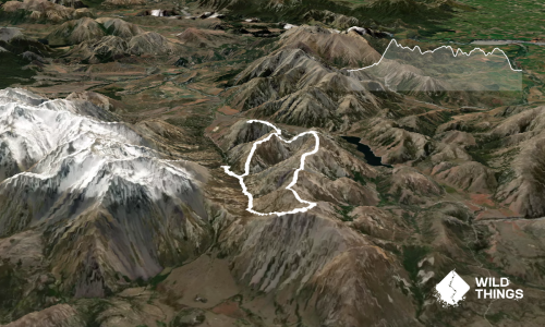
This one is great for someone who wants a shorter run with a lot of elevation gain that doesn’t take much time and still offers beautiful views. Park your car by the bridge at Dry Stream (see photo). There’s a wooden gate that you walk through — just behind the gate, on the left, you’ll see a small trail.
From there it's a scramble and climb for a few minutes until you reach a nice little ridge line, where you’ll find a fairly visible path. Follow it.
Roughly halfway between the parking area and the summit, the trail becomes less steep, and the narrow ridge opens up into a wide crest. The path disappears here, and you’ll need to find your way through some low bushes — but it’s nothing too difficult, and from here it's an easy trek all the way to the summit.
At the summit pyramid, enjoy the views. If you want, you can continue along the ridge towards Castle Peak and Foggy Peak — this could also be a good alternative route. Otherwise, just return the same way you came.
This trail includes the peak Mount Plenty.
Castle Hill, Castle Peak...
None.
Dry stream car park.
7 km
6 minutes
Yes
No
Moderate.
Follow ridgeline.
Generally good.
Waterproof leggings, Thermal leggings, Lightweight fleece top, Short-sleeved thermal top, Long-sleeved thermal top, Seam-sealed waterproof jacket, Windproof jacket, Gloves, Beanie/thermal headwear, Whistle, First aid kit, Extra food for emergencies, Survival blanket, Cellphone, Map, Headtorch and spare batteries, Crampons / microspikes (for winter conditions)
Dry Stream
Snow
Loose rocks
Do you have a suggestion on where to go afterwards for the best coffee / cake / breakfast / brunch / beer?
Trail Legend
Login as a VIP to become a Trail Legend. Learn about Trail Legends.
Fastest Known Times (FKTs)
You and Mt. Plenty route
As a VIP member you can record private notes for this trail, see all of your times and more.
Already have an account? Login now
Length: 20.2km
Level: Intermediate - Experienced
Send to your phone
Scan the below QR code to open this trail on your phone.

Tip: position the QR code in your phone camera screen.
Plan smarter, stay motivated, track your progress, and unlock the full Wild Things experience — while saving along the way.