Last Updated: 21st Sep 2023
Kerry's Lollipop
Last Updated: 21st Sep 2023
Closed More info
Grunt Factor: 20 ?
Gnarl Factor: 56 ?
10.0km
570m
570m
246m
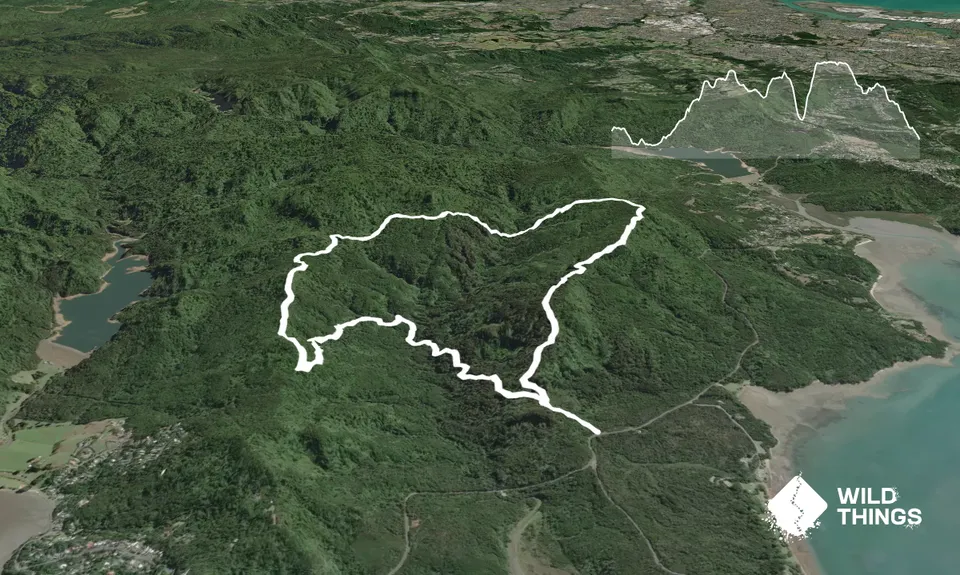
Trail Map
This Topo layer only covers NSW/ACT.
Switch to another map layer when viewing outside this area.
Switch to another map layer when viewing outside this area.