Last Updated: 21st Sep 2023
Polar Discovery
Submitted by Mike Steel
Last Updated: 21st Sep 2023
Open
Grunt Factor: 65 ?
Gnarl Factor: 91 ?
25.0km
1450m
1450m
1937m
Last Updated: 21st Sep 2023
Submitted by Mike Steel
Last Updated: 21st Sep 2023
Open
Grunt Factor: 65 ?
Gnarl Factor: 91 ?
25.0km
1450m
1450m
1937m
Back country - remote
Loop
Mountainous
Native bush
Riverside
Open tussock/grasslands
Open ridges/tops
Technical Single Track
Untracked / Route only
Average Uphill Gradient: +13.0%
Average Downhill Gradient: -13.2%
Login as a VIP to see the trailhead information.
Not suitable
Slow
10:00
Moderate
6:00
Fast
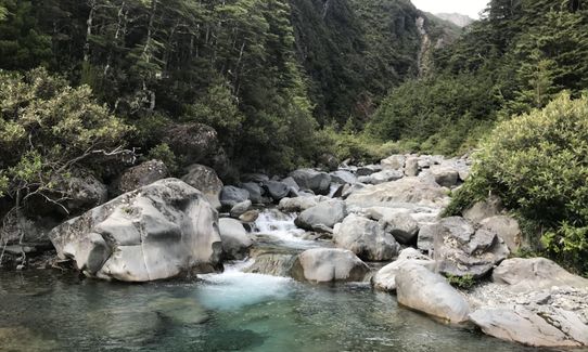
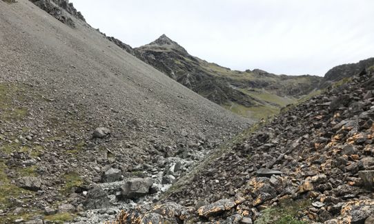
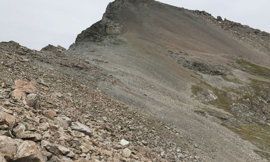
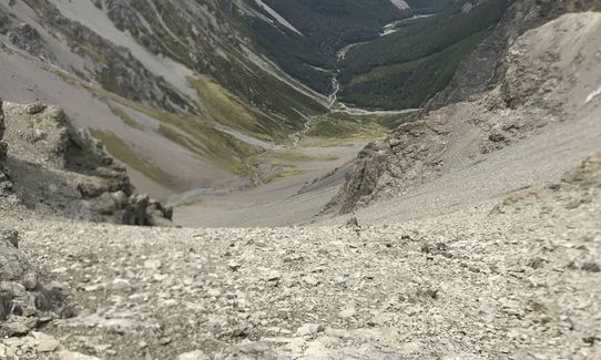
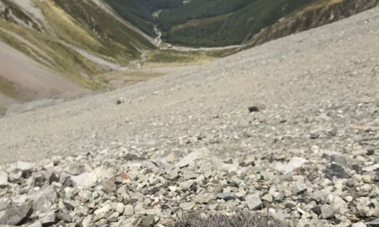
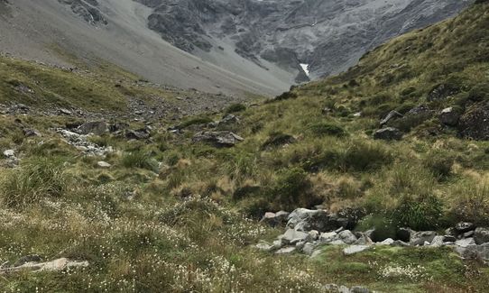
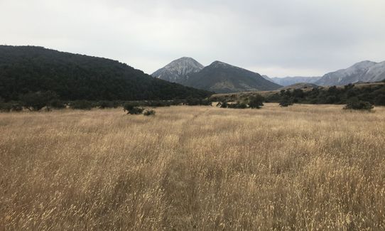
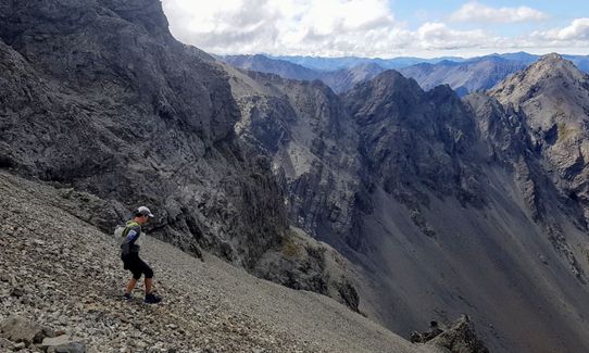
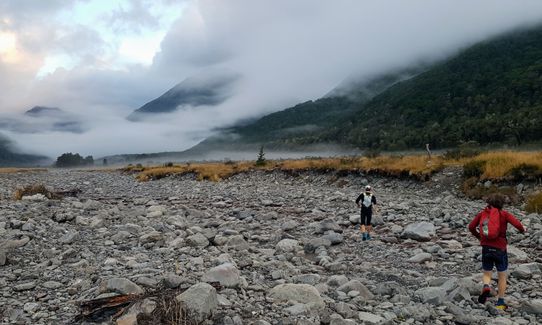
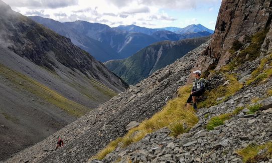
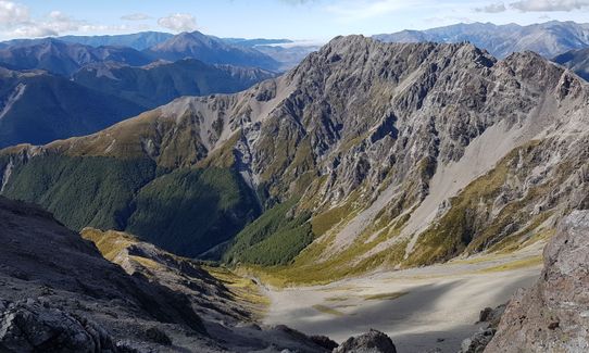
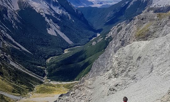
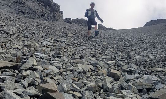
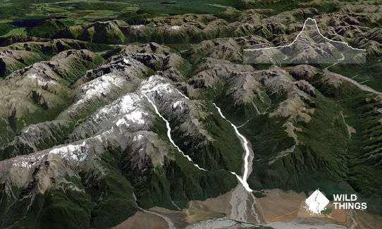
Run up the Hawdon valley following occasional markers till you reach Discovery creek (1 hour) which is just before Hawdon Hut. Pleasant boulder hopping up this stream through an impressive gorge soon follows, then you meet a side-branch that comes in on your right (small cairn on mossy boulder). Head straight up the true left (i.e. right hand side looking up) of this stream in dense bush, it's steep but avoids waterfalls. Stay close to the stream higher up so you can pop out onto the rocky stream bed and follow it up towards the head of the valley. Higher up this valley an obvious deep ravine appears ahead on your left; just before this ravine head up left and climb up onto the Polar range, and over the high point of Pt 1937 (various options). From here there is some airy running along the ridge, particularly if you are close to the sheer eastern side! Closer to Mt Scott some obstacles on the ridge come into view - they can easily be negotiated with care on the western side. There is only one safe spot to descend east off the ridge and this is a col just before the rock ramp that leads up to join the start of bulky Mt Scott - run down from the col on excellent scree into the head of Sudden valley - once off the scree, the going is quite slow until you reach the open valley. Nice running from here to the Sudden Valley Biv, and onwards along this open hanging valley to where the valley narrows. Marked trails follow the river through this section on both sides of the river; be sure to pick up the last one on the true left that leads around the impassable Barrier Falls. Once you've landed in the lower valley there is more boulder hopping before the valley finally opens up for some pleasant running back to the car park.
This alpine circuit linking Discovery Stream, the Polar Range, and Sudden Valley, has a bit of everything - river running, bush bashing, rock scrambling, short sections of ridge running with fantastic views, a big scree descent, hanging valleys and bush trails.
Safe and spacious car park. Likely to be other vehicles there. Can camp there also.
25 km
25 minutes
Unknown
No
Hard.
Safest to do this trip in the direction described. Some navigation required in (and above) Discovery Stream.
The deep ravine (in the description) can be climbed (I went up it not realizing it had been described as "dead end" in a tramping guide book!) but it's not recommended. Also, keep an eye out for the exit of the hanging Sudden valley.
Non-existent.
Long-sleeved thermal top, Seam-sealed waterproof jacket, Beanie/thermal headwear, Personal Locator Beacon (PLB), Whistle, First aid kit, Extra food for emergencies, Survival blanket, Cellphone, Compass, Map
Plenty of water most of the way, and the Polar Range section is fairly short.
Will be snowed under in winter. Also the rivers (Hawdon, Sudden Valley steam) need to be fairly low. More of a summer-time trip this one. It's east of the divide, so can be OK when the weather at Arthur's Pass is not so flash, but avoid gale-force nor-westers which could be unpleasant on the Polar Range section.
Fastest Known Times (FKTs)
You and Polar Discovery
As a VIP member you can record private notes for this trail, see all of your times and more.
Already have an account? Login now
In my opinion, this fits into the trail 'adventure' category, rather than trail run. Having said that, it really is a fantastic adventure, and has a bit of everything to offer. Mostly off trail, so navigation skills are essential, and the climb up the screen to the high point is brutal! The screen descent makes up for it however, and the passage through the tight gorges of sudden valley make it worthwhile. We found the whole route quite slow going in favourable conditions, so allow at least 6 hours for this loop... Longer if you want to stop and soak up the views like we did!
February 27, 2021
JJ
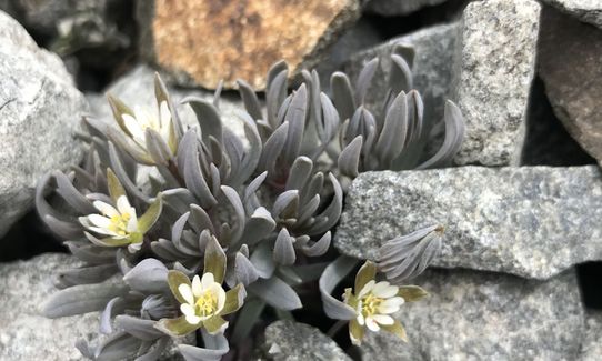
Excellent outing and aesthetic loop. The upward Discovery trib scree to gain the ridge was rather trying. One for the masochistic types. Great scree run down. Mind the specialist scree plants on the scree true left.7hours total. I was 2.5hrs w a NWer to Discovery Stream. 1.5hr up to the drop in col of the scree. 3hr down and to car.
February 1, 2020
The Wild Things Trail Directory is proudly supported by 
Send to your phone
Scan the below QR code to open this trail on your phone.

Tip: position the QR code in your phone camera screen.


