Last Updated: 21st Sep 2023
Deepest Darkest George
Last Updated: 21st Sep 2023
Grunt Factor: 52 ?
Gnarl Factor: 84 ?
17.9km
1300m
1200m
925m
Last Updated: 21st Sep 2023
Last Updated: 21st Sep 2023
Grunt Factor: 52 ?
Gnarl Factor: 84 ?
17.9km
1300m
1200m
925m
Back country - remote
Point to Point (one way)
Mountainous
Native bush
Coastal
Riverside
Lakeside
Open tussock/grasslands
Open ridges/tops
Technical Single Track
Average Uphill Gradient: +12.8%
Average Downhill Gradient: -10.9%
Login as a VIP to see the trailhead information.
Not suitable
Slow
10:00
Moderate
7:00
Fast
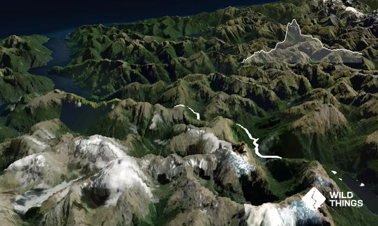
This is one serious mission! Getting there is almost the hardest bit. Once you have sorted that out you are in for a blast in here, but you better take your most expansive fast packing kit you can. Include a tent and sleeping bag just in case, and maybe even a mountain radio with your PLB. The first choice you made would have been whether you fly into George Sound and head east, or if you are doing an out and back via boat options up Lake Te Anau, and Lake Hankinson. Operators can help you with this. See the DOC info.
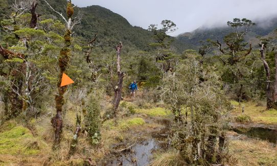
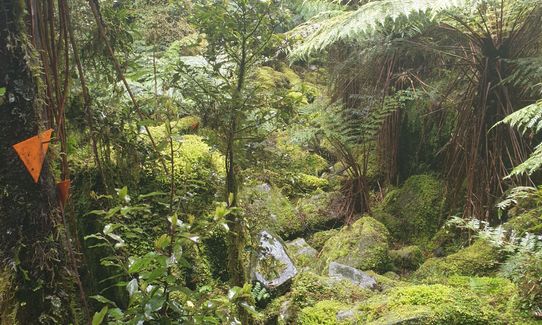
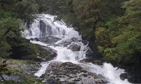
The route described is from George Sound back to Lake Hankinson. Its a doozy, a mini Dusky Track if you like. If walking it's 10 hours one day and 4 the next, so running this in a day is a challenge for the most experienced trail gurus out there. And unless you move fast enough, take sandfly repellent! DOC provide a detailed description and brochure but basically you are on rough trail the whole way. Expect frequent river crossings, mud, 3 wire bridges, tree roots, and mountainous, steep rough terrain.
From George Sound follow the route up to Lake Katherine, probably take you about an hour. You'll soon get a feel for what proper Fiordland trails are all about. The route goes round Lake Katherine - at one point you usually need to wade a bit. Use the chains provided where needed. From the lake it's more beech forest bashing until eventually you reach a steep climb up to Henry Saddle (named after famed early conservationist Richard Henry).
Henry Saddle provides the only part of this route above the bushline, and affords wonderful views. Take the time to linger and explore a bit, the tarns a bit up the south side are well worth going up to for some great photo opportunities. The tops beckon beyond, but don't be tempted unless you are planning to tent out!
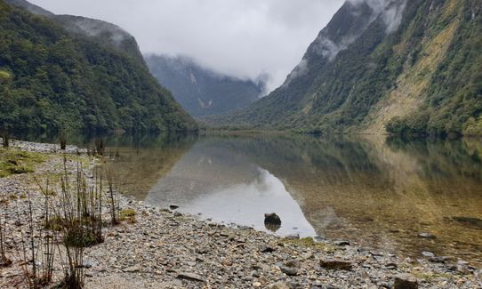
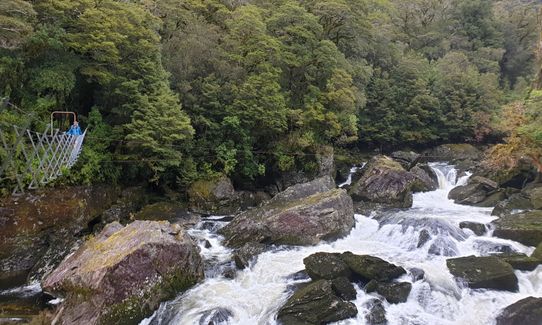
Once over the saddle you'll go back into the bush. Look out for the historic mining operation. You will strike particularly boggy terrain round Deadwood Lagoon. Eventually you'll reach Lake Thompson Hut. There is a good route to the tops from the hut if you are staying overnight and have extra time - incredible views too! Out from Lake Thompson Hut the trail undulates from here around the shoreline of Lake Thompson and then down valley until you reach Lake Hankinson Hut. Here you will have to have arranged boat transport to get home - see the links for information to explore those options.
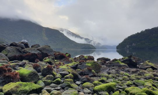
George Sound Hut, Henry Saddle, Lake Thompson Hut Lakes, waterfalls and Fiordland majesty.
Hard.
Take a map, GPS, compass, and know how to use them
Non-existent.
Waterproof leggings, Thermal leggings, Lightweight fleece top, Short-sleeved thermal top, Long-sleeved thermal top, Seam-sealed waterproof jacket, Windproof jacket, Gloves, Beanie/thermal headwear, Personal Locator Beacon (PLB), Whistle, First aid kit, Extra food for emergencies, Survival bag, Survival blanket, Cellphone, Compass, Map, Headtorch and spare batteries, Crampons / microspikes (for winter conditions), Gaiters
Lots of pristine Fiordland water to graze on
Don't go when its flooding. Don't go when its snowing. Winter would be a bad idea. All the usual Fiordland risks exist in here, take enough gear to hunker down in case the conditions require it.
Know Fiordland. Know your limits. Take the right gear and right experience level with you in here
All the Te Anau eateries and watering holes deserve your support
Fastest Known Times (FKTs)
You and Deepest Darkest George
As a VIP member you can record private notes for this trail, see all of your times and more.
Already have an account? Login now
JS
Great mud hopping, tree rooty fastpack fun! Trail is generally well marked with the DOC orange triangles, but there are several points, especially coming down Katherine Creek, where you may have to hunt a bit to find the track. The Moir's Guide South (if you can still find a copy) also has further details about what to expect and possible side trips.
March 15, 2021
The Wild Things Trail Directory is proudly supported by 
Send to your phone
Scan the below QR code to open this trail on your phone.

Tip: position the QR code in your phone camera screen.


