Last Updated: 21st Sep 2023
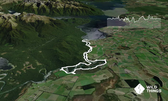
Waiau River Loop
Last Updated: 21st Sep 2023
Open
Grunt Factor: 22 ?
Gnarl Factor: 17 ?
23.6km
290m
290m
200m
Last Updated: 21st Sep 2023
Last Updated: 21st Sep 2023
Open
Grunt Factor: 22 ?
Gnarl Factor: 17 ?
23.6km
290m
290m
200m
Front country - easily accessible
Loop
Undulating, small hills only
Native bush
Riverside
Open farmlands
Sealed Road
Gravel Road
Farm Road / 4WD Track
Easy Single Track
Moderate Single Track
Technical Single Track
Average Uphill Gradient: +2.5%
Average Downhill Gradient: -3.3%
Login as a VIP to see the trailhead information.
3:15
Slow
2:30
Moderate
1:55
Fast
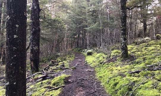
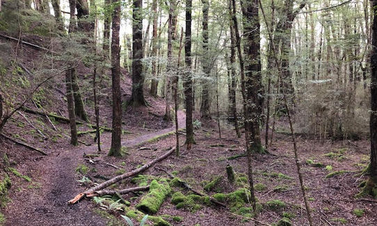
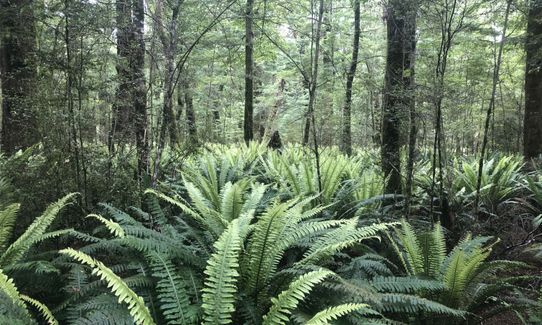
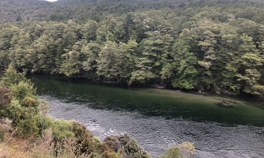
Starting from the Kepler track carpark head down the gravel track past a visitor shelter towards the control gates, continue over the gates and on to a grassy area at which point the track forks - take the left fork which is marked for Rainbow Reach. From this point the track mostly follows the Western side of the Waiau River through native bush on a well formed track, plenty of places to stop along the way and take in the scenery.
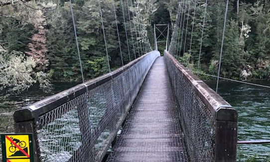
There are a couple of sections of the track that you'll lose sight of the river but sure enough it comes back into sight - at about the 10km mark you will be greeted by the Rainbow Reach Swing bridge. A good opportunity to enjoy the views and catch your breath as you cross the bridge to the otherside.
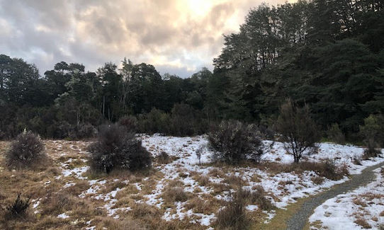
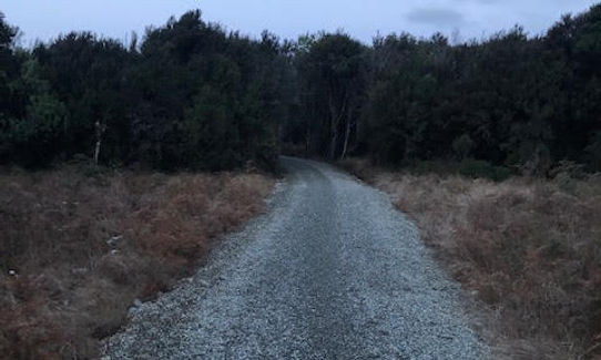
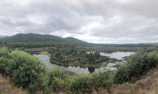
Across the bridge is a small visitor shelter and toilet area - continue straight until you reach a gravel road - there are signposts to follow for the Te Anau/Manapouri Cycle trail which leads to a junction in the track - head left which will have arrows for Te Anau. The next part of the track is more exposed and open compared to the the sheltered first 10km. The cycle trail follows a meandering path along the Eastern side of the river and in places skirts along the edge of farmland and the Te Anau/Manapouri highway, then the track narrows and veers away from the highway and through a short stretch of bush, emerging at Queens Reach road. Keeping an eye out for any traffic follows sign for Te Anau and cross a small ford leading to a gravel road through the Queens Reach recreation area - this is a popular access point to the Waiau River and the track is mainly gravel road through here, but watch towards the end as the track deviates away on its course although it is well signposted.
Continue on through native bush with a few glimpses of the river, shortly the track emerges and follows along beside Golf Course Road before ending up back opposite the Te Anau Control gates - back where you started.
Plenty of carparking available, depending on time of year usually other vehicles around.
6 km
9 minutes
Unknown
No
Easy.
Follow the main track through the Queens Reach Recreation area and watch for yellow cycleway signposts as there are a few smaller side tracks in this section.
Patchy.
Long-sleeved thermal top, Seam-sealed waterproof jacket, Windproof jacket, Beanie/thermal headwear, Whistle, First aid kit, Extra food for emergencies, Cellphone, Map, Headtorch and spare batteries
Apart from the obvious river there is water at Rainbow Reach and Kepler carpark, although best not to rely on this and take your own.
Usually muddy on the Eastern side of the river after rainfall, possibilty of snow in open areas. The cycle trail section is more exposed and potential for flooding after heavy rainfall - watch particularly the Queens Reach Recreation area and the ford leading to it.
Trail Legend
Fastest Known Times (FKTs)
You and Waiau River Loop
As a VIP member you can record private notes for this trail, see all of your times and more.
Already have an account? Login now
Great trail! The bike trail side is nice and easy with such a contrast in the bush on the kepler side, almost two different places 😀
September 29, 2022
Peaceful and pleasant... great route for some low-key k's. Kepler side is beautiful. Highway side has its nice moments and its boring moments... I was surprised by the amount of variety!
December 20, 2020
A pleasant loop that is easily accessible, and combines a single trail bush section with an undulating gravel path that is often close to the river. The gravel section affords numerous river views, with several spots that allow access for a water refill or a wade. The Rainbow Reach Bridge is quite picturesque, and last time across, there were half a dozen Piwakawaka flitting around!
June 28, 2020
These overlap with this trail to some degree. You may wish to combine them but please note that to qualify for FKTs on these runs you should record a separate activity for each.
The Wild Things Trail Directory is proudly supported by 
Send to your phone
Scan the below QR code to open this trail on your phone.

Tip: position the QR code in your phone camera screen.


