Last Updated: 21st Apr 2024
The Routeburn
Last Updated: 21st Apr 2024
Open
Grunt Factor: 55 ?
Gnarl Factor: 53 ?
32.0km
1150m
1220m
1300m


Last Updated: 21st Apr 2024
Last Updated: 21st Apr 2024
Open
Grunt Factor: 55 ?
Gnarl Factor: 53 ?
32.0km
1150m
1220m
1300m
Back country - remote
Point to Point (one way)
Mountainous
Native bush
Lakeside
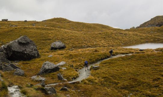
Open tussock/grasslands
Open ridges/tops
Easy Single Track
Moderate Single Track
Technical Single Track
Average Uphill Gradient: +12.4%
Average Downhill Gradient: -11.8%
Login as a VIP to see the trailhead information.
5:00
Slow
4:00
Moderate
2:50
Fast
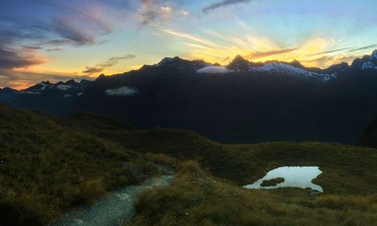
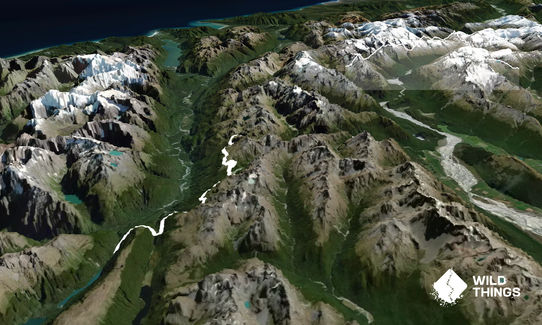
This is the 'Classic' many say the best trail in Godzone under the marathon distance. The classic is the name for the race but also the standard 32km Routeburn running from the Divide to the Shelter.
There are lots of alternate possibilities but this is the pure original. This is one track you will keep coming back to it is seriously that good.
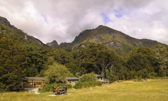
You can tick this one off if you have done the race or a training run starting from The Divide. The trail is quite well marked (read the yellow and green DOC signs if you are not sure) you will pass many trampers on the way. On a training run chill at the huts for a few minutes, on race day just go hard!
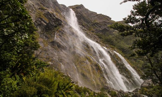
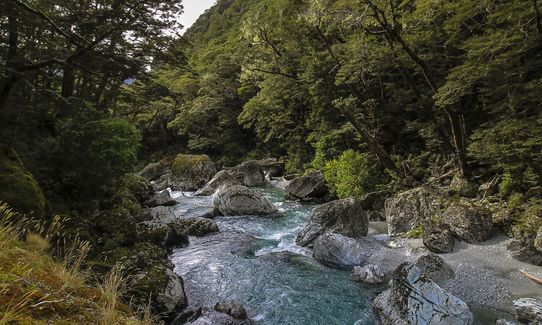
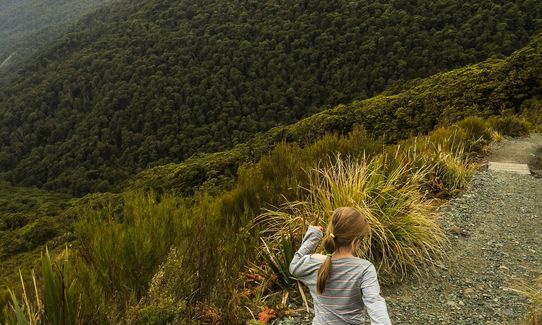
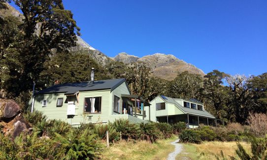
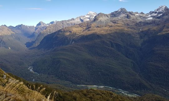
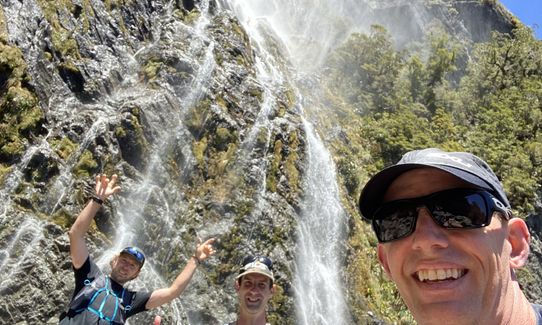
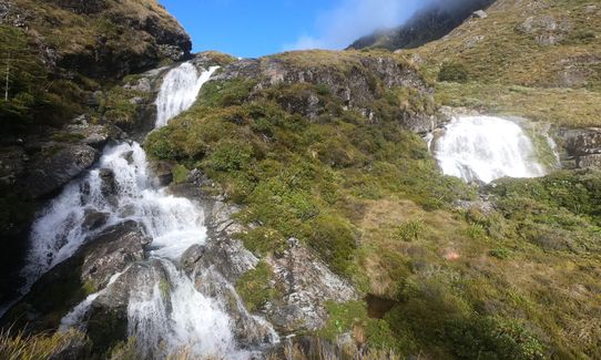
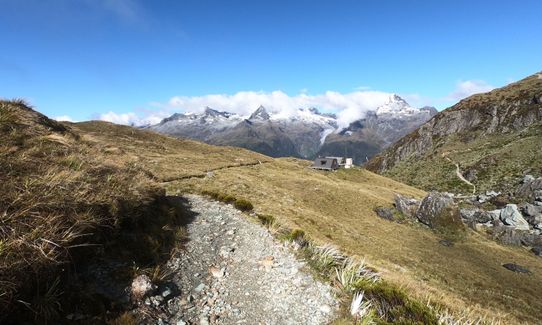
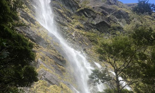
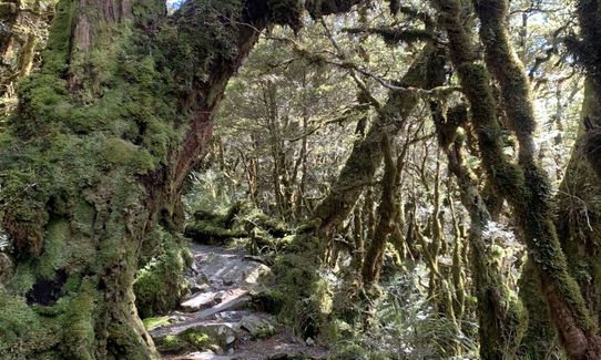
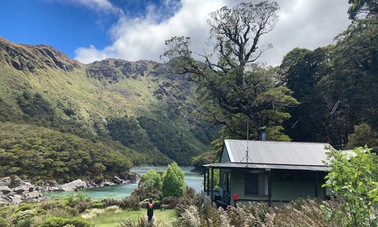
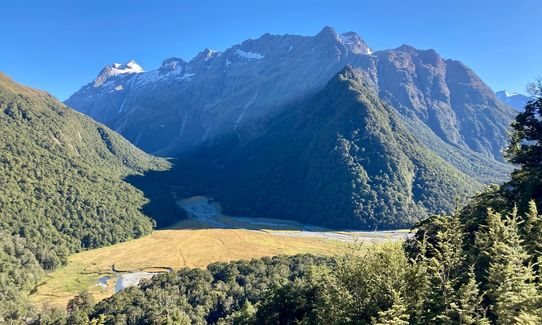
Starting in diverse Milford temperate rain forest you will ascend up and then down to the site of the old Howden Hut (no longer available for shelter). Up past Earland Falls, then watch out for The Orchard I love this spot, then down again to MacKenzie Hut.
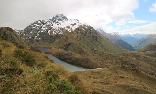
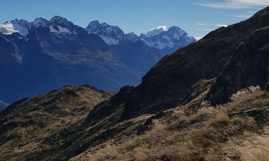
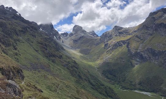
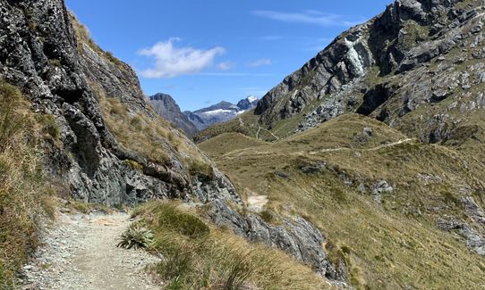
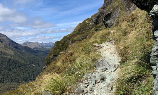
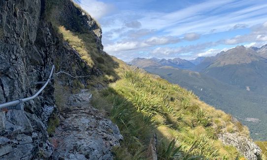
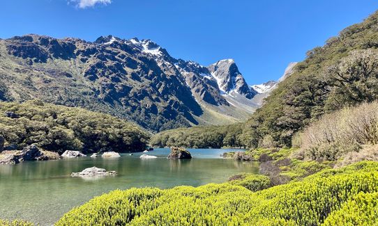
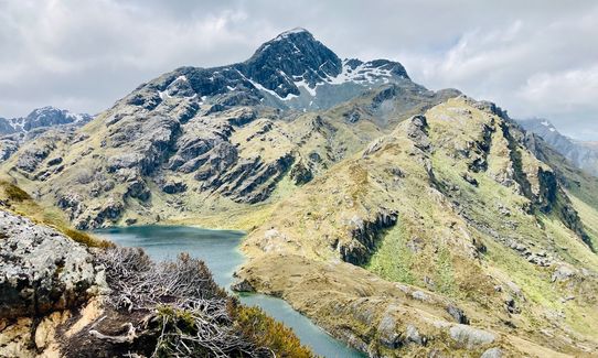
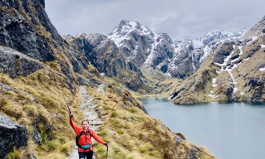
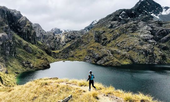
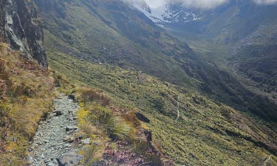
After this it's a massive slog and a lot of vertical to ascend up to Ocean Peak Corner (look for the sea on a good day). Then head up to the Harris Saddle, just after this you will hit the highest point on the main track.
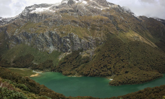
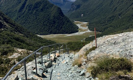
From here it's sweet downhill.....except that's for the pro's that can navigate the technical downhill at the speed of a goat running away from a hunter! Lots of rocks to navigate but most runners love that stuff. You go past Routeburn Falls Hut and then the speedy part begins. The track opens up into an easy to run downhill, past Routeburn Flats and then undulates past some stunning views...keep running your heart out - you can come back to marvel these wonders another day.
You are running the Routeburn and to do so means you are giving it your all and when you get to the Routeburn Shelter you will be buzzing and feeling better than most other trails since the distance of 32km is so sweet!
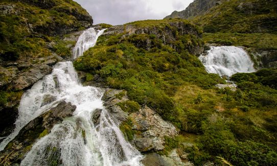
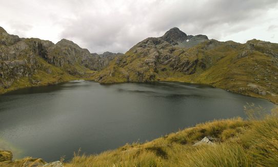
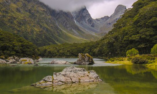
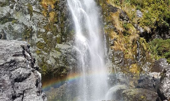
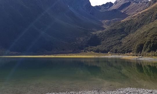
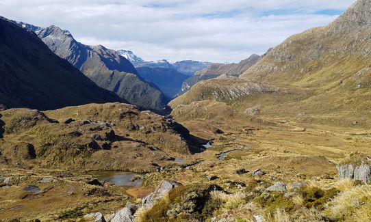
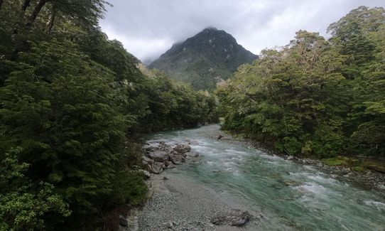
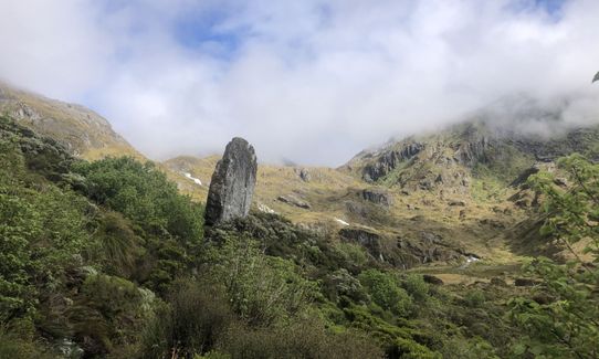
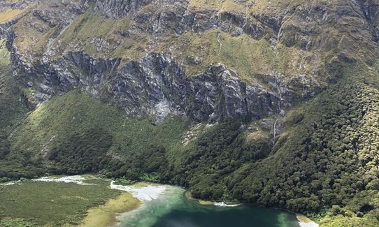
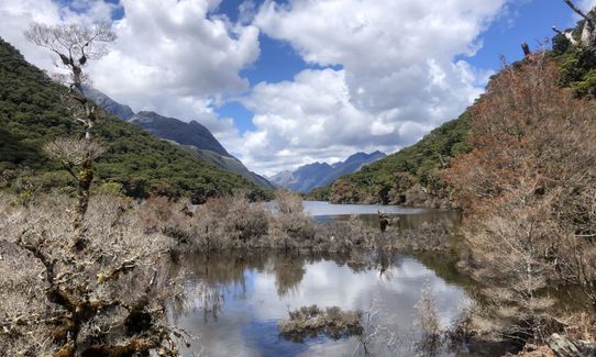
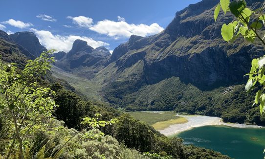
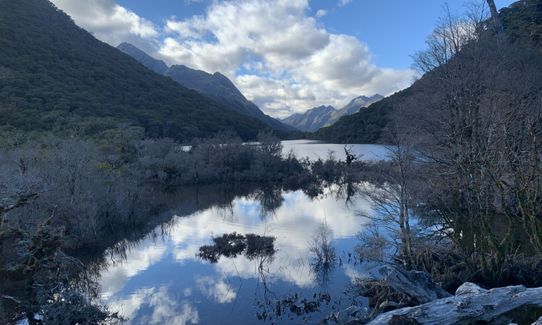
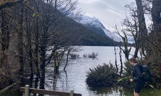
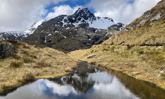
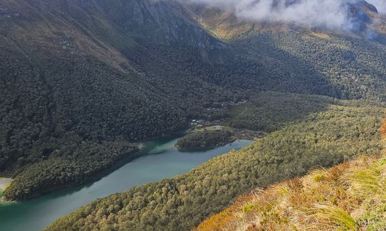
Stunning trail, check out the amazing spots the huts are located in with lakes, rivers and waterfalls just a small sample of the area. Special points of interest are Lake Howden, Lake MacKenzie, Lake Harris, Routeburn River, Routeburn Falls and Earland Falls. Split rock is worth a visit and is a side trip off Mackenzie Hut. Conical Hill is the highest point on the official trail (above Harris Saddle) but is also a side trip and well worth it if you have the time and the energy! The site of the old Howden Hut has a side trail which leads to the Greenstone/Caples Tracks and opens up new running possibilities!
Key Summit (the access to the Whisky Trail) is another insanely good side trip near The Divide but with a bit of vertical you want to be fit to run this as well the whole track. Near the Harris Saddle look for the aptly named Deadmans Track which leads you to the Hollyford River.
Transport is usually tricky as this is not a loop track and the drive time is usually more than the run time!!
Either self drive and swap keys with someone doing the reverse direction, or pay a company to relocate your car from one end to the other.
There are several bus options available including on race day. The fastest option on race day is taking the helicopter and avoids all the hassle.
Parking is at The Divide (start) and Routeburn Shelter (end), there is usually enough space but during peak season these parks get pretty full.
84 km
65 minutes
No
No
Moderate.
This track is pretty straight forward, having said that there are numerous side trails so read the signage. Forks include: The Divide, Lake Howden campsite and Pass Creek Track near Lake Howden, Split Rock side track near Lake MacKenzie, Deadmans Track and Conical Hill near the Harris Saddle. Near the Routeburn River there are several mini trails plus the infamous nature walk some runners have accidentally taken during the race. Basically if you are not sure of the route stop and read the sign, get out a map or GPS, if you do make a mistake it should be obvious pretty quickly, look for trampers they are everywhere and a very good source of information.
Non-existent.
Waterproof leggings, Thermal leggings, Lightweight fleece top, Short-sleeved thermal top, Long-sleeved thermal top, Seam-sealed waterproof jacket, Windproof jacket, Gloves, Beanie/thermal headwear, Whistle, First aid kit, Extra food for emergencies, Survival bag, Survival blanket, Cellphone, Compass, Map
Water is everywhere on the track. Even in dry conditions it would be a maximum of half an hour at any point between good drinking locations.
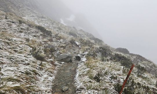
During winter avalanches and snow make the track seriously dangerous at times. Always check with DOC as well as checking the weather forecast before going. If it's too dangerous usually winter through to spring don't hesitate to wait for another day. This track has claimed lives and runners are usually less prepared for adverse weather.
The main things to look out for are rocks, yes it should be called the 'Rockburn' there are seriously thousands of them in different sizes, add to that roots and small sections of mud and it can make for an interesting run. If it's raining it is still doable but ups the challenge level as you may get slightly uncomfortable. Watch for the cliff drops especially around the Hollyford facing section before the Harris Saddle and then immediately above Lake Harris. Also the descent just before the Routeburn Falls is very rocky and slippery at times, use the handrails when provided.
It can get windy on the tops too. Watch out for snow and avalanches in winter time and don't hesitate to turn back if it becomes too treacherous.
Glenorchy Cafe Restaurant
25 Mull St | Opp Petrol Station, Glenorchy Otago, New Zealand
https://www.facebook.com/glenorchycafe/
This place is compulsory, gotta check it out and the chilled out atmosphere that Glenorchy has to offer.
Kinloch Lodge Restaurant
Lake Wakatipu, Central Otago, Glenorchy 9372, New Zealand
http://www.kinlochlodge.co.nz/
Ok this place is slightly away from it all and will take a few more minutes to get to being in Kinloch, but it is seriously worth going to if you get the chance. The setting is stunning and it's a quaint little place to grab some dinner and drinks.
Trail Legend
Fastest Known Times (FKTs)
You and The Routeburn
As a VIP member you can record private notes for this trail, see all of your times and more.
Already have an account? Login now
I've done it from the reverse direction, Routeburn Shelter to the Divide, absolutely spectacular, beautiful day for it, not a single cloud on the sky, quite busy with walkers, big groups at times but very easy to pass. -2 C in the morning, 13 C when finished ( t-shirt and running vest all the way). Beautiful Beautiful Beautiful. Completed in 4hrs 27 Min
March 31, 2023
what I can say, backyard trail - managed to do under 5 hours once From the divide back to glenorchy. one of the best runs in the country if not on the world.
February 11, 2022
We ran from the Divide end and paid for our car to be relocated to the Glenorchy end. More elevation in this direction but figured this direction meant running towards the view along the hillside above the Hollyford Valley and gave us a relatively easy final 10km. Views in every part of the track are jaw dropping. This is an epic run. But I was much slower than the times suggested, probably because I’m very slow on the technical terrain (especially the downhills). I recorded six hours of moving time and another hour of stops for photos, bottle refills and just to gawp at the views!
January 16, 2022
The Wild Things Trail Directory is proudly supported by 
Send to your phone
Scan the below QR code to open this trail on your phone.

Tip: position the QR code in your phone camera screen.


