Last Updated: 21st Sep 2023
Gobsmacking Gertrude
Last Updated: 21st Sep 2023
Grunt Factor: 32 ?
Gnarl Factor: 93 ?
8.9km
640m
640m
1420m

Last Updated: 21st Sep 2023
Last Updated: 21st Sep 2023
Grunt Factor: 32 ?
Gnarl Factor: 93 ?
8.9km
640m
640m
1420m
Back country - remote
Out and Back
Mountainous
Native bush
Riverside
Lakeside
Open tussock/grasslands
Open ridges/tops
Technical Single Track
Untracked / Route only
Average Uphill Gradient: +15.1%
Average Downhill Gradient: -15.1%
Login as a VIP to see the trailhead information.
Not suitable
Slow
5:00
Moderate
3:30
Fast
This route is not for the faint of heart and is a true alpine run/ scramble, and should be approached with the requisite experience, confidence, and only undertaken in favourable summer weather patterns. There have been fatalities by inexperienced people who underestimate Fiordland terrain and weather conditions. Pack and plan accordingly! Do not run an attempt in winter or autumn/spring-like snow conditions! Having said all that, in good weather most experienced Wild Things will have a ball here.
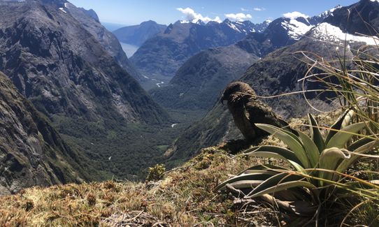
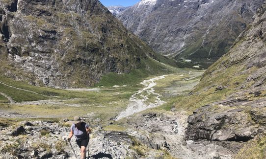
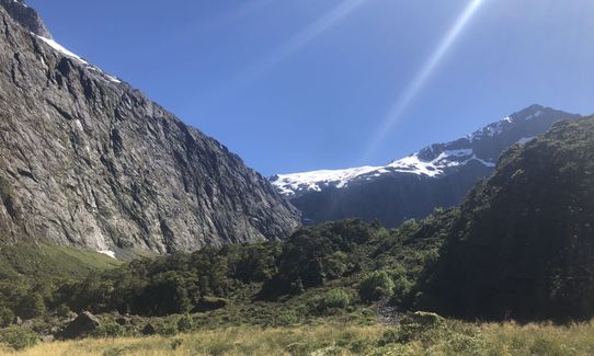
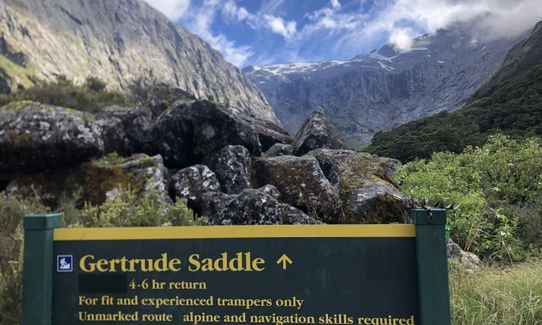
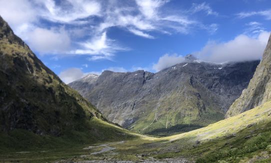
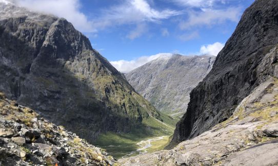
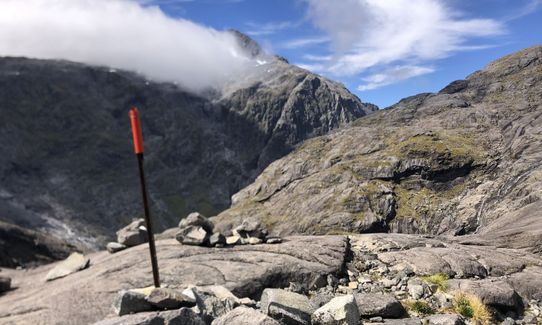
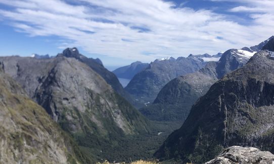
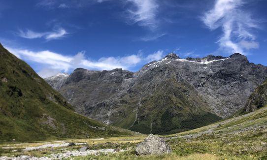
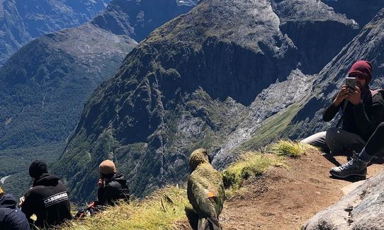
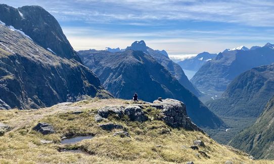
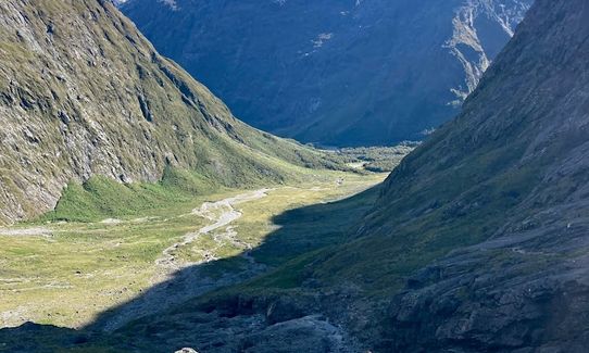
The route heads out from the Homer Hut area from the signposted entrance beside the highway, and hops up through alpine scrub, herbfields and large boulders. Reasonably runnable in here for the nimble of feet. As the valley closes in it steepens rapidly. Make sure you are following the fairly heavily marked route (poles, orange markers and cairns). Once clear of the vegetation zone the real fun starts. Steep terrain follows - rocky slabs, tiptoeing around bluffs and waterfalls, permanent steel ropes to assist (nothing technical, just to help) and more steep ascending will eventually head up to Gertrude Saddle, where you will gape at the views (which you will have because you only attempted this in good weather!) Some say this is the best daytrip view in NZ, it certainly has to be a contender).
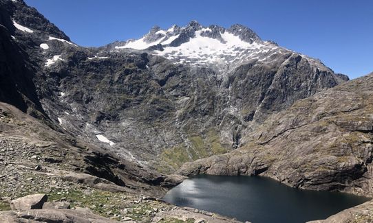
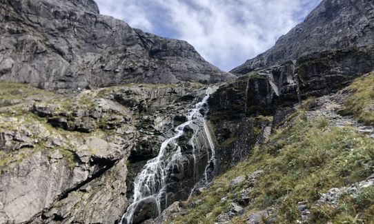
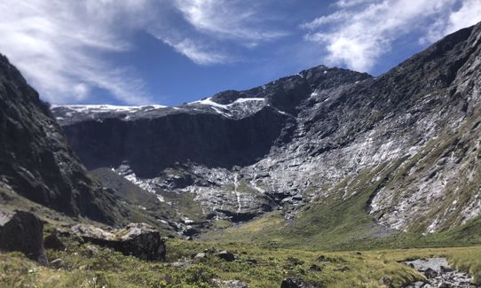
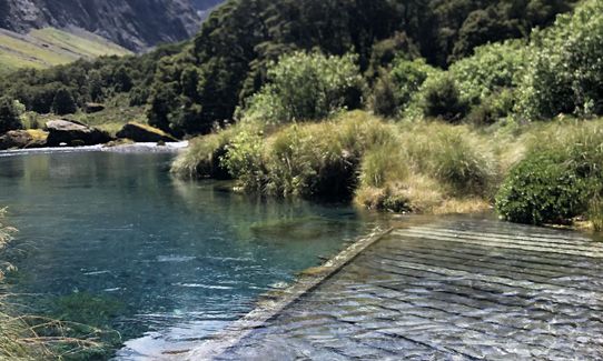
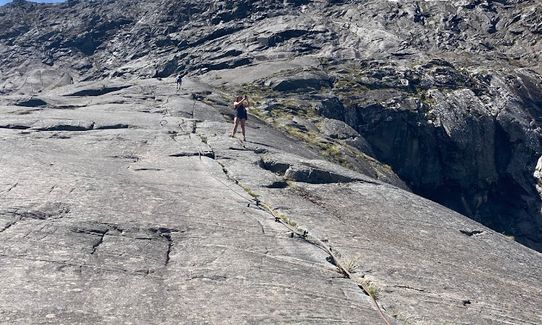
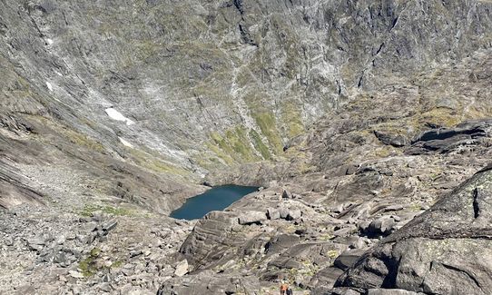
The crux of this route is going the right way around the waterfall as you ascend under bluffs below the Black Lake outlet. Do not miss the river crossing under the waterfall, marked with large orange triangles - especially coming back on the downhill. It may be helpful to familiarize yourself with the DOC video on their website about how to pick the correct route. No other route is safe on this section Above the waterfall area sidle scree and rocks and head up the classic Fiordland angled granite rock slabs following cairns and more orange triangles. Take care on any wet areas, it can be slippery. Then you'll reach Black Lake which is a great spot to catch breath and fuel up, before the last few scrambles and rocky bits up to Gertrude Saddle. Here you will find a world of goodness.
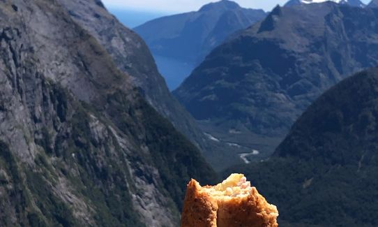
A short distance to the right (north) of the saddle there's an easy extra 50m bit of vert where your view of Milford Sound will be even better, but please do not be tempted to go further in either direction from Gertrude Saddle as this is mountaineering / climbing country beyond.
True Fiordland majesty Breathtaking viewpoint of Milford Sound and surrounds from high
Park up beside the highway near the NZ Alpine Club Homer Hut and follow the poled route from there
98 km
84 minutes
Unknown
No
Hard.
If you are not following cairns, poles and orange markets be sure to back track and find the last one
It's a well marked route, but please don't rush without spotting where you need to be
Non-existent.
Waterproof leggings, Thermal leggings, Lightweight fleece top, Short-sleeved thermal top, Long-sleeved thermal top, Seam-sealed waterproof jacket, Windproof jacket, Gloves, Beanie/thermal headwear, Personal Locator Beacon (PLB), Whistle, First aid kit, Extra food for emergencies, Survival bag, Survival blanket, Cellphone, Compass, Map, Headtorch and spare batteries, Gaiters
Fiordland water is good to drink up here
This trail is only for fine weather summer conditions. Do not attempt in any other conditions, there are plenty of other options off the Milford Road if its not a nice summers day
Exposed cliffs, know the weather forecast and don't attempt outside summer conditions.
Use Mountain Safety Council intentions systems, tell someone you are going, and when you are due out
Have all the gear you'd need for a remote experience.
Te Anau. All of it.
Trail Legend
Fastest Known Times (FKTs)
You and Gobsmacking Gertrude
As a VIP member you can record private notes for this trail, see all of your times and more.
Already have an account? Login now
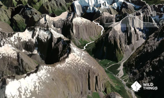
Do venture beyond! It late summer it’s easy to hike on to Barrier Knob, and really worthwhile for the views of Lake Adelaide basin.
March 24, 2022
Short, sharp and sh*t hot! Awesome views in all directions, and deservedly popular (if the car park is full, there's parking on the road). The side trip up Barrier Knob (1879m) is an option but only in settled clear weather and only if you are comfortable rock scrambling on steep terrain (trail shoes are fine) - in that case follow the cairns/faint trail from the saddle then higher up strike out left to gain the rocky ridge that avoids the steep hard snow - the true summit is towards the other end of the narrow summit ridge.
February 17, 2022
If it’s been raining recently it’s not worth even attempting to keep your feet dry!! The bridge had sunk and the river had burst its banks. But my goodness what an utterly gobsmacking trail! Definitely one for a dry day, and definitely more a tramp than a run. But just bloody incredible 🤩
February 5, 2022
Best fine weather day hike/ power hike/ gnarly and grunty training!! It's a must do in Fiordland, although it's mostly not runnable! Great way to try out the grip on my Scott running shoes ;)
December 30, 2020
The Wild Things Trail Directory is proudly supported by 
Send to your phone
Scan the below QR code to open this trail on your phone.

Tip: position the QR code in your phone camera screen.


