Last Updated: 21st Sep 2023
Parachute Rocks and St Arnaud Ridge
Submitted by Sarah Biss
Last Updated: 21st Sep 2023
Open
Grunt Factor: 44 ?
Gnarl Factor: 81 ?
11.3km
1310m
1310m
1713m
.jpg?tr=w-542,h-325)
Last Updated: 21st Sep 2023
Submitted by Sarah Biss
Last Updated: 21st Sep 2023
Open
Grunt Factor: 44 ?
Gnarl Factor: 81 ?
11.3km
1310m
1310m
1713m
Back country - remote
Out and Back
Mountainous
Native bush
Lakeside
Open ridges/tops
Easy Single Track
Moderate Single Track
Technical Single Track
Untracked / Route only
Average Uphill Gradient: +19.8%
Average Downhill Gradient: -18.8%
Login as a VIP to see the trailhead information.
3:30
Slow
2:30
Moderate
1:45
Fast
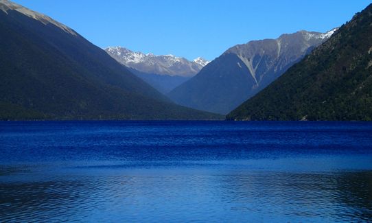
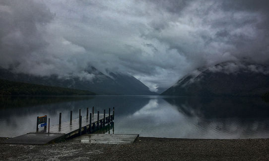
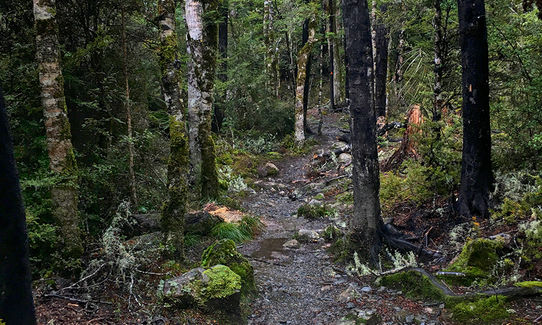
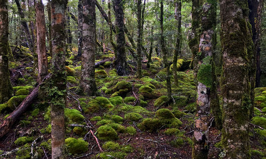
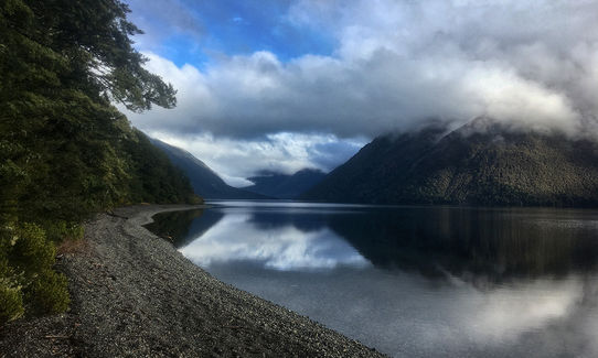
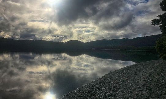
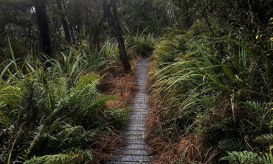
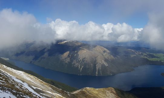
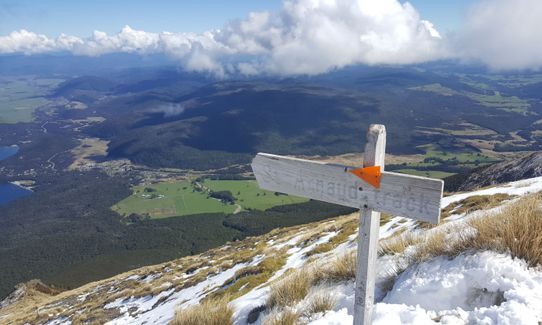
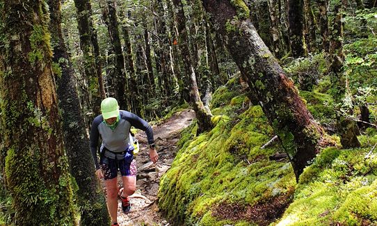
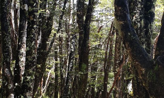
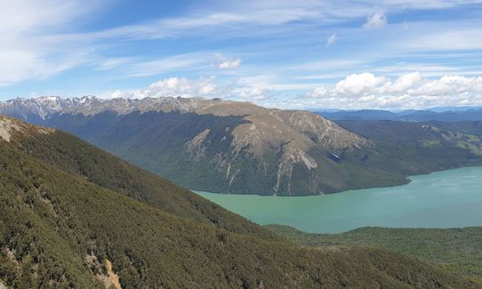
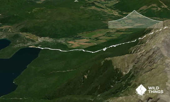
Starting at the edge of Lake Rotoiti, the track ascends steadily through beech forest up to St Arnaud Range. Much of the climb is in bush - a technical trail with plenty of tree roots and natural steps to negotiate as the trail zig zags its way up towards the bushline.
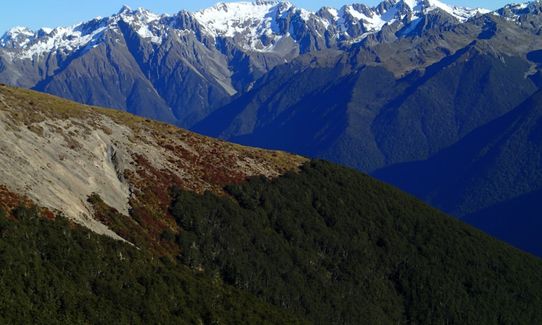
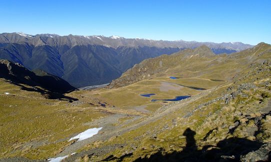
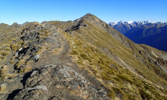
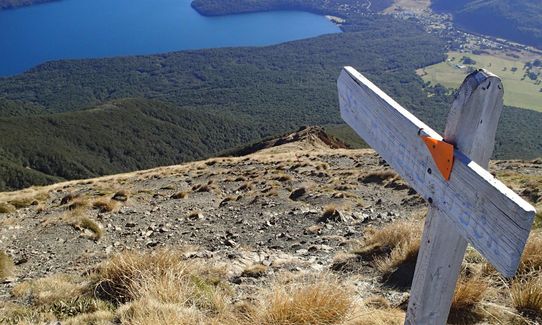
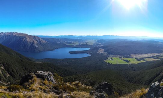
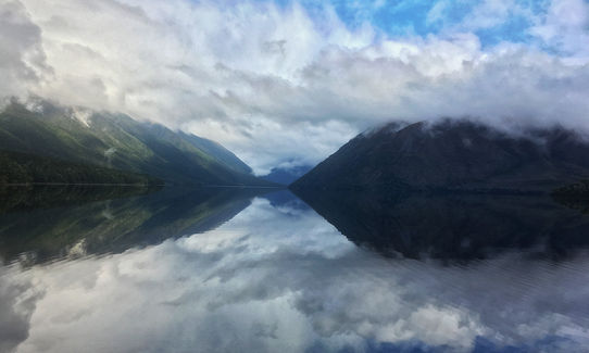
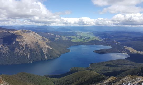
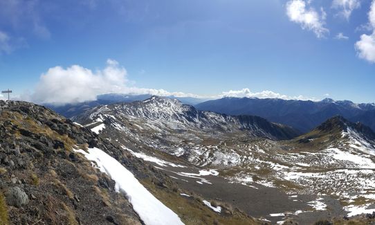
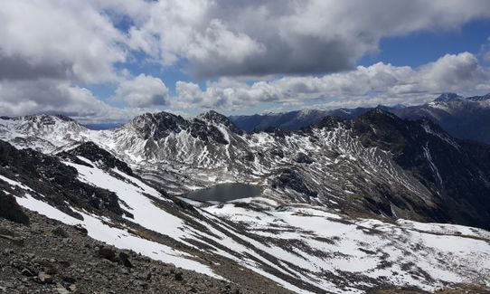
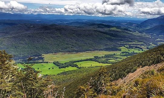
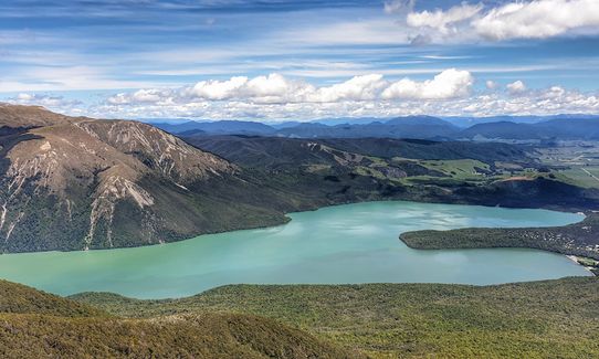
At about 1400m you come across Parachute Rocks and wonderful views of Nelson Lakes National Park. The track then gets steeper as you follow the orange poles up straight up an exposed slope, to the St Arnaud Ridge line. You are rewarded by spectacular views of the surrounding area, as described in "features of interest" .
Come back down the way you came.
This trail includes the peak Parachute Rock.
"The lower section of the walk crosses moraine terraces deposited by past glaciers. As you climb through the beech forest, notice how it adapts to suit the changing altitude. The lower slopes are dominated by large red beech, with a healthy sub-canopy of other species, such as broadleaf and putaputawÄ“tÄ. Higher up, silver beech and finally the hardy mountain beech take over. Note how the mountain beech becomes progressively stunted as you climb higher to the bushline. Above the bushline (at 1400 m), there are spectacular views from Parachute Rocks, which gained their name from a parachute-shaped gravel scree located just to the north. Trees give way to snow tussock, sub-alpine shrubs and, higher still, alpine herb fields. In late spring and early summer, these herbs flower, creating a glorious display of gold and white. The track climbs from here to the ridge line, where you are rewarded by spectacular views of the surrounding area: east down the Wairau Valley, north to Mt Richmond Forest Park, west towards Kahurangi National Park and the Buller Valley, and south to the rest of Nelson Lakes National Park. The truncated spurs of St Arnaud Range are evidence of further glacial action at higher altitude. Advancing rivers of ice cut off the ends of the ridges and, on the eastern side, gouged out the many small basins where small tarns now fill hollows left by the melting ice"
From: http://www.doc.govt.nz/Documents/parks-and-recreation/tracks-and-walks/nelson-marlborough/nelson-lakes-short-walks-brochure.pdf
Easy safe parking at track entrance.
1 km
2 minutes
Unknown
No
Easy.
Take care to follow the orange marker poles above the bush line.
Very patchy.
Thermal leggings, Lightweight fleece top, Long-sleeved thermal top, Seam-sealed waterproof jacket, Gloves, Beanie/thermal headwear, Personal Locator Beacon (PLB), Whistle, First aid kit, Extra food for emergencies, Survival blanket, Cellphone, Map, Headtorch and spare batteries
Nil
The tops can be very cold and wind swept at any time of year. In the winter the upper reaches of the track can be snowed under.
Cold windy conditions on the ridge line.
Alpine Lodge
St Arnaud
http://www.alpinelodge.co.nz/
Less than a five minute drive from the track start/finish. Nice restaurant and bar, beer or coffee, you choose.
Trail Legend
Fastest Known Times (FKTs)
You and Parachute Rocks and St Arnaud Ridge
As a VIP member you can record private notes for this trail, see all of your times and more.
Already have an account? Login now
Stunning. A great option if you’re passing through and want some great views without venturing too far from a car park! The gradient starts out nice and gentle and gradually ramps up to the ridge where it’s quite steep. Definitely do this one on a clear day, you don’t want to miss the 360 views at the top. Very keen to come back and traverse the range.
December 24, 2022
Part of our Plan B after not being able to Heaphy. Such a great choice. The view just from the lake of the surrounding mountains is beautiful and we had a crystal clear day for it. The first part through the forest is really pretty and very runnable and then you start to climb through the beech forest. It does. seem interminable as you traverse along, hit the edge of the forest and then head back into it. I made the mistake of reaching the edge near the end, seeing the scree slope and thinking that was where we climbed to the ridge. So, headed up the precarious scree slope as far as I dared until I reached an outcrop and had a view of the lake below. Came back down even more gingerly, and then we noticed the arrow pointing back into the forest and up another hairpin! It wasn't far from heir to Parachute Rocks where there was a much more accessible and wide-ranging view of the area! Need to go back and explore this rohe more. Beautiful.
February 15, 2020
Good climb to the top. Only went to Parachute Rock, did not go along the ridge line this time. Unfortunately no view for me, we were in the clouds! This has its own beauty, just means I will have to go do it again when its clear.
February 5, 2018
The Wild Things Trail Directory is proudly supported by 
Send to your phone
Scan the below QR code to open this trail on your phone.

Tip: position the QR code in your phone camera screen.


