Last Updated: 21st Sep 2023
Waihohonu Springs Revolution
Last Updated: 21st Sep 2023
Open
Grunt Factor: 41 ?
Gnarl Factor: 38 ?
22.6km
830m
830m
1280m
Last Updated: 21st Sep 2023
Last Updated: 21st Sep 2023
Open
Grunt Factor: 41 ?
Gnarl Factor: 38 ?
22.6km
830m
830m
1280m
Back country - remote
Out and Back
Undulating, some big hills
Native bush
Riverside
Open tussock/grasslands
Open ridges/tops
Volcanic
Easy Single Track
Moderate Single Track
Untracked / Route only
Average Uphill Gradient: +7.3%
Average Downhill Gradient: -7.3%
Login as a VIP to see the trailhead information.
4:30
Slow
3:30
Moderate
2:45
Fast
Please note, you should not simply rely on the GPX trace for this run. Most of the route is on formed and marked tracks that are easily navigated, but there is a substantial section that is unmarked, remote, and rough and requires navigation skills. Have the GPX for reference but you should be capable of reading and following a topo map.
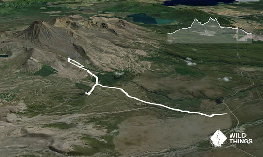
Follow the trail to the vicinity of the Waihohonu Hut and then to the north on the Waihohonu-Oturere track that is part of the Northern Circuit.
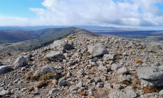
Eventually this will top out on the ridgeline extending down from Tama, north-east of pt1268. This is the point just before the trail descends into trees.
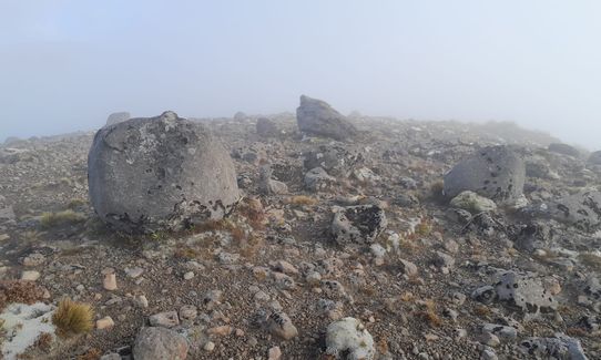
Leave the marked trail to follow the ridgeline to the north-east in the direction of Tama. You will pass over one prominent knob before progressing along the ridgeline to a lower one with a large boulder standing in front of you (see photos).
At this point take a right to follow the scree slope below the ridgeline directly down. As the treeline approaches, plunge straight in. The GPX trace goes back and forward in search of an optimum path, but the best approach is a direct one. If you are lucky you may find some clearer ground for some trail as you go but there is largely a bit of bushwhacking here until you descend below the trees. An alternative route that appears likely is to instead stay above the tree line and follow it towards the north-east, dropping lower as the trees clear. However, that path is untested.
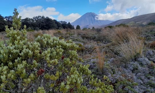
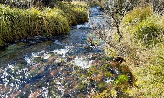
Having descended below the bush you will continue up the Waihohonu valley to the north-east, parallel to the ridgeline above. Do not rely on the GPX here - there is rocky ground, bushes, and swampy sections to self-navigate. The temptation in searching for the spring head is to drift down towards the river but generally, it is better to remain higher on the rocks.
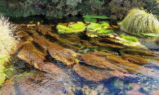
Note that the NZ topo map incorrectly marks the spring head, as it is further up the valley. As it comes in sight set your bearing on the small hill rising in the valley, pt1212, as the spring head is at the base of this hill.
Having reached the spring head, return by angling up and along the Tama ridgeline then enjoy the ramble down it back to the marked track and back in the direction of Waihohonu Hut.
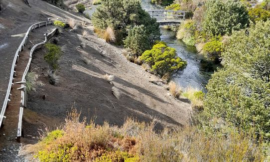
Passing the hut head south on the Round the Mountain Track to Ohinepango Springs. Crossing the bridge over the stream, take the right to follow the streamside path to the spring.
Then retrace your steps to the Waihohonu Hut and then back to the trailhead.
This route goes off the usual marked Tongariro trails to take in the remote and unique Waihohonu Springs spring head, as well as the more frequented Ohinepango Springs.
There is some space to park around the trailhead.
32 km
25 minutes
Unknown
No
Hard.
Note that there is no particular path through the trees below the Tama ridgeline or up the valley afterwards, figure your route out as you go. Once descended to the Waihohonu Valley, tend to hug below the ridgeline rather than drift towards the stream as you'll have better footing. Set your bearing on the hill at pt1212.
Generally good.
Seam-sealed waterproof jacket, Gloves, Beanie/thermal headwear, Personal Locator Beacon (PLB), Whistle, First aid kit, Extra food for emergencies, Cellphone, Map, Gaiters
Water is available at the Waihohonu Hut. Do not plan to fill up from the springs as that flow is not easily accessible.
None
Fastest Known Times (FKTs)
You and Waihohonu Springs Revolution
As a VIP member you can record private notes for this trail, see all of your times and more.
Already have an account? Login now
The Wild Things Trail Directory is proudly supported by 
Send to your phone
Scan the below QR code to open this trail on your phone.

Tip: position the QR code in your phone camera screen.


