Last Updated: 10th Feb 2024
Mount Titiraupenga
Last Updated: 10th Feb 2024
Grunt Factor: 38 ?
Gnarl Factor: 60 ?
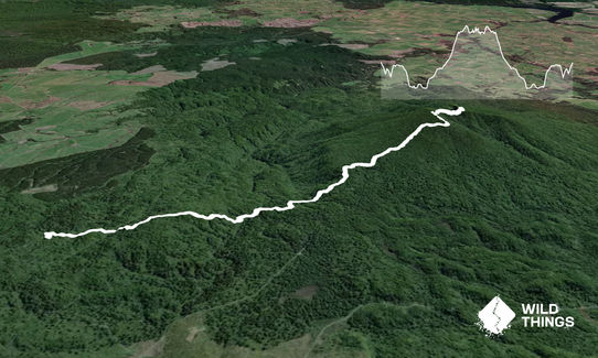
14.0km
980m
980m
1016m
Last Updated: 10th Feb 2024
Last Updated: 10th Feb 2024
Grunt Factor: 38 ?
Gnarl Factor: 60 ?
14.0km
980m
980m
1016m
Back country - remote
Out and Back
Very hilly
Dog Friendly
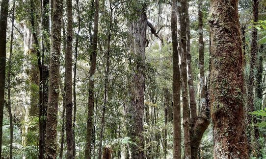
Native bush
Plantation/exotic forest
Open ridges/tops
Easy Single Track
Moderate Single Track
Technical Single Track
Average Uphill Gradient: +12.2%
Average Downhill Gradient: -12.2%
Login as a VIP to see the trailhead information.
4:15
Slow
3:15
Moderate
2.15
Fast
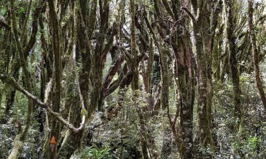
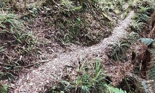
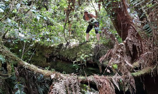
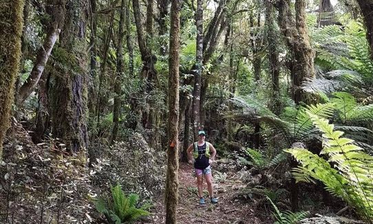
Starting on Link Track, the terrain is semi-technical, lots of gullies and a few small stream crossings. The climbs out the gullies are quite steep with lots of obstacles to go around but the DoC orange triangles are easy to follow.
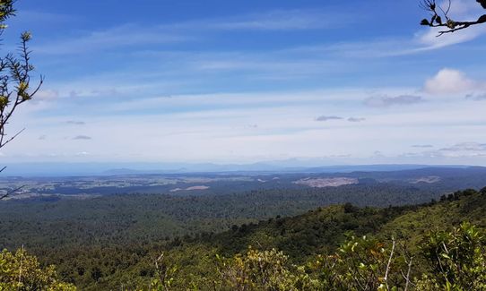
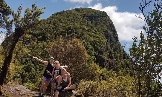
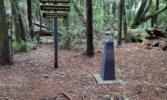
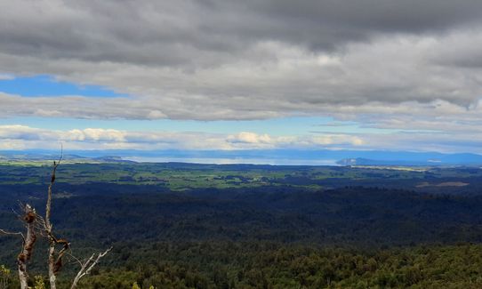
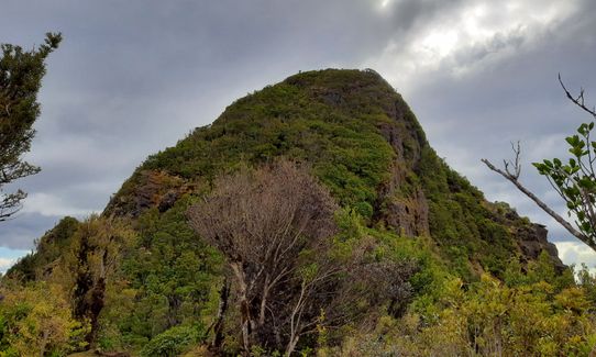
You'll come to the centre of the North Island monument - keep going up, from here the track is much easier and is well used. The climb to the summit feels quite gradual and when you're nearly at the top it goes downhill for a little bit, bringing you out at the foot of the summit rock. Follow the track up onto a small rocky outcrop and you'll find some awesome views of Waikato and Taupo and a good view of the summit rock. Please note that the summit rock is iwi toanga and please do not attempt to climb - it's a sheer cliff by the looks anyway.
Return the same way!
This trail includes the peaks Titiraupenga and Mount Titiraupenga.
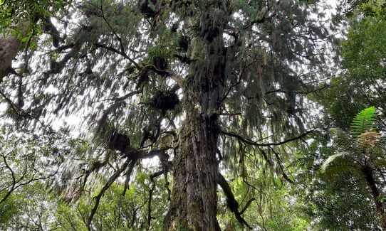
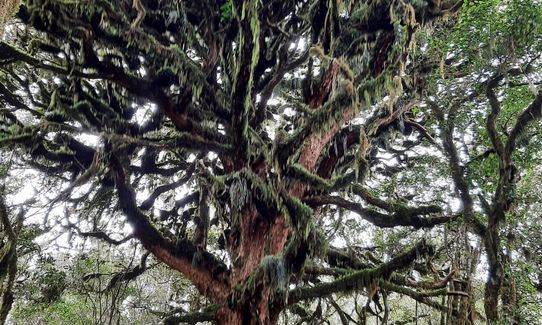
Ancient trees with hanging moss.
Enough parking for a few cars, maybe 5 max. It's a secluded area - leave valuables out of sight.
63 km
55 minutes
Yes
No
Moderate.
Follow the orange DoC triangles, follow the sign at centre of North Island point
Very patchy.
Long-sleeved thermal top, Seam-sealed waterproof jacket, Gloves, Beanie/thermal headwear, Personal Locator Beacon (PLB), Whistle, First aid kit, Extra food for emergencies, Cellphone, Map, Gaiters
One of the streams looked fine to drink from
Not recommended after or during alot of rain
Tree roots, stream crossings, lots of fallen debris, steep trail.
Trail Legend
Fastest Known Times (FKTs)
You and Mount Titiraupenga
As a VIP member you can record private notes for this trail, see all of your times and more.
Already have an account? Login now
Great views to reward you at the end but slow going as definitely more of a hiking trail. A couple of small steam crossings to navigate.
October 9, 2022
Stunning bush & birdlife, thoroughly enjoyable track, but hard work. 14km of solid workout. Well marked & used track so pretty easy to follow, but also a lot of tree fall the scramble over/around.
September 19, 2021
The Wild Things Trail Directory is proudly supported by 
Send to your phone
Scan the below QR code to open this trail on your phone.

Tip: position the QR code in your phone camera screen.


