Last Updated: 22nd Nov 2023
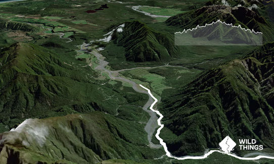
Milltown to Lower Arahura Hut
Submitted by Kirstine Collins
Last Updated: 22nd Nov 2023
Open
Grunt Factor: 36 ?
Gnarl Factor: 37 ?
20.3km
680m
670m
314m
Last Updated: 22nd Nov 2023
Submitted by Kirstine Collins
Last Updated: 22nd Nov 2023
Open
Grunt Factor: 36 ?
Gnarl Factor: 37 ?
20.3km
680m
670m
314m
Back country - remote
Out and Back
Undulating, small hills only
Native bush
Riverside
Open farmlands
Open tussock/grasslands
Farm Road / 4WD Track
Easy Single Track
Moderate Single Track
Technical Single Track
Untracked / Route only
Average Uphill Gradient: +6.5%
Average Downhill Gradient: -6.5%
Login as a VIP to see the trailhead information.
5:00
Slow
4:00
Moderate
3:00
Fast
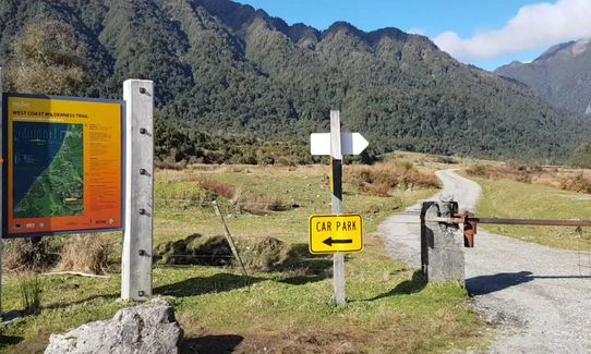
From the information boards follow the gravel road east along the West Coast Wilderness Trail (WCWT). After 1 km is a junction where the WCWT turns left. Continue straight ahead.
Follow the 4WD track which alternates between open farmland and bush. After a km the track drops steeply and you cross a big stream. Follow the faint vehicle tracks up the valley a few hundred meters and look for the big orange triangle at the base of a steep vehicle track to the left. From there continue following the 4WD tracks through a swampy area.
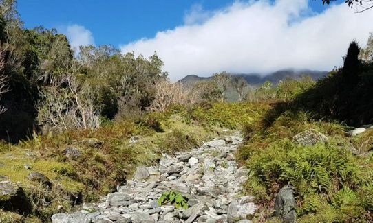
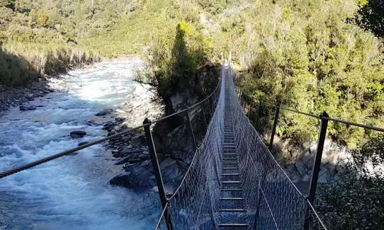
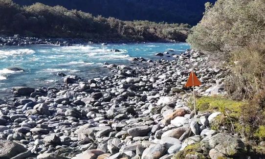
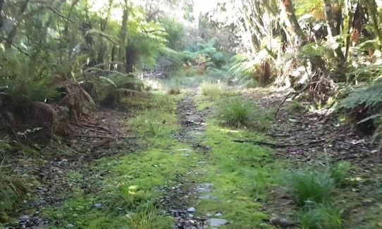
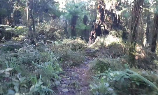
After another 1 km you leave the 4WD track turning left onto single track. A few hundred metres later you cross the Cesspool Swingbridge. The next 6.6 km is a constant change between technical singletrack, rock hopping beside the river, flat flood plains and wide grassy ex roads.
When you reach the hut turn around and head back to the carpark enjoying the stunning views from a different direction. There are no sustained climbs, just a few short steep climbs.
The track follows the route of the former road between Hokatika to Christchurch used to resupply the gold and Ponamu rush on the 1850s to 1860s. The route was classed when the Arthurs Pass road opened in 1866.
Gravel carpark with room for 15 cars
29 km
61 minutes
Unknown
No
Moderate.
Care is needed to follow the markers which are far apart, especially on the river flats.
Non-existent.
Short-sleeved thermal top, Seam-sealed waterproof jacket, Gloves, Beanie/thermal headwear, Whistle, First aid kit, Extra food for emergencies, Survival blanket, Cellphone, Map, Headtorch and spare batteries
Water is plentiful with numerous small streams and the main river.
Do not do this trail immediately after or during heavy rain as there are two side streams that will be inpassable.
There is a lot of areas where the trail is in the water but not many muddy patches.
There is one main stream crossing that care is needed after rain.
The trail is washed away in several places and care is needed on the steep gravelly alternate temporary tracks.
Fastest Known Times (FKTs)
You and Milltown to Lower Arahura Hut
As a VIP member you can record private notes for this trail, see all of your times and more.
Already have an account? Login now
The Wild Things Trail Directory is proudly supported by 
Send to your phone
Scan the below QR code to open this trail on your phone.

Tip: position the QR code in your phone camera screen.


