Last Updated: 21st Sep 2023
Slick and Quick Swampy
Last Updated: 21st Sep 2023
Open
Grunt Factor: 17 ?
Gnarl Factor: 34 ?
10.0km
600m
600m
724m
Last Updated: 21st Sep 2023
Last Updated: 21st Sep 2023
Open
Grunt Factor: 17 ?
Gnarl Factor: 34 ?
10.0km
600m
600m
724m
Front country - easily accessible
Loop
Very hilly
Dog Friendly
Native bush
Open tussock/grasslands
Open ridges/tops
Gravel Road
Farm Road / 4WD Track
Easy Single Track
Moderate Single Track
Technical Single Track
Average Uphill Gradient: +11.6%
Average Downhill Gradient: -9.8%
Login as a VIP to see the trailhead information.
1:30
Slow
1:10
Moderate
0:45
Fast
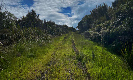
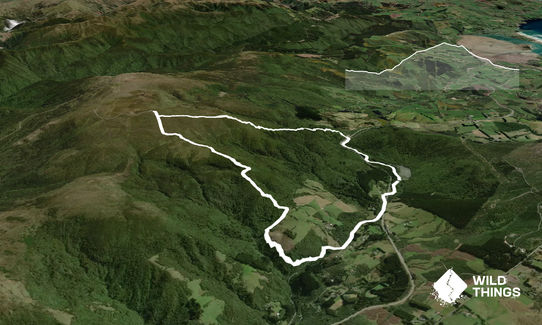
Start at the carpark at Sullivan's Dam and make your way down the gravel road (away from Sullivan's Dam), across the bridge over the top of the motorway and keep following the gravel road for about 1.85km until you reach a bridge. Just before this bridge you'll want to turn right and head up a steepish gravel track for about 600m and you'll see a little track heading into the bush on your right (easily missed so keep an eye out).
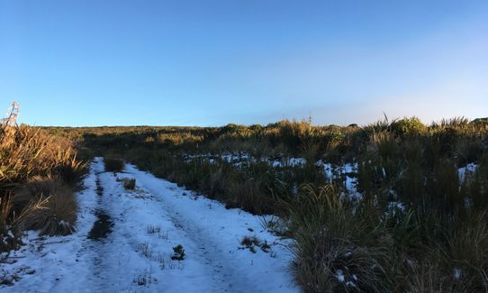
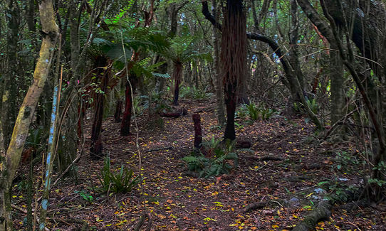
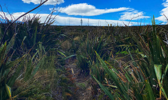
Head up this muddy, technical 'track' (you'll pop out into the open grass once or twice) before heading into the bush again. You'll eventually end up on a 4WD track that heads up (very steep in places). Keep following this and as it starts to ease. As you get closer to the summit you'll see a little track on your right which will take you up to the summit (again, easily missed).
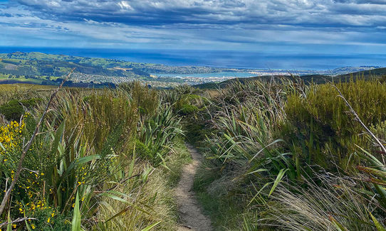
From here, shoot down the Leith Saddle track (very muddy in places), to the top of the the motorway. Cross, and run down to the car. You can add distance by adding a loop or two of Sullivan's Dam if you feel like it. Very enjoyable run with plenty of variation, and is relatively short, (slick) and sweet!
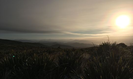
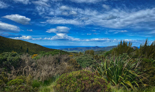
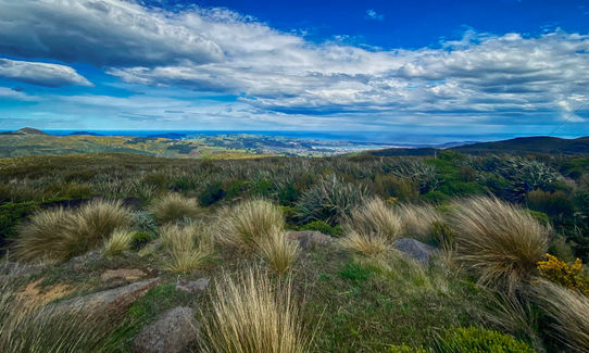
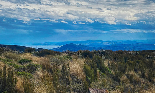
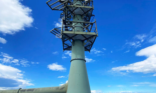
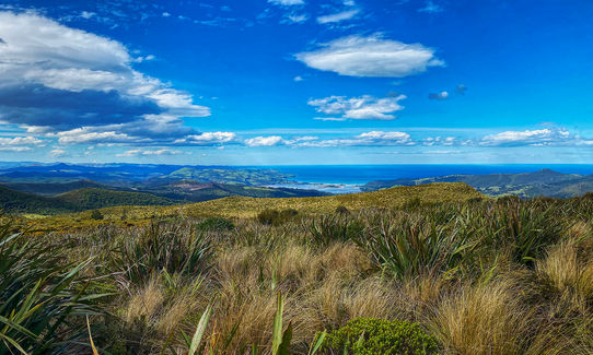
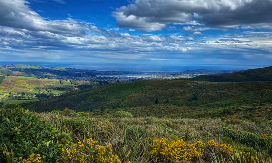
Fantastic views from the top of Swampy of the city, up the northern coast and of Mount Cargill.
If you know of any public toilets near the trail start or on the route, please login and then let us know so we can update this section.
Enough room to park on either side of the road and safe.
12 km
17 minutes
Yes
No
Moderate.
As mentioned above, two tracks which you need to take on your RIGHT can easily be missed. Not disastrous if you take the wrong turn, you'll soon realise!
Perfect throughout.
Lightweight fleece top, Seam-sealed waterproof jacket, Beanie/thermal headwear, Headtorch and spare batteries
No water
Very muddy after rain (but fun).
Trail Legend
Fastest Known Times (FKTs)
You and Slick and Quick Swampy
As a VIP member you can record private notes for this trail, see all of your times and more.
Already have an account? Login now
If you are looking for a shortish trail near the city with all the terrains, this is it.
September 10, 2020
Nice loop, fantastic views up top... think I would prefer to run it in the other direction but overall a neat 10km
December 5, 2019
EM
great run thanks. The directions were great. It was icy with lots of frozen snow when I did it. Need to be careful descending the Leith Saddle track in the ice.
May 30, 2018
These overlap with this trail to some degree. You may wish to combine them but please note that to qualify for FKTs on these runs you should record a separate activity for each.
The Wild Things Trail Directory is proudly supported by 
Send to your phone
Scan the below QR code to open this trail on your phone.

Tip: position the QR code in your phone camera screen.


